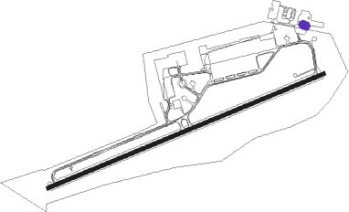
Landsberg/lech
Airport details
| Country | Germany |
| State | Bavaria |
| Region | ED |
| Airspace | Munich Ctr |
| Municipality | Penzing |
| Elevation | 2042ft (622m) |
| Timezone | GMT +1 |
| Coordinates | 48.07240, 10.90527 |
| Magnetic var | |
| Type | land |
| Available since | X-Plane v10.40 |
| ICAO code | ETSA |
| IATA code | n/a |
| FAA code | n/a |
Communication
| Landsberg/Lech Landsberg Info | 130.500 |
| Landsberg/Lech Landsberg Tower | 122.100 |
Nearby Points of Interest:
Landsberg-Lech Air Base
-Wallfahrtskirche St. Leonhard (Kaufering)
-Ursulinenkloster Landsberg
-Pfarrhaus (Kaufering)
-Sandauer Tor
-St. Johannes am Vorderanger
-Gothic stained-glass windows of Mariä Himmelfahrt
-Christopherusfenster
-Alte Bergstraße 421 (Landsberg am Lech)
-Historisches Rathaus
-Wohnhaus
-Landsberg Prison
-Städtisches Forstamt
-Pfarrhaus Weil
-Pürgen Pfarrhaus
-Pfarrhaus Petzenhausen
-Ehem. Wagnerei(Schöffelding)
-Pfarrhaus Pitzling
-Pfarrhaus
-Burgstall Stoffersberg
-Haustür
-Schanze Unterfinning
-Pfarrhaus (Eresing)
Nearby beacons
| code | identifier | dist | bearing | frequency |
|---|---|---|---|---|
| LCH | LECHFELD TACAN | 7.3 | 339° | 108.80 |
| OBI | OBERPFAFFENHOFEN NDB | 15.2 | 89° | 429 |
| MAH | MAISACH VOR/DME | 19.9 | 65° | 115.20 |
| AGB | AUGSBURG NDB | 21.1 | 5° | 318 |
| AUG | DME | 21.2 | 5° | 115.90 |
| ALG | ALLGAEU (MEMMINGEN) NDB | 26.2 | 263° | 341 |
| ALD | (MEMMINGEN/ALLGAU) DME | 27.5 | 263° | 117.20 |
| KPT | KEMPTEN VOR/DME | 29.7 | 240° | 108.40 |
| WLD | WALDA VOR/DME | 31.7 | 24° | 112.80 |
| MSE | MUNICH NDB | 33.7 | 71° | 358 |
| MNE | MUNICH NDB | 35.2 | 70° | 369 |
| OTT | OTTERSBERG VOR/DME | 37.1 | 83° | 112.30 |
| DMS | DME | 38.4 | 73° | 115 |
| DMN | DME | 39.7 | 72° | 116 |
| NEU | NEUBURG TACAN | 40.3 | 26° | 108.90 |
| LUP | LAUPHEIM NDB | 40.7 | 278° | 407 |
| MIQ | MIKE NDB | 40.7 | 54° | 426 |
| MSW | MUNICH NDB | 43.3 | 74° | 400 |
| IGL | INGOLSTADT TACAN | 46.9 | 46° | 111.40 |
| IGL | INGOLSTADT NDB | 49.6 | 48° | 345 |
| RUM | RUM NDB | 52.9 | 145° | 320 |
| INN | INNSBRUCK NDB | 54.4 | 149° | 420 |
| PAT | DME | 56.5 | 147° | 112 |
Disclaimer
The information on this website is not for real aviation. Use this data with the X-Plane flight simulator only! Data taken with kind consent from X-Plane 12 source code and data files. Content is subject to change without notice.