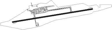
Kaunas - Kaunas International
Airport details
| Country | Lithuania |
| State | Kaunas County |
| Region | EY |
| Airspace | Vilnius Ctr |
| Municipality | Karmėlavos seniūnija |
| Elevation | 254ft (77m) |
| Timezone | GMT +2 |
| Coordinates | 54.96389, 24.08472 |
| Magnetic var | |
| Type | land |
| Available since | X-Plane v10.40 |
| ICAO code | EYKA |
| IATA code | KUN |
| FAA code | n/a |
Communication
| Kaunas International Kaunas ATIS | 129.055 |
| Kaunas International Kaunas Tower | 124.205 |
Approach frequencies
| ILS-cat-II | RW26 | 109.9 | 18.00mi |
| ILS-cat-I | RW08 | 109.5 | 18.00mi |
| 3° GS | RW08 | 109.5 | 18.00mi |
| 3° GS | RW26 | 109.9 | 18.00mi |
Nearby Points of Interest:
Kedainiai Old Town
Runway info
| Runway 08 / 26 | ||
| length | 3240m (10630ft) | |
| bearing | 87° / 267° | |
| width | 45m (148ft) | |
| surface | asphalt | |
| displ threshold | 297m (974ft) / 297m (974ft) | |
| blast zone | 75m (246ft) / 75m (246ft) | |
Nearby beacons
| code | identifier | dist | bearing | frequency |
|---|---|---|---|---|
| KNA | KAUNAS VOR/DME | 0.6 | 259° | 114.40 |
| KUS | KAUNAS INTL NDB | 1.2 | 87° | 343 |
| SML | DME | 27.2 | 115° | 112.50 |
| VLK | DME | 44.4 | 130° | 116.70 |
| SAU | SIAULIAI VOR/DME | 59.4 | 324° | 115.20 |
| SQQ | SIAULIAI TACAN | 60.3 | 324° | 116.30 |
Departure and arrival routes
| Transition altitude | 5000ft |
| SID end points | distance | outbound heading | |
|---|---|---|---|
| RW08 | |||
| ELEK1A | 23mi | 105° | |
| KAZL1A, KAZL1C | 39mi | 239° | |
| AKUM1A | 48mi | 280° | |
| UGNI1A | 31mi | 331° | |
| RW26 | |||
| ELEK1C, ELEK1B | 23mi | 105° | |
| KAZL1B, KAZL1D | 39mi | 239° | |
| AKUM1B | 48mi | 280° | |
| UGNI1B | 31mi | 331° | |
| STAR starting points | distance | inbound heading | |
|---|---|---|---|
| RW08 | |||
| KAZL2A | 38.7 | 59° | |
| AKUM2A | 47.8 | 100° | |
| PELU2A | 33.4 | 136° | |
| ELEK2A | 23.0 | 285° | |
| RW26 | |||
| KAZL2B | 38.7 | 59° | |
| AKUM2B | 47.8 | 100° | |
| PELU2B | 33.4 | 136° | |
| IKAM3B | 29.6 | 235° | |
| ELEK2B | 23.0 | 285° | |
Instrument approach procedures
| runway | airway (heading) | route (dist, bearing) |
|---|---|---|
| RW08 | KNA (79°) | KNA 4000ft KA354 (9mi, 296°) KA355 (4mi, 267°) KA352 (6mi, 171°) 3000ft |
| RW08 | MATAM (82°) | MATAM 4000ft KA352 (6mi, 73°) 3000ft |
| RW08 | VEBUS (101°) | VEBUS 4000ft KA352 (6mi, 143°) 3000ft |
| RNAV | KA352 3000ft KA351 (4mi, 87°) 2200ft EYKA (7mi, 87°) 290ft KA353 (8mi, 87°) KNA (9mi, 267°) 4000ft | |
| RW26 | KNA (79°) | KNA 4000ft KA454 (9mi, 111°) KA455 (4mi, 87°) KA452 (6mi, 352°) 3000ft |
| RW26 | NASAP (253°) | NASAP 5000ft KA456 (3mi, 130°) 4000ft KA457 (4mi, 201°) KA452 (4mi, 278°) 3000ft |
| RW26 | REGLU (286°) | REGLU 4000ft KA452 (7mi, 333°) 3000ft |
| RNAV | KA452 3000ft KA451 (4mi, 267°) 2200ft EYKA (7mi, 267°) 310ft KA453 (9mi, 267°) KNA (8mi, 88°) 4000ft |
Holding patterns
| STAR name | hold at | type | turn | heading* | altitude | leg | speed limit |
|---|---|---|---|---|---|---|---|
| AKUM2A | VEBUS | VHF | left | 283 (103)° | > 4000ft | 1.0min timed | 230 |
| AKUM2B | NASAP | VHF | right | 54 (234)° | 5000ft - 9000ft | 1.0min timed | 230 |
| ELEK2A | MATAM | VHF | left | 250 (70)° | > 4000ft | 1.0min timed | 230 |
| ELEK2B | REGLU | VHF | left | 107 (287)° | 4000ft - 9000ft | DME 4.1mi | 230 |
| IKAM3B | NASAP | VHF | right | 54 (234)° | 5000ft - 9000ft | 1.0min timed | 230 |
| KAZL2A | MATAM | VHF | left | 250 (70)° | > 4000ft | 1.0min timed | 230 |
| KAZL2B | REGLU | VHF | left | 107 (287)° | 4000ft - 9000ft | DME 4.1mi | 230 |
| PELU2A | VEBUS | VHF | left | 283 (103)° | > 4000ft | 1.0min timed | 230 |
| PELU2B | NASAP | VHF | right | 54 (234)° | 5000ft - 9000ft | 1.0min timed | 230 |
| *) magnetic outbound (inbound) holding course | |||||||
Disclaimer
The information on this website is not for real aviation. Use this data with the X-Plane flight simulator only! Data taken with kind consent from X-Plane 12 source code and data files. Content is subject to change without notice.