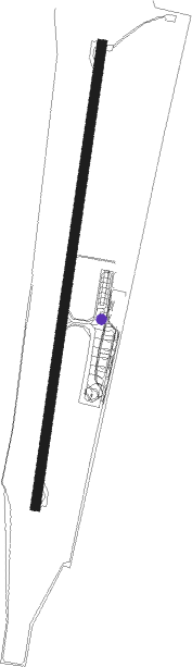
Palanga - Palanga Intl
Airport details
| Country | Lithuania |
| State | Klaipeda County |
| Region | EY |
| Airspace | Vilnius Ctr |
| Municipality | Palanga |
| Elevation | 33ft (10m) |
| Timezone | GMT +2 |
| Coordinates | 55.97333, 21.09389 |
| Magnetic var | |
| Type | land |
| Available since | X-Plane v10.40 |
| ICAO code | EYPA |
| IATA code | PLQ |
| FAA code | n/a |
Communication
| Palanga Intl ATIS | 127.805 |
| Palanga Intl Tower | 124.305 |
| Palanga Intl Dep | 124.305 |
Approach frequencies
| ILS-cat-I | RW19 | 110.1 | 18.00mi |
| 3° GS | RW19 | 110.1 | 18.00mi |
Nearby beacons
| code | identifier | dist | bearing | frequency |
|---|---|---|---|---|
| PLG | DME | 1 | 202° | 114.80 |
| PN | PALANGA INTL NDB | 1 | 202° | 407 |
| KLP | KLAIPEDA VOR/DME | 16.2 | 150° | 115 |
| LEP | LIEPAJA VOR/DME | 32.3 | 359° | 116.95 |
| RDB | DME | 48 | 50° | 110.80 |
Departure and arrival routes
| Transition altitude | 5000ft |
| SID end points | distance | outbound heading | |
|---|---|---|---|
| RW01 | |||
| ASKO1C | 56mi | 75° | |
| XARI1C, XARI1A | 33mi | 75° | |
| MANU1A, MANU1C | 36mi | 108° | |
| VALU1C, VALU1A | 37mi | 254° | |
| TIRI1C, TIRI1A | 13mi | 285° | |
| RW19 | |||
| XARI1B, XARI1D | 33mi | 75° | |
| MANU1D, MANU1B | 36mi | 108° | |
| TIGN1D | 48mi | 254° | |
| VALU1B, VALU1D | 37mi | 254° | |
| TIRI1D, TIRI1B | 13mi | 285° | |
| STAR starting points | distance | inbound heading | |
|---|---|---|---|
| RW01 | |||
| VALU2A | 36.5 | 74° | |
| TIRI2A | 12.9 | 105° | |
| XARI2A | 33.1 | 255° | |
| MANU2A | 36.4 | 288° | |
| RW19 | |||
| VALU2B | 36.5 | 74° | |
| TIRI2B | 12.9 | 105° | |
| MANU2B | 36.4 | 288° | |
Instrument approach procedures
| runway | airway (heading) | route (dist, bearing) |
|---|---|---|
| RW01 | LAPKO (32°) | LAPKO 4000ft PA352 (6mi, 47°) 2000ft |
| RW01 | ONIFA (337°) | ONIFA 4000ft PA352 (6mi, 288°) 2000ft |
| RW01 | SOMPU (60°) | SOMPU 3500ft PA352 (6mi, 96°) 2000ft |
| RNAV | PA352 2000ft PA351 (4mi, 22°) 1700ft EYPA (6mi, 22°) 83ft PA353 (2mi, 22°) SOMPU (13mi, 236°) 3500ft SOMPU (turn) 3500ft | |
| RW19 | NAPUS (250°) | NAPUS 3000ft PA453 (4mi, 278°) 1700ft PA452 (2mi, 277°) 1500ft |
| RNAV | PA452 1500ft PA451 (2mi, 202°) 1300ft EYPA (4mi, 202°) 82ft PA454 (6mi, 202°) 1500ft NAPUS (14mi, 54°) 3000ft NAPUS (turn) 3000ft |
Holding patterns
| STAR name | hold at | type | turn | heading* | altitude | leg | speed limit |
|---|---|---|---|---|---|---|---|
| MANU2A | ONIFA | VHF | left | 114 (294)° | > 4000ft | 1.0min timed | 230 |
| MANU2B | NAPUS | VHF | right | 99 (279)° | > 3000ft | 1.0min timed | 230 |
| TIRI2A | SOMPU | VHF | right | 276 (96)° | > 3500ft | 1.0min timed | 230 |
| TIRI2B | NAPUS | VHF | right | 99 (279)° | > 3000ft | 1.0min timed | 230 |
| TIRI2B | PA405 | VHF | left | 271 (91)° | > 5000ft | 1.0min timed | 230 |
| VALU2A | PA304 | VHF | right | 260 (80)° | > 5000ft | 1.0min timed | 230 |
| VALU2B | NAPUS | VHF | right | 99 (279)° | > 3000ft | 1.0min timed | 230 |
| VALU2B | PA405 | VHF | left | 271 (91)° | > 5000ft | 1.0min timed | 230 |
| XARI2A | ONIFA | VHF | left | 114 (294)° | > 4000ft | 1.0min timed | 230 |
| XARI2B | NAPUS | VHF | right | 99 (279)° | > 3000ft | 1.0min timed | 230 |
| *) magnetic outbound (inbound) holding course | |||||||
Disclaimer
The information on this website is not for real aviation. Use this data with the X-Plane flight simulator only! Data taken with kind consent from X-Plane 12 source code and data files. Content is subject to change without notice.