Kimberley
Airport details
| Country | South Africa |
| State | Northern Cape |
| Region | FA |
| Airspace | Johannesburg Ctr |
| Municipality | Sol Plaatje Local Municipality |
| Elevation | 3950ft (1204m) |
| Timezone | GMT +2 |
| Coordinates | -28.79136, 24.76936 |
| Magnetic var | |
| Type | land |
| Available since | X-Plane v10.40 |
| ICAO code | FAKM |
| IATA code | KIM |
| FAA code | n/a |
Communication
| Kimberley APN | 122.650 |
| Kimberley Tower | 118.200 |
| Kimberley BLOEMFONTEIN Approach | 119.400 |
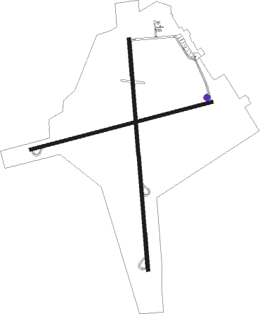
Runway info
Runway 02 / 20  | ||
| length | 3013m (9885ft) | |
| bearing | 360° / 180° | |
| width | 46m (151ft) | |
| surface | asphalt | |
| blast zone | 49m (161ft) / 49m (161ft) | |
| Runway 10 / 28 | ||
| length | 2434m (7986ft) | |
| bearing | 81° / 261° | |
| width | 46m (151ft) | |
| surface | asphalt | |
| blast zone | 49m (161ft) / 49m (161ft) | |
Nearby beacons
| code | identifier | dist | bearing | frequency |
|---|---|---|---|---|
| KYV | KIMBERLEY VOR/DME | 0.7 | 226° | 113.20 |
Departure and arrival routes
| Transition altitude | 7000ft |
| Transition level | 8000ft |
| SID end points | distance | outbound heading | |
|---|---|---|---|
| RW02 | |||
| UNRA1A | 71mi | 71° | |
| OKPA1A | 46mi | 220° | |
| RW20 | |||
| OKPA1B | 46mi | 220° | |
| STAR starting points | distance | inbound heading | |
|---|---|---|---|
| RW02 | |||
| IBKE1A | 45.6 | 66° | |
| EVES1A | 24.8 | 245° | |
| RW20 | |||
| IBKE1B | 45.6 | 66° | |
Instrument approach procedures
| runway | airway (heading) | route (dist, bearing) |
|---|---|---|
| RW02 | ETBAB (331°) | ETBAB KM1T1 (6mi, 270°) 7000ft |
| RW02 | NIDUN (1°) | NIDUN KM1T1 (6mi, 360°) 7000ft |
| RW02 | UVKIS (31°) | UVKIS KM1T1 (6mi, 90°) 7000ft |
| RNAV | KM1T1 7000ft KM1F1 (5mi, 360°) 5600ft KM1MP (5mi, 360°) 3950ft KM1MP (turn) 4260ft KM1M1 (3mi, 360°) 4500ft UVKIS (15mi, 207°) UVKIS (turn) | |
| RW20 | GADSO (213°) | GADSO KM2T1 (6mi, 270°) 7000ft |
| RW20 | IBSIX (179°) | IBSIX KM2T1 (6mi, 180°) 7000ft |
| RW20 | UNKUR (145°) | UNKUR KM2T1 (6mi, 90°) 7000ft |
| RNAV | KM2T1 7000ft KM2F1 (5mi, 180°) 5600ft KM2SD (2mi, 180°) 4820ft KM2MP (3mi, 180°) 3990ft KM2MP (turn) 4540ft KM2M1 (4mi, 180°) 4900ft GADSO (15mi, 26°) GADSO (turn) |
Disclaimer
The information on this website is not for real aviation. Use this data with the X-Plane flight simulator only! Data taken with kind consent from X-Plane 12 source code and data files. Content is subject to change without notice.