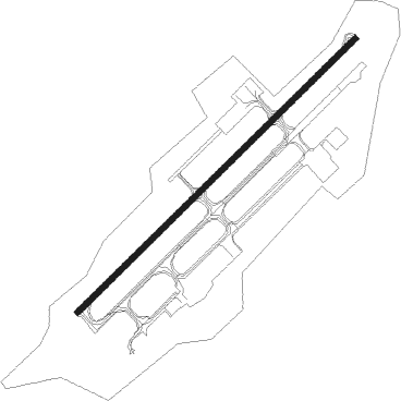
Brazzaville - Maya Maya
Airport details
| Country | Congo |
| State | Pool Department |
| Region | FC |
| Airspace | Brazzaville Ctr |
| Municipality | Brazzaville |
| Elevation | 1046ft (319m) |
| Timezone | GMT +1 |
| Coordinates | -4.25050, 15.25150 |
| Magnetic var | |
| Type | land |
| Available since | X-Plane v10.40 |
| ICAO code | FCBB |
| IATA code | BZV |
| FAA code | n/a |
Communication
| Maya Maya Tower | 118.700 |
| Maya Maya Approach | 121.100 |
| Maya Maya Departure | 118.700 |
Approach frequencies
| ILS-cat-I | RW05 | 111.7 | 18.00mi |
| 3° GS | RW05 | 111.7 | 18.00mi |
Nearby beacons
| code | identifier | dist | bearing | frequency |
|---|---|---|---|---|
| BZ | BRAZZAVILLE VOR/DME | 0.2 | 258° | 113.10 |
| KSA | KINSHASA VOR/DME | 13.5 | 132° | 115 |
| OK | N'DJILI INTL (KINSHASA) NDB | 16.6 | 109° | 340 |
Departure and arrival routes
| Transition altitude | 4500ft |
| Transition level | 5000ft |
| SID end points | distance | outbound heading | |
|---|---|---|---|
| RW05 | |||
| KSA4B | 14mi | 132° | |
| STAR starting points | distance | inbound heading | |
|---|---|---|---|
| ALL | |||
| RAPU3V | 83.3 | 17° | |
| SEMO2V | 101.7 | 80° | |
| POGL2V | 77.6 | 129° | |
| ODRA2V | 77.0 | 145° | |
| NAMO2V | 146.9 | 172° | |
| MENA2V | 76.5 | 185° | |
| LIKE2V | 76.6 | 201° | |
| KSA3V | 13.5 | 312° | |
| RW05 | |||
| RAPU1L | 83.3 | 17° | |
| SEMO1T | 101.7 | 80° | |
| POGL1P | 77.6 | 129° | |
| ODRA1P | 77.0 | 145° | |
| NAMO1P | 146.9 | 172° | |
| MENA1P | 76.5 | 185° | |
| LIKE1P | 76.6 | 201° | |
| KIRG2V | 84.6 | 252° | |
| IKRO2V | 87.9 | 269° | |
| KSA1L | 13.5 | 312° | |
| RW23 | |||
| SEMO1U | 101.7 | 80° | |
| POGL1U | 77.6 | 129° | |
| ODRA1U | 77.0 | 145° | |
| NAMO1M | 146.9 | 172° | |
| MENA1M, MENA1U | 76.5 | 185° | |
| LIKE1M, LIKE1U | 76.6 | 201° | |
| KIRG1M | 84.6 | 252° | |
| IKRO1A | 87.9 | 269° | |
| KSA1A | 13.5 | 312° | |
Instrument approach procedures
| runway | airway (heading) | route (dist, bearing) |
|---|---|---|
| RW05 | DIPVA (73°) | DIPVA 4000ft TANIS (5mi, 140°) 4000ft |
| RW05 | NAPUX (27°) | NAPUX 4000ft TANIS (5mi, 320°) 4000ft |
| RNAV | TANIS 4000ft BB501 (5mi, 50°) 3000ft FCBB (7mi, 50°) 1077ft BB502 (4mi, 50°) DIPVA (17mi, 248°) 4000ft DIPVA (turn) 4000ft | |
| RW23 | BILEV (206°) | BILEV 4000ft GUGUS (5mi, 140°) 4000ft |
| RW23 | RASUK (254°) | RASUK 4000ft GUGUS (5mi, 320°) 4000ft |
| RNAV | GUGUS 4000ft BB503 (5mi, 230°) 3000ft FCBB (7mi, 230°) 1101ft BB504 (4mi, 230°) BILEV (17mi, 32°) 4000ft BILEV (turn) 4000ft |
Holding patterns
| STAR name | hold at | type | turn | heading* | altitude | leg | speed limit |
|---|---|---|---|---|---|---|---|
| LIKE1P | PONUS | VHF | left | 262 (82)° | 4500ft - 12000ft | DME 5.0mi | 230 |
| LIKE1U | UBALA | VHF | right | 357 (177)° | 4500ft - 12000ft | DME 5.0mi | 230 |
| MENA1P | PONUS | VHF | left | 262 (82)° | 4500ft - 12000ft | DME 5.0mi | 230 |
| MENA1U | UBALA | VHF | right | 357 (177)° | 4500ft - 12000ft | DME 5.0mi | 230 |
| NAMO1P | PONUS | VHF | left | 262 (82)° | 4500ft - 12000ft | DME 5.0mi | 230 |
| ODRA1P | PONUS | VHF | left | 262 (82)° | 4500ft - 12000ft | DME 5.0mi | 230 |
| ODRA1U | UBALA | VHF | right | 357 (177)° | 4500ft - 12000ft | DME 5.0mi | 230 |
| POGL1P | PONUS | VHF | left | 262 (82)° | 4500ft - 12000ft | DME 5.0mi | 230 |
| POGL1U | UBALA | VHF | right | 357 (177)° | 4500ft - 12000ft | DME 5.0mi | 230 |
| RAKO1P | PONUS | VHF | left | 262 (82)° | 4500ft - 12000ft | DME 5.0mi | 230 |
| RAKO1U | UBALA | VHF | right | 357 (177)° | 4500ft - 12000ft | DME 5.0mi | 230 |
| SEMO1U | UBALA | VHF | right | 357 (177)° | 4500ft - 12000ft | DME 5.0mi | 230 |
| *) magnetic outbound (inbound) holding course | |||||||
Disclaimer
The information on this website is not for real aviation. Use this data with the X-Plane flight simulator only! Data taken with kind consent from X-Plane 12 source code and data files. Content is subject to change without notice.