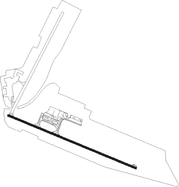
Douala - Douala Intl.
Airport details
| Country | Cameroon |
| State | Littoral |
| Region | FK |
| Airspace | Brazzaville Ctr |
| Municipality | Douala II |
| Elevation | 33ft (10m) |
| Timezone | GMT +1 |
| Coordinates | 4.01882, 9.70918 |
| Magnetic var | |
| Type | land |
| Available since | X-Plane v10.40 |
| ICAO code | FKKD |
| IATA code | DLA |
| FAA code | n/a |
Communication
| Douala Intl. Douala Tower | 119.700 |
| Douala Intl. Douala Approach | 125.100 |
| Douala Intl. Douala Departure | 125.100 |
Approach frequencies
| ILS-cat-I | RW30 | 110.3 | 18.00mi |
| 3° GS | RW30 | 110.3 | 18.00mi |
Nearby Points of Interest:
Port autonome de Douala
-Palace of Justice of Douala
-Central post office in Douala
-Bessengue train station
-Douala bridge
-Port négrier de Bimbia
Nearby beacons
| code | identifier | dist | bearing | frequency |
|---|---|---|---|---|
| DLA | DOUALA VOR/DME | 2.5 | 126° | 112.90 |
| DE | EDEA NDB | 29.1 | 118° | 362 |
| PA | MALABO NDB | 51.4 | 248° | 342 |
| MBO | MALABO VOR/DME | 61.1 | 256° | 114.50 |
Departure and arrival routes
| Transition altitude | 2200ft |
| SID end points | distance | outbound heading | |
|---|---|---|---|
| RW12 | |||
| EDEB1E, EDEB1N | 112mi | 99° | |
| MBO1W | 61mi | 256° | |
| STAR starting points | distance | inbound heading | |
|---|---|---|---|
| ALL | |||
| MBO2V | 61.1 | 76° | |
| TI1V | 21.5 | 101° | |
| KOKA1V | 29.5 | 163° | |
| BIGO1V | 115.8 | 213° | |
| EDEB1V | 27.4 | 281° | |
| ETNO1V | 110.5 | 326° | |
| BT1V | 127.0 | 357° | |
| RW12 | |||
| BILO1M | 40.0 | 36° | |
| ERPI1M | 39.1 | 75° | |
| MBO2M | 61.1 | 76° | |
| TI1M | 21.5 | 101° | |
| KOKA1A, KOKA1M | 29.5 | 163° | |
| BIGO1M | 115.8 | 213° | |
| ONIL1A | 29.9 | 216° | |
| EDEB1M | 112.0 | 279° | |
| IRAN1M | 32.5 | 325° | |
| ETNO1M | 110.5 | 326° | |
| NATE1M | 32.1 | 343° | |
| SIBI1M | 31.8 | 355° | |
| BT1M | 127.0 | 357° | |
| RW30 | |||
| BILO1L | 40.0 | 36° | |
| ERPI1L | 39.1 | 75° | |
| MBO2D | 61.1 | 76° | |
| TI1D | 21.5 | 101° | |
| KOKA1R, KOKA1D | 29.5 | 163° | |
| BIGO1D | 115.8 | 213° | |
| ONIL1R | 29.9 | 216° | |
| DE1D | 112.0 | 279° | |
| IRAN1K, IRAN1L | 32.5 | 325° | |
| ETNO1D, ETN1DB | 110.5 | 326° | |
| NATE1L, NATE1K | 32.1 | 343° | |
| SIBI1K, SIBI1L | 31.8 | 355° | |
| BT1D | 127.0 | 357° | |
Instrument approach procedures
| runway | airway (heading) | route (dist, bearing) |
|---|---|---|
| RW12 | ARBOX (140°) | ARBOX KD501 (5mi, 207°) |
| RW12 | MINRO (90°) | MINRO KD501 (5mi, 27°) |
| RNAV | KD501 KD502 (5mi, 117°) 2000ft FKKD (6mi, 113°) 84ft FKKD (turn) 440ft KD503 (5mi, 121°) SERUR (15mi, 214°) | |
| RW30 | KEREM (298°) | KEREM KD504 (5mi, 297°) |
| RW30 | LIPEV (320°) | LIPEV KD504 (5mi, 27°) |
| RW30 | RINAP (277°) | RINAP KD504 (5mi, 207°) |
| RNAV | KD504 KD506 (5mi, 297°) 2000ft FKKD (8mi, 300°) 64ft FKKD (turn) 440ft KD507 (3mi, 290°) NURES (14mi, 199°) |
Holding patterns
| STAR name | hold at | type | turn | heading* | altitude | leg | speed limit |
|---|---|---|---|---|---|---|---|
| BIGO1D | DISDO | VHF | left | 118 (298)° | 2200ft - 8000ft | DME 5.0mi | 230 |
| BIGO1M | MOKAL | VHF | right | 298 (118)° | 2200ft - 8000ft | DME 5.0mi | 230 |
| BIGO1V | DLA | NDB | right | 298 (118)° | 2200ft - 8000ft | 1.0min timed | 230 |
| BT1D | DISDO | VHF | left | 118 (298)° | 2200ft - 8000ft | DME 5.0mi | 230 |
| BT1M | MOKAL | VHF | right | 298 (118)° | 2200ft - 8000ft | DME 5.0mi | 230 |
| DE1D | DISDO | VHF | left | 118 (298)° | 2200ft - 8000ft | DME 5.0mi | 230 |
| EDEB1M | MOKAL | VHF | right | 298 (118)° | 2200ft - 8000ft | DME 5.0mi | 230 |
| ETN1DB | DISDO | VHF | left | 118 (298)° | 2200ft - 8000ft | DME 5.0mi | 230 |
| ETNO1D | DISDO | VHF | left | 118 (298)° | 2200ft - 8000ft | DME 5.0mi | 230 |
| ETNO1M | MOKAL | VHF | right | 298 (118)° | 2200ft - 8000ft | DME 5.0mi | 230 |
| KOKA1D | DISDO | VHF | left | 118 (298)° | 2200ft - 8000ft | DME 5.0mi | 230 |
| KOKA1M | MOKAL | VHF | right | 298 (118)° | 2200ft - 8000ft | DME 5.0mi | 230 |
| MBO2D | DISDO | VHF | left | 118 (298)° | 2200ft - 8000ft | DME 5.0mi | 230 |
| MBO2M | MOKAL | VHF | right | 298 (118)° | 2200ft - 8000ft | DME 5.0mi | 230 |
| TI1D | DISDO | VHF | left | 118 (298)° | 2200ft - 8000ft | DME 5.0mi | 230 |
| TI1M | MOKAL | VHF | right | 298 (118)° | 2200ft - 8000ft | DME 5.0mi | 230 |
| *) magnetic outbound (inbound) holding course | |||||||
Disclaimer
The information on this website is not for real aviation. Use this data with the X-Plane flight simulator only! Data taken with kind consent from X-Plane 12 source code and data files. Content is subject to change without notice.