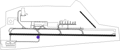
Lusaka - Lusaka Intl
Airport details
| Country | Zambia |
| State | Lusaka Province |
| Region | FL |
| Airspace | Lusaka Ctr |
| Municipality | Chongwe District |
| Elevation | 3777ft (1151m) |
| Timezone | GMT +2 |
| Coordinates | -15.32667, 28.45583 |
| Magnetic var | |
| Type | land |
| Available since | X-Plane v10.40 |
| ICAO code | FLKK |
| IATA code | LUN |
| FAA code | n/a |
Communication
| LUSAKA INTL Tower | 118.100 |
| LUSAKA INTL Approach | 121.300 |
Approach frequencies
| ILS-cat-I | RW10 | 110.3 | 18.00mi |
| 3° GS | RW10 | 110.3 | 18.00mi |
Nearby beacons
| code | identifier | dist | bearing | frequency |
|---|---|---|---|---|
| VLS | LUSAKA VOR/DME | 2 | 268° | 113.50 |
| LE | LUSAKA NDB | 4.5 | 97° | 325 |
| LW | LUSAKA NDB | 4.8 | 271° | 386 |
| LY | LILAYI (LUSAKA) NDB | 15.8 | 232° | 235 |
| LN | LUSAKA NDB | 21.3 | 347° | 338 |
Departure and arrival routes
| Transition altitude | 6000ft |
| SID end points | distance | outbound heading | |
|---|---|---|---|
| RW10 | |||
| APDE1A | 66mi | 52° | |
| EGNI1A | 50mi | 183° | |
| EKBI1A | 108mi | 258° | |
| APNO1A | 39mi | 351° | |
| RW28 | |||
| APDE1B | 66mi | 52° | |
| EGNI1B | 50mi | 183° | |
| EKBI1B | 108mi | 258° | |
| APNO1B | 39mi | 351° | |
| STAR starting points | distance | inbound heading | |
|---|---|---|---|
| RW10 | |||
| EKBI1A | 108.0 | 78° | |
| KALNU1 | 21.3 | 167° | |
| IBNO1A | 54.0 | 249° | |
| KARI1A | 75.5 | 340° | |
| RW28 | |||
| EKBI1B | 108.0 | 78° | |
| IBNO1B | 54.0 | 249° | |
| KARI1B | 75.5 | 340° | |
Instrument approach procedures
| runway | airway (heading) | route (dist, bearing) |
|---|---|---|
| RW10 | APRAS (50°) | APRAS 6500ft ATULI (15mi, 14°) 5500ft |
| RW10 | AXADO (92°) | AXADO 6500ft ATULI (7mi, 90°) 5500ft |
| RW10 | EGRAN (140°) | EGRAN 6500ft ATULI (13mi, 186°) 5500ft |
| RNAV | ATULI 5500ft APLAT (6mi, 95°) 5500ft FLKK (6mi, 93°) 3831ft (1923mi, 298°) 4182ft EGMAX (1936mi, 118°) 6100ft | |
| RW28 | APREG (246°) | APREG 6500ft AVIRA (7mi, 184°) 5500ft |
| RW28 | ATUPO (275°) | ATUPO 6500ft AVIRA (6mi, 274°) 5500ft |
| RW28 | AXOGA (320°) | AXOGA 6500ft AVIRA (19mi, 347°) 5500ft |
| RNAV | AVIRA 5500ft EGPAL (6mi, 275°) 5500ft FLKK (6mi, 277°) 3799ft (1923mi, 298°) 4182ft APKOX (1910mi, 119°) 6100ft |
Disclaimer
The information on this website is not for real aviation. Use this data with the X-Plane flight simulator only! Data taken with kind consent from X-Plane 12 source code and data files. Content is subject to change without notice.

