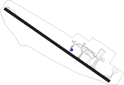
St Pierre - Saint Pierre Pierrefonds
Airport details
| Country | France |
| State | Réunion |
| Region | FM |
| Airspace | Antananarivo Ctr |
| Municipality | Saint-Pierre |
| Elevation | 56ft (17m) |
| Timezone | GMT +4 |
| Coordinates | -21.32167, 55.42556 |
| Magnetic var | |
| Type | land |
| Available since | X-Plane v10.40 |
| ICAO code | FMEP |
| IATA code | ZSE |
| FAA code | n/a |
Communication
| Saint Pierre Pierrefonds Pierrefonds INFO | 122.400 |
| Saint Pierre Pierrefonds Roland Garros Approche | 127.200 |
| Saint Pierre Pierrefonds Roland Garros Departure | 127.200 |
Nearby Points of Interest:
Domaine de la Vallée
-Cheminée La Vallée
-Propriété Mon Repos
-Cheminée Mon Repos 2
-Villa Edwards
-cheminies of La Rivière-Saint-Étienne
-Cheminée de Basse-Terre
-Marché couvert de Saint-Pierre
-Ancien tribunal de première instance de Saint-Pierre
-Cheminée Isautier
-Gare de Saint-Pierre
-Bassin de radoub de Saint-Pierre
-Maison Adam de Villiers
-Maison Orré
-Maison Motais de Narbonne
-Maison Loupy
-Maison Levesque
-Maison Vasseur
-Ancienne gendarmerie de Saint-Pierre
-Maison Canonville
-Presbytère de l'église Saint-Pierre-Saint-Paul
-Entrepôt Kerveguen
-Cheminée Mahavel
-Cheminée Gol-les-Hauts
-Château Bel-Air
Nearby beacons
| code | identifier | dist | bearing | frequency |
|---|---|---|---|---|
| PRF | ST PIERRE (PIERREFONDS) VOR/DME | 0.3 | 290° | 115.90 |
| SP | ST PIERRE (PIERREFONDS) NDB | 4.4 | 305° | 352 |
| FXR | LA REUNION NDB | 26.3 | 13° | 382 |
| SDG | LA REUNION VOR/DME | 26.6 | 11° | 112.90 |
Departure and arrival routes
| Transition altitude | 12000ft |
| SID end points | distance | outbound heading | |
|---|---|---|---|
| RW15 | |||
| GETI3S | 132mi | 242° | |
| GERA3S | 141mi | 266° | |
| UNKI3S | 154mi | 293° | |
| ANTO3S | 159mi | 303° | |
| DOBU3S | 164mi | 315° | |
| NODS3S | 167mi | 323° | |
| UVEN3S | 173mi | 339° | |
| RECI3S | 32mi | 348° | |
| RW33 | |||
| GETI3N | 132mi | 242° | |
| GERA3N | 141mi | 266° | |
| UNKI3N | 154mi | 293° | |
| ANTO3N | 159mi | 303° | |
| DOBU3N | 164mi | 315° | |
| NODS3N | 167mi | 323° | |
| UVEN3N | 173mi | 339° | |
| RECI3N | 32mi | 348° | |
| STAR starting points | distance | inbound heading | |
|---|---|---|---|
| RW15 | |||
| GETI4A | 131.6 | 62° | |
| GERA4A | 140.5 | 86° | |
| UNKI4A | 154.1 | 113° | |
| ANTO4A | 158.6 | 123° | |
| DOBU4A | 164.2 | 135° | |
| NODS4A | 167.4 | 143° | |
| UVEN4A | 173.0 | 159° | |
| PASA4R, PASA4A | 57.5 | 253° | |
Instrument approach procedures
| runway | airway (heading) | route (dist, bearing) |
|---|---|---|
| RW15 | ERDIP (155°) | ERDIP OKTIB (15mi, 199°) 3500ft EP406 (7mi, 127°) 3500ft |
| RW15 | OKTIB (127°) | OKTIB 3500ft EP406 (7mi, 127°) 3500ft |
| RW15 | SUKUM (27°) | SUKUM 3500ft EP400 (17mi, 307°) EP406 (7mi, 41°) 3500ft |
| RNAV | EP406 3500ft EP408 (4mi, 127°) 3500ft FMEP (11mi, 127°) 109ft (3489mi, 291°) 460ft SUKUM (3487mi, 111°) 3500ft SUKUM (turn) 3500ft |
Holding patterns
| STAR name | hold at | type | turn | heading* | altitude | leg | speed limit |
|---|---|---|---|---|---|---|---|
| ANTO4A | ANTIR | VHF | right | 310 (130)° | 3000ft - 14000ft | DME 5.0mi | 220 |
| DOBU4A | ANTIR | VHF | right | 310 (130)° | 3000ft - 14000ft | DME 5.0mi | 220 |
| GERA4A | ANTIR | VHF | right | 310 (130)° | 3000ft - 14000ft | DME 5.0mi | 220 |
| GETI4A | ANTIR | VHF | right | 310 (130)° | 3000ft - 14000ft | DME 5.0mi | 220 |
| MG4A | ANTIR | VHF | right | 310 (130)° | 3000ft - 14000ft | DME 5.0mi | 220 |
| NODS4A | ANTIR | VHF | right | 310 (130)° | 3000ft - 14000ft | DME 5.0mi | 220 |
| PASA4A | ANTIR | VHF | right | 310 (130)° | 3000ft - 14000ft | DME 5.0mi | 220 |
| SDG4A | ANTIR | VHF | right | 310 (130)° | 3000ft - 14000ft | DME 5.0mi | 220 |
| UNKI4A | ANTIR | VHF | right | 310 (130)° | 3000ft - 14000ft | DME 5.0mi | 220 |
| UVEN4A | ANTIR | VHF | right | 310 (130)° | 3000ft - 14000ft | DME 5.0mi | 220 |
| *) magnetic outbound (inbound) holding course | |||||||
Disclaimer
The information on this website is not for real aviation. Use this data with the X-Plane flight simulator only! Data taken with kind consent from X-Plane 12 source code and data files. Content is subject to change without notice.
