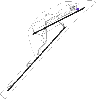
Luanda - Luanda 4 De Fevereiro
Airport details
| Country | Angola |
| State | Luanda Province |
| Region | FN |
| Airspace | Luanda Ctr |
| Municipality | Luanda |
| Elevation | 243ft (74m) |
| Timezone | GMT +1 |
| Coordinates | -8.85769, 13.22834 |
| Magnetic var | |
| Type | land |
| Available since | X-Plane v10.40 |
| ICAO code | FNLU |
| IATA code | LAD |
| FAA code | n/a |
Communication
| Luanda 4 de Fevereiro Ground Control | 121.900 |
| Luanda 4 de Fevereiro A/G VOICE RDO | 129.500 |
| Luanda 4 de Fevereiro Tower | 118.100 |
| Luanda 4 de Fevereiro Approach | 119.100 |
Approach frequencies
| ILS-cat-I | RW23 | 110.3 | 18.00mi |
| 3° GS | RW23 | 110.3 | 18.00mi |
Nearby beacons
| code | identifier | dist | bearing | frequency |
|---|---|---|---|---|
| VNA | LUANDA VOR/DME | 1.3 | 57° | 112.70 |
| LU | LUANDA NDB | 5.9 | 49° | 258 |
Instrument approach procedures
| runway | airway (heading) | route (dist, bearing) |
|---|---|---|
| RW23 | ETOSO (204°) | ETOSO 3000ft G048L (5mi, 137°) 1800ft |
| RW23 | EVADA (228°) | EVADA 3000ft G048L (6mi, 227°) 1800ft |
| RW23 | IMKAK (251°) | IMKAK 3000ft G048L (5mi, 317°) 1800ft |
| RNAV | G048L 1800ft G048F (6mi, 227°) 1800ft FNLU (6mi, 229°) 282ft G221G (7mi, 216°) G241V (16mi, 251°) 3000ft |
Disclaimer
The information on this website is not for real aviation. Use this data with the X-Plane flight simulator only! Data taken with kind consent from X-Plane 12 source code and data files. Content is subject to change without notice.

