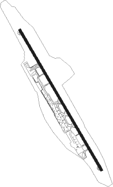
Libreville - Leon Mba
Airport details
| Country | Gabon |
| State | Estuaire Province |
| Region | FO |
| Airspace | Brazzaville Ctr |
| Municipality | Libreville |
| Elevation | 39ft (12m) |
| Timezone | GMT +1 |
| Coordinates | 0.45071, 9.41536 |
| Magnetic var | |
| Type | land |
| Available since | X-Plane v10.40 |
| ICAO code | FOOL |
| IATA code | LBV |
| FAA code | n/a |
Communication
| Leon Mba Tower | 118.700 |
| Leon Mba Approach | 126.500 |
| Leon Mba Departure | 126.500 |
Approach frequencies
| ILS-cat-I | RW16 | 109.5 | 18.00mi |
| 3° GS | RW16 | 109.5 | 18.00mi |
Nearby beacons
| code | identifier | dist | bearing | frequency |
|---|---|---|---|---|
| LV | LIBREVILLE VOR/DME | 1.9 | 335° | 112.10 |
| LN | LIBREVILLE NDB | 5.6 | 335° | 305 |
Departure and arrival routes
| Transition altitude | 3100ft |
| SID end points | distance | outbound heading | |
|---|---|---|---|
| RW16 | |||
| BTA3S | 90mi | 15° | |
| ARAS3S | 96mi | 33° | |
| IKRO1S | 136mi | 69° | |
| NEBE1S | 157mi | 89° | |
| PONO1S | 149mi | 129° | |
| TAPI1S | 149mi | 155° | |
| BUND1S | 149mi | 158° | |
| VORE1S | 118mi | 220° | |
| TURE1S | 112mi | 229° | |
| ILDA1S | 112mi | 236° | |
| AGSI1S | 95mi | 248° | |
| KOPU3S | 80mi | 269° | |
| GULE2S | 86mi | 291° | |
| DESO2S | 94mi | 301° | |
| BIPI1S | 228mi | 316° | |
| RW34 | |||
| BATA2N | 90mi | 15° | |
| ARAS2N | 96mi | 33° | |
| GAKA2N | 78mi | 128° | |
| EBTO2N | 78mi | 155° | |
| MISV2N | 78mi | 158° | |
| TEMK2N | 41mi | 211° | |
| KOPU2N | 80mi | 269° | |
| GULE1N | 86mi | 291° | |
| DESO1N | 94mi | 301° | |
| ARKO2N | 122mi | 316° | |
| STAR starting points | distance | inbound heading | |
|---|---|---|---|
| RW16 | |||
| SEPA1V | 41.2 | 31° | |
| SEPA1D | 24.8 | 32° | |
| VORE1R, GAKO1V | 118.3 | 40° | |
| GAKO1D | 24.8 | 43° | |
| RALE1V, TURE1R | 111.5 | 49° | |
| RALE1D | 24.9 | 53° | |
| IKRU1V, ILDA1R, IKRU1D | 111.6 | 56° | |
| AGSI1R, POGM1V | 95.1 | 68° | |
| POGM1D | 25.0 | 71° | |
| KOLA1V, KOPU1R | 80.0 | 89° | |
| KOLA1D | 25.1 | 92° | |
| GULE1R, ONAN1B, ONAN1D, ONAN1V | 85.6 | 111° | |
| DESO1B | 93.7 | 121° | |
| LUBR1D, LUBR1B, LUBR1V | 72.0 | 122° | |
| MERI1D, MERI1V, MERI1B | 61.9 | 136° | |
| BIPI1B | 227.5 | 136° | |
| AGTE1B, AGTE1A, AGTE1V | 70.3 | 195° | |
| BTA1B | 90.3 | 195° | |
| ARAS1L, VABE1A, VABE1B, VABE1V | 96.1 | 213° | |
| BIKE1A, BIKE1V | 70.1 | 248° | |
| IKRO1L | 136.2 | 249° | |
| UBOL1V, UBOL1A | 70.8 | 268° | |
| NEBE1L | 156.7 | 269° | |
| DITK1V | 24.6 | 307° | |
| DITK1A | 71.7 | 308° | |
| PONO1L | 148.5 | 309° | |
| TAPI1L | 148.7 | 335° | |
| EBRA1D | 24.6 | 338° | |
| BUND1L | 148.8 | 338° | |
Instrument approach procedures
| runway | airway (heading) | route (dist, bearing) |
|---|---|---|
| RW16 | LILAT (175°) | LILAT 2100ft BINAS (5mi, 244°) 2000ft |
| RW16 | RATOS (133°) | RATOS 2000ft BINAS (5mi, 64°) 2000ft |
| RNAV | BINAS 2000ft OL501 (6mi, 154°) 2000ft FOOL (7mi, 154°) 78ft (566mi, 267°) 600ft RATOS (557mi, 86°) 2000ft |
Holding patterns
| STAR name | hold at | type | turn | heading* | altitude | leg | speed limit |
|---|---|---|---|---|---|---|---|
| AGTE1A | ARDAN | VHF | left | 55 (235)° | 2100ft - 12000ft | DME 5.0mi | 230 |
| AGTE1V | LV | NDB | left | 336 (156)° | 3000ft - 6000ft | 1.0min timed | 230 |
| BIKE1A | ARDAN | VHF | left | 55 (235)° | 2100ft - 12000ft | DME 5.0mi | 230 |
| BIKE1V | LV | NDB | left | 336 (156)° | 3000ft - 6000ft | 1.0min timed | 230 |
| DITK1A | ARDAN | VHF | left | 55 (235)° | 2100ft - 12000ft | DME 5.0mi | 230 |
| DITK1V | LV | NDB | left | 336 (156)° | 3000ft - 6000ft | 1.0min timed | 230 |
| EBRA1D | DEGIL | VHF | right | 270 (90)° | 2100ft - 12000ft | DME 5.0mi | 230 |
| EBRA1V | LV | NDB | left | 336 (156)° | 3000ft - 6000ft | 1.0min timed | 230 |
| GAKO1D | DEGIL | VHF | right | 270 (90)° | 2100ft - 12000ft | DME 5.0mi | 230 |
| GAKO1V | LV | NDB | left | 336 (156)° | 3000ft - 6000ft | 1.0min timed | 230 |
| IKRU1D | DEGIL | VHF | right | 270 (90)° | 2100ft - 12000ft | DME 5.0mi | 230 |
| IKRU1V | LV | NDB | left | 336 (156)° | 3000ft - 6000ft | 1.0min timed | 230 |
| KOLA1D | DEGIL | VHF | right | 270 (90)° | 2100ft - 12000ft | DME 5.0mi | 230 |
| KOLA1V | LV | NDB | left | 336 (156)° | 3000ft - 6000ft | 1.0min timed | 230 |
| LUBR1D | DEGIL | VHF | right | 270 (90)° | 2100ft - 12000ft | DME 5.0mi | 230 |
| LUBR1V | LV | NDB | left | 336 (156)° | 3000ft - 6000ft | 1.0min timed | 230 |
| MERI1D | DEGIL | VHF | right | 270 (90)° | 2100ft - 12000ft | DME 5.0mi | 230 |
| MERI1V | LV | NDB | left | 336 (156)° | 3000ft - 6000ft | 1.0min timed | 230 |
| ONAN1D | DEGIL | VHF | right | 270 (90)° | 2100ft - 12000ft | DME 5.0mi | 230 |
| ONAN1V | LV | NDB | left | 336 (156)° | 3000ft - 6000ft | 1.0min timed | 230 |
| POGM1D | DEGIL | VHF | right | 270 (90)° | 2100ft - 12000ft | DME 5.0mi | 230 |
| POGM1V | LV | NDB | left | 336 (156)° | 3000ft - 6000ft | 1.0min timed | 230 |
| RALE1D | DEGIL | VHF | right | 270 (90)° | 2100ft - 12000ft | DME 5.0mi | 230 |
| RALE1V | LV | NDB | left | 336 (156)° | 3000ft - 6000ft | 1.0min timed | 230 |
| SEPA1D | DEGIL | VHF | right | 270 (90)° | 2100ft - 12000ft | DME 5.0mi | 230 |
| SEPA1V | LV | NDB | left | 336 (156)° | 3000ft - 6000ft | 1.0min timed | 230 |
| TASO1D | DEGIL | VHF | right | 270 (90)° | 2100ft - 12000ft | DME 5.0mi | 230 |
| TASO1V | LV | NDB | left | 336 (156)° | 3000ft - 6000ft | 1.0min timed | 230 |
| UBOL1A | ARDAN | VHF | left | 55 (235)° | 2100ft - 12000ft | DME 5.0mi | 230 |
| UBOL1V | LV | NDB | left | 336 (156)° | 3000ft - 6000ft | 1.0min timed | 230 |
| VABE1A | ARDAN | VHF | left | 55 (235)° | 2100ft - 12000ft | DME 5.0mi | 230 |
| VABE1V | LV | NDB | left | 336 (156)° | 3000ft - 6000ft | 1.0min timed | 230 |
| *) magnetic outbound (inbound) holding course | |||||||
Disclaimer
The information on this website is not for real aviation. Use this data with the X-Plane flight simulator only! Data taken with kind consent from X-Plane 12 source code and data files. Content is subject to change without notice.