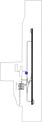
Nacala
Airport details
| Country | Mozambique |
| State | Nampula Province |
| Region | FQ |
| Airspace | Beira Ctr |
| Municipality | Nacala |
| Elevation | 410ft (125m) |
| Timezone | GMT +2 |
| Coordinates | -14.49047, 40.71208 |
| Magnetic var | |
| Type | land |
| Available since | X-Plane v10.40 |
| ICAO code | FQNC |
| IATA code | MNC |
| FAA code | n/a |
Communication
| Nacala Ground Control | 121.900 |
| Nacala Tower | 118.200 |
| Nacala Approach | 119.100 |
Approach frequencies
| IGS | RW19 | 110.3 | 18.00mi |
| 3° GS | RW19 | 110.3 | 18.00mi |
Nearby beacons
| code | identifier | dist | bearing | frequency |
|---|---|---|---|---|
| VNC | NACALA VOR/DME | 1.6 | 5° | 116.50 |
Departure and arrival routes
| Transition altitude | 5000ft |
| SID end points | distance | outbound heading | |
|---|---|---|---|
| RW01 | |||
| NERE1D | 42mi | 22° | |
| IBNE1D | 39mi | 248° | |
| ETKA1D | 42mi | 352° | |
| RW19 | |||
| OKDI1E | 42mi | 22° | |
| TETO1E | 39mi | 248° | |
| NESU1E | 42mi | 352° | |
| STAR starting points | distance | inbound heading | |
|---|---|---|---|
| RW01 | |||
| OKBO1A | 39.2 | 68° | |
| ETKA1A | 41.7 | 172° | |
| NERE1A | 41.7 | 202° | |
| RW19 | |||
| OKBO1B | 39.2 | 68° | |
| ETKA1B | 41.7 | 172° | |
| NERE1B | 41.7 | 202° | |
Instrument approach procedures
| runway | airway (heading) | route (dist, bearing) |
|---|---|---|
| RW01 | APDUT (34°) | APDUT 2100ft NERAV (6mi, 94°) 2100ft |
| RW01 | APGIV (335°) | APGIV 2100ft NERAV (6mi, 274°) 2100ft |
| RW01 | IMKEL (5°) | IMKEL 2100ft NERAV (6mi, 5°) 2100ft |
| RNAV | NERAV 2100ft NERET (5mi, 5°) 2100ft FQNC (6mi, 5°) 448ft FQNC (turn) 1500ft APGIV (12mi, 155°) 2100ft APGIV (turn) 2100ft | |
| RW19 | APGOD (213°) | APGOD 2100ft NESEX (6mi, 274°) 2000ft |
| RW19 | APKAR (156°) | APKAR 2200ft NESEX (6mi, 94°) 2000ft |
| RW19 | IBTIS (185°) | IBTIS 2100ft NESEX (6mi, 185°) 2000ft |
| RNAV | NESEX 2000ft NEROP (5mi, 185°) 2000ft FQNC (6mi, 185°) 380ft FQNC (turn) 1500ft APGOD (13mi, 33°) 2100ft APGOD (turn) 2100ft |
Disclaimer
The information on this website is not for real aviation. Use this data with the X-Plane flight simulator only! Data taken with kind consent from X-Plane 12 source code and data files. Content is subject to change without notice.
