Windhoek - Windhoek Hosea Kutako Intl
Airport details
| Country | Namibia |
| State | Khomas |
| Region | FY |
| Airspace | Windhoek Ctr |
| Elevation | 5641ft (1719m) |
| Timezone | GMT +1 |
| Coordinates | -22.47989, 17.47095 |
| Magnetic var | |
| Type | land |
| Available since | X-Plane v10.40 |
| ICAO code | FYWH |
| IATA code | WDH |
| FAA code | n/a |
Communication
| Windhoek Hosea Kutako Intl ATIS | 126.200 |
| Windhoek Hosea Kutako Intl Alpha Oscar (Ground Control) | 125.900 |
| Windhoek Hosea Kutako Intl Windhoek (Tower) | 118.100 |
| Windhoek Hosea Kutako Intl Windhoek (Approach) | 120.500 |
Approach frequencies
| ILS-cat-I | RW26 | 110.3 | 18.00mi |
| 3° GS | RW26 | 110.3 | 18.00mi |
Nearby Points of Interest:
Old German School Building
-Look-Out Post
-Ten-man House
-War Memorial
-Elisabeth House
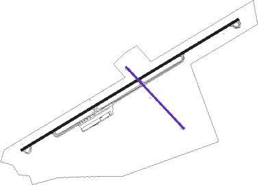
Runway info
Runway 08 / 26  | ||
| length | 4573m (15003ft) | |
| bearing | 65° / 245° | |
| width | 45m (148ft) | |
| surface | asphalt | |
| blast zone | 28m (92ft) / 28m (92ft) | |
| Runway 16 / 34 | ||
| length | 1526m (5007ft) | |
| bearing | 139° / 319° | |
| width | 30m (98ft) | |
| surface | asphalt | |
| blast zone | 5m (16ft) / 13m (43ft) | |
Nearby beacons
| code | identifier | dist | bearing | frequency |
|---|---|---|---|---|
| WHV | WINDHOEK VOR/DME | 0.1 | 352° | 114.50 |
Departure and arrival routes
| Transition altitude | 10000ft |
| SID end points | distance | outbound heading | |
|---|---|---|---|
| RW08 | |||
| EGMA1A | 50mi | 127° | |
| UTUL1A | 47mi | 171° | |
| RW26 | |||
| EGMA1B | 50mi | 127° | |
| UTUL1B | 47mi | 171° | |
| STAR starting points | distance | inbound heading | |
|---|---|---|---|
| RW08 | |||
| ATUP1A | 45.5 | 26° | |
| AXOD1A | 49.5 | 285° | |
| RW26 | |||
| ATUP1B | 45.5 | 26° | |
| AXOD1B | 49.5 | 285° | |
Instrument approach procedures
| runway | airway (heading) | route (dist, bearing) |
|---|---|---|
| RW08 | APNUL (65°) | APNUL WH08I (5mi, 65°) 9000ft |
| RW08 | OLLIE (49°) | OLLIE WH08I (5mi, 353°) 9000ft |
| RW08 | OOVER (81°) | OOVER WH08I (5mi, 132°) 9000ft |
| RNAV | WH08I 9000ft WH08F (5mi, 65°) 8110ft WH08S (5mi, 65°) 6490ft FYWH (4mi, 65°) 5692ft WHM01 (turn) OOVER (17mi, 261°) 9500ft OOVER (turn) 9500ft | |
| RW26 | FRITZ (245°) | FRITZ 8000ft |
| RNAV | FRITZ 8000ft WH26F (3mi, 245°) 8000ft FYWH (9mi, 245°) 5550ft FRITZ (12mi, 65°) 8000ft FRITZ (turn) |
Holding patterns
| STAR name | hold at | type | turn | heading* | altitude | leg | speed limit |
|---|---|---|---|---|---|---|---|
| ATUP1A | ATUPI | VHF | left | 217 (37)° | 20000ft - 46000ft | 1.0min timed | 315 |
| ATUP1B | ATUPI | VHF | left | 217 (37)° | 20000ft - 46000ft | 1.0min timed | 315 |
| AXOD1A | AXODO | VHF | right | 119 (299)° | 20000ft - 46000ft | 1.0min timed | 315 |
| AXOD1B | AXODO | VHF | right | 119 (299)° | 20000ft - 46000ft | 1.0min timed | 315 |
| *) magnetic outbound (inbound) holding course | |||||||
Disclaimer
The information on this website is not for real aviation. Use this data with the X-Plane flight simulator only! Data taken with kind consent from X-Plane 12 source code and data files. Content is subject to change without notice.