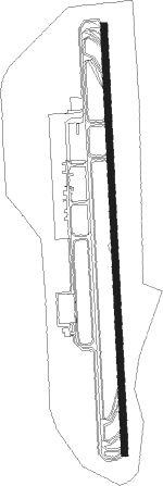
Fuerteventura Island - Fuerteventura
Airport details
| Country | Spain |
| State | Canary Islands |
| Region | GC |
| Airspace | Canaries Ctr |
| Municipality | Puerto del Rosario |
| Elevation | 20ft (6m) |
| Timezone | GMT +0 |
| Coordinates | 28.44163, -13.86840 |
| Magnetic var | |
| Type | land |
| Available since | X-Plane v10.40 |
| ICAO code | GCFV |
| IATA code | FUE |
| FAA code | n/a |
Communication
| Fuerteventura ATIS | 118.650 |
| Fuerteventura Tower | 119.200 |
| Fuerteventura Tower | 118.500 |
| Fuerteventura Approach | 129.300 |
Approach frequencies
| ILS-cat-I | RW19 | 111.3 | 18.00mi |
| ILS-cat-I | RW01 | 109.5 | 18.00mi |
| 3.5° GS | RW19 | 111.3 | 18.00mi |
| 3° GS | RW01 | 109.5 | 18.00mi |
Nearby Points of Interest:
Castillo de Caleta de Fuste
-Edificio Segarra
Nearby beacons
| code | identifier | dist | bearing | frequency |
|---|---|---|---|---|
| FTV | FUERTEVENTURA VOR/DME | 0.6 | 160° | 114.10 |
| FUE | DME | 3.5 | 178° | 108 |
| FV | FUERTEVENTURA NDB | 3.5 | 178° | 397 |
| TLZ | LANZAROTE TACAN | 33.2 | 27° | 114.70 |
| LTE | LANZAROTE AEROPUERTO VOR/DME | 33.5 | 28° | 114.40 |
| LZR | LANZAROTE VOR/DME | 47.4 | 26° | 115.20 |
Departure and arrival routes
| Transition altitude | 6000ft |
| SID end points | distance | outbound heading | |
|---|---|---|---|
| RW01 | |||
| VAST9Q, VAST5Z | 125mi | 8° | |
| LUNO4Q | 45mi | 9° | |
| KORA9Q, KORA6Z | 103mi | 45° | |
| LORP4Q | 44mi | 254° | |
| LARY5Q | 57mi | 294° | |
| MAPE4Q | 31mi | 336° | |
| SAMA5Z, SAMA9Q | 150mi | 347° | |
| RW19 | |||
| VAST8R | 125mi | 8° | |
| LUNO3R | 45mi | 9° | |
| KORA7R, KORA4Y | 103mi | 45° | |
| LORP3R | 44mi | 254° | |
| LARY3R | 57mi | 294° | |
| MAPE3R | 31mi | 336° | |
| SAMA7R | 150mi | 347° | |
| STAR starting points | distance | inbound heading | |
|---|---|---|---|
| ALL | |||
| RUSI4B | 62.0 | 246° | |
| RW01 | |||
| KOPU3S | 38.3 | 65° | |
| GDV5S | 85.3 | 77° | |
| TERT7S | 116.6 | 215° | |
| RUSI4S | 62.0 | 246° | |
| RW19 | |||
| KOPU1W | 38.3 | 65° | |
| GDV3W | 85.3 | 77° | |
| TERT8W | 116.6 | 215° | |
| RUSI5W | 62.0 | 246° | |
Instrument approach procedures
| runway | airway (heading) | route (dist, bearing) |
|---|---|---|
| RW01 | SOTAD (358°) | SOTAD 5000ft DEMEX (14mi, 4°) 2700ft LIRBU (2mi, 314°) 2700ft |
| RNAV | LIRBU 2700ft FV07S (5mi, 2°) 2500ft GCFV (7mi, 360°) 87ft FV627 (4mi, 5°) TENDA (12mi, 85°) 4000ft TENDA (turn) 4000ft | |
| RW19 | BAMKU (294°) | BAMKU 6000ft ROXES (8mi, 1°) 3000ft NOBLI (8mi, 1°) 3000ft RATAT (4mi, 300°) 3000ft TUVIL (4mi, 265°) 3000ft |
| RNAV | TUVIL 3000ft FV737 (5mi, 182°) 2300ft FV04N (4mi, 182°) 1500ft GCFV (5mi, 185°) 133ft FV738 (10mi, 180°) FV739 (8mi, 290°) FV740 (10mi, 301°) KEMEV (18mi, 42°) 4000ft KEMEV (turn) 4000ft |
Holding patterns
| STAR name | hold at | type | turn | heading* | altitude | leg | speed limit |
|---|---|---|---|---|---|---|---|
| GDV3W | KEMEV | VHF | right | 233 (53)° | > 4000ft | 1.0min timed | ICAO rules |
| GDV5S | SIRPU | VHF | right | 223 (43)° | > 5000ft | 1.0min timed | ICAO rules |
| KOPU1W | KEMEV | VHF | right | 233 (53)° | > 4000ft | 1.0min timed | ICAO rules |
| KOPU3S | SIRPU | VHF | right | 223 (43)° | > 5000ft | 1.0min timed | ICAO rules |
| RUSI4B | DURCO | VHF | left | 67 (247)° | 9000ft - 13000ft | 1.0min timed | 230 |
| RUSI4B | TENDA | VHF | left | 66 (246)° | > 5000ft | DME 4.7mi | ICAO rules |
| RUSI4S | DURCO | VHF | left | 67 (247)° | 9000ft - 13000ft | 1.0min timed | 230 |
| RUSI4S | SOTAD | VHF | left | 134 (314)° | > 5000ft | 1.0min timed | 220 |
| RUSI5W | BAMKU | VHF | right | 117 (297)° | > 6000ft | 1.0min timed | 220 |
| RUSI5W | DURCO | VHF | left | 67 (247)° | 9000ft - 13000ft | 1.0min timed | 230 |
| TERT7S | SOTAD | VHF | left | 134 (314)° | > 5000ft | 1.0min timed | 220 |
| TERT8W | BAMKU | VHF | right | 117 (297)° | > 6000ft | 1.0min timed | 220 |
| *) magnetic outbound (inbound) holding course | |||||||
Disclaimer
The information on this website is not for real aviation. Use this data with the X-Plane flight simulator only! Data taken with kind consent from X-Plane 12 source code and data files. Content is subject to change without notice.
