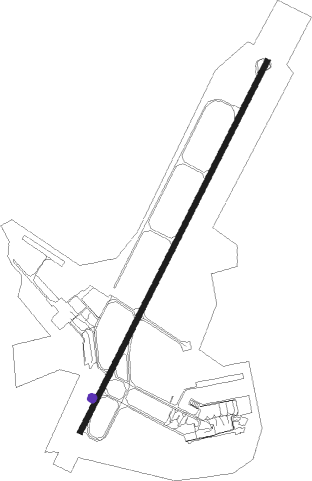
Rabat - Sale Intl
Airport details
| Country | Morocco |
| State | Rabat-Salé Province |
| Region | GM |
| Airspace | Casablanca Ctr |
| Municipality | Salé |
| Elevation | 270ft (82m) |
| Timezone | GMT +0 |
| Coordinates | 34.04971, -6.76434 |
| Magnetic var | |
| Type | land |
| Available since | X-Plane v10.40 |
| ICAO code | GMME |
| IATA code | RBA |
| FAA code | n/a |
Communication
| Sale Intl ATIS | 127.700 |
| Sale Intl Tower | 119.700 |
| Sale Intl Tower | 118.300 |
| Sale Intl Approach | 118.900 |
Approach frequencies
| ILS-cat-I | RW21 | 110.9 | 18.00mi |
| 3° GS | RW21 | 110.9 | 18.00mi |
Nearby beacons
| code | identifier | dist | bearing | frequency |
|---|---|---|---|---|
| RBT | RABAT VOR/DME | 0.8 | 89° | 116.50 |
| SBI | RABAT NDB | 9 | 38° | 332 |
| CNL | KENITRA NDB | 15.9 | 31° | 380 |
| CAE | BENSLIMANE NDB | 31.3 | 219° | 275 |
| BNS | BENSLIMANE VOR/DME | 33 | 227° | 117.45 |
| SMN | SIDI SLIMANE VOR/DME | 37.1 | 75° | 115.50 |
| CBA | DME | 55.5 | 240° | 116.90 |
| SAK | ANFA NDB | 55.5 | 240° | 413 |
| NUA | NOUASSEUR (CASABLANCA) NDB | 56.2 | 234° | 255 |
| CBL | CASABLANCA VOR/DME | 56.5 | 233° | 115.10 |
| NSR | BARRECHID (CASABLANCA) NDB | 61.1 | 226° | 282 |
| SLK | SIDI KHEDIM (CASABLANCA) VOR/DME | 67.2 | 218° | 112.50 |
Departure and arrival routes
| Transition altitude | 3000ft |
| SID end points | distance | outbound heading | |
|---|---|---|---|
| RW03 | |||
| VARA5D | 21mi | 93° | |
| BISM5D | 25mi | 198° | |
| TOLS5D | 35mi | 336° | |
| RW21 | |||
| VARA1C | 21mi | 93° | |
| BISM1C | 25mi | 198° | |
| TOLS1C | 35mi | 336° | |
| STAR starting points | distance | inbound heading | |
|---|---|---|---|
| RW21 | |||
| ESAL1G, ESAL5A | 20.3 | 89° | |
| TUSO1G, TUSO5A | 34.4 | 224° | |
| VARA1G, VARA5A | 20.7 | 273° | |
Holding patterns
| STAR name | hold at | type | turn | heading* | altitude | leg | speed limit |
|---|---|---|---|---|---|---|---|
| ESAL1G | FAHIM | VHF | left | 339 (159)° | 6000ft - 9000ft | 1.0min timed | 220 |
| ESAL5A | SBI | FIX | right | 36 (216)° | 2700ft - 6000ft | 1.0min timed | 220 |
| TUSO1G | ENNAV | VHF | left | 69 (249)° | 6000ft - 9000ft | 1.0min timed | 220 |
| TUSO5A | SBI | FIX | right | 36 (216)° | 2700ft - 6000ft | 1.0min timed | 220 |
| TUSO5A | TUSOR | VHF | right | 41 (221)° | 9000ft - 12000ft | 1.0min timed | 220 |
| VARA1G | ENNAV | VHF | left | 69 (249)° | 6000ft - 9000ft | 1.0min timed | 220 |
| VARA5A | SBI | FIX | right | 36 (216)° | 2700ft - 6000ft | 1.0min timed | 220 |
| VARA5A | VARAS | VHF | left | 96 (276)° | 6000ft - 12000ft | 1.0min timed | 220 |
| *) magnetic outbound (inbound) holding course | |||||||
Disclaimer
The information on this website is not for real aviation. Use this data with the X-Plane flight simulator only! Data taken with kind consent from X-Plane 12 source code and data files. Content is subject to change without notice.
