El Aaiún - Hassan I
Airport details
| Country | Morocco |
| State | Laayoune-Boujdour-Sakia El Hamra |
| Region | GM |
| Airspace | Canaries Ctr |
| Municipality | Laayoune |
| Elevation | 207ft (63m) |
| Timezone | GMT +0 |
| Coordinates | 27.15302, -13.22609 |
| Magnetic var | |
| Type | land |
| Available since | X-Plane v10.40 |
| ICAO code | GMML |
| IATA code | EUN |
| FAA code | n/a |
Communication
| HASSAN I LAAYOUNE Tower | 131.100 |
| HASSAN I LAAYOUNE Approach | 127.500 |
Approach frequencies
| ILS-cat-I | RW02 | 110.7 | 18.00mi |
| 3° GS | RW02 | 110.7 | 18.00mi |
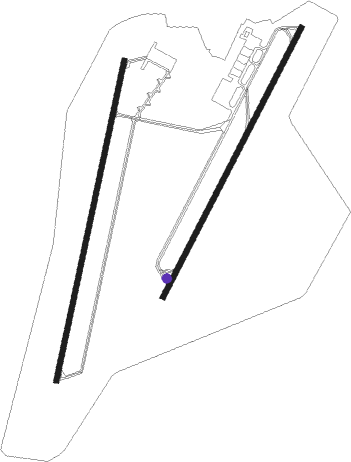
Runway info
Runway 02 / 20  | ||
| length | 2710m (8891ft) | |
| bearing | 18° / 198° | |
| width | 45m (148ft) | |
| surface | asphalt | |
| blast zone | 61m (200ft) / 61m (200ft) | |
| Runway 04 / 22 | ||
| length | 2506m (8222ft) | |
| bearing | 35° / 215° | |
| width | 45m (148ft) | |
| surface | asphalt | |
| blast zone | 62m (203ft) / 201m (659ft) | |
Nearby beacons
| code | identifier | dist | bearing | frequency |
|---|---|---|---|---|
| LAY | LAAYOUNE VOR/DME | 0.7 | 141° | 112.10 |
Instrument approach procedures
| runway | airway (heading) | route (dist, bearing) |
|---|---|---|
| RW02 | DEXAD (355°) | DEXAD 3500ft ML402 (5mi, 285°) 2500ft |
| RW02 | ETAVO (19°) | ETAVO 2500ft ML402 (5mi, 18°) 2500ft |
| RW02 | ROLGO (42°) | ROLGO 3000ft ML402 (5mi, 105°) 2500ft |
| RNAV | ML402 2500ft ML404 (5mi, 18°) 2200ft GMML (8mi, 19°) 273ft GMML (turn) 1500ft ROLGO (14mi, 222°) 3000ft ROLGO (turn) 3000ft |
Disclaimer
The information on this website is not for real aviation. Use this data with the X-Plane flight simulator only! Data taken with kind consent from X-Plane 12 source code and data files. Content is subject to change without notice.