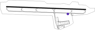
Tangier - Ibn Battouta
Airport details
| Country | Morocco |
| State | Tanger Province |
| Region | GM |
| Airspace | Casablanca Ctr |
| Municipality | Hjar Ennhal حجر النحل |
| Elevation | 62ft (19m) |
| Timezone | GMT +0 |
| Coordinates | 35.72351, -5.91577 |
| Magnetic var | |
| Type | land |
| Available since | X-Plane v10.40 |
| ICAO code | GMTT |
| IATA code | TNG |
| FAA code | n/a |
Communication
| Ibn Battouta TANGER Tower | 119.500 |
| Ibn Battouta TANGER Approach | 121.200 |
Approach frequencies
| ILS-cat-I | RW28 | 109.3 | 18.00mi |
| 3° GS | RW28 | 109.3 | 18.00mi |
Nearby Points of Interest:
Caves of Hercules (Tanger)
-Cape Spartel Lighthouse
-Dar el Makhzen (Tangier)
-Bab El Bhar (Tangier)
-El Estrecho Natural Park
-Castle of Zahara de los Atunes and Palace of Jadraza
-Arte Sureño
-Torre de Trafalgar
-Zawiya of Harrak
-medersa loukach
-Fort of Yebel Ányera, Ceuta
-Dar Al Mandri
-Torre de Piniés
-Torre del Fraile
-Marinid Walls of Ceuta
-Contraguardia de San Francisco Javier, Ceuta
-Revellín de San Ignacio, Museo de Ceuta
-Revellín del Ángulo de San Pablo, Ceuta
-Plaza de Armas, Ceuta
-Baluarte de Santa Ana, Ceuta
-Semibaluarte de San Pedro, Ceuta
-Royal Walls
-Hornabeque del Frente de la Valenciana, Ceuta
-Baluarte de la Coraza Alta, Ceuta
-Baluarte de la Bandera, Ceuta
Nearby beacons
| code | identifier | dist | bearing | frequency |
|---|---|---|---|---|
| TNR | TANGER VOR/DME | 0.6 | 342° | 108.05 |
| TNG | TANGER VOR/DME | 1.2 | 78° | 115.90 |
| TAN | TANGER NDB | 5.4 | 91° | 374 |
| TTN | TETOUAN VOR/DME | 29.8 | 102° | 117.30 |
| VJF | VEJER DE LA FRONTERA VOR/DME | 31.1 | 353° | 117.80 |
| CEU | CEUTA NDB | 31.4 | 75° | 300 |
| GBR | GIBRALTAR TACAN | 37.5 | 54° | 113.60 |
| AOG | ROTA TACAN | 59.3 | 335° | 108.60 |
Departure and arrival routes
| Transition altitude | 4200ft |
| SID end points | distance | outbound heading | |
|---|---|---|---|
| RW10 | |||
| BARP1D | 14mi | 66° | |
| LAMA1D | 21mi | 82° | |
| NARM1D | 21mi | 102° | |
| MADO1D | 20mi | 152° | |
| SOBM1D | 19mi | 180° | |
| ABIR1D | 19mi | 282° | |
| RW28 | |||
| BARP2D | 14mi | 66° | |
| LAMA2D | 21mi | 82° | |
| NARM2D | 21mi | 102° | |
| MADO2D | 20mi | 152° | |
| SOBM2D | 19mi | 180° | |
| ABIR2D | 19mi | 282° | |
| STAR starting points | distance | inbound heading | |
|---|---|---|---|
| RW10 | |||
| VAGN1A | 18.7 | 92° | |
| ABIR1A | 18.8 | 102° | |
| LAMA1A | 21.2 | 262° | |
| NARM1A | 21.0 | 282° | |
| MADO1A | 20.1 | 332° | |
| RW28 | |||
| VAGN2A | 18.7 | 92° | |
| ABIR2A | 18.8 | 102° | |
| LAMA2A, LAMA5A | 21.2 | 262° | |
| NARM2A, NARM5A | 21.0 | 282° | |
| MADO2A, MADO5A | 20.1 | 332° | |
Disclaimer
The information on this website is not for real aviation. Use this data with the X-Plane flight simulator only! Data taken with kind consent from X-Plane 12 source code and data files. Content is subject to change without notice.