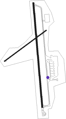
Espargos - Amilcar Cabral Intl
Airport details
| Country | Cabo Verde |
| State | Barlavento Islands |
| Region | GV |
| Airspace | Sal Oceanic Ctr |
| Municipality | Sal |
| Elevation | 184ft (56m) |
| Timezone | GMT -1 |
| Coordinates | 16.73759, -22.95002 |
| Magnetic var | |
| Type | land |
| Available since | X-Plane v10.32 |
| ICAO code | GVAC |
| IATA code | SID |
| FAA code | n/a |
Communication
| Amilcar Cabral Intl Tower | 119.700 |
| Amilcar Cabral Intl SAL Approach | 119.700 |
| Amilcar Cabral Intl SAL Departure | 119.700 |
Approach frequencies
| ILS-cat-I | RW01 | 109.9 | 18.00mi |
| 3° GS | RW01 | 109.9 | 18.00mi |

Nearby beacons
| code | identifier | dist | bearing | frequency |
|---|---|---|---|---|
| CVS | SAL VOR/DME | 0 | 222° | 115.30 |
| SAL | SAL NDB | 2.1 | 178° | 274 |
| BVT | BOA VISTA NDB | 36.4 | 174° | 341 |
Departure and arrival routes
| Transition altitude | 7000ft |
| SID end points | distance | outbound heading | |
|---|---|---|---|
| RW01 | |||
| PISP1A | 80mi | 31° | |
| PINP1A | 80mi | 48° | |
| POLM1A | 80mi | 109° | |
| RAMO1A | 86mi | 127° | |
| BVT1A | 36mi | 174° | |
| SNT1A, SNT1K | 112mi | 196° | |
| BULV1K, BULV1A | 185mi | 210° | |
| NCL1A | 77mi | 263° | |
| SVT1A | 122mi | 272° | |
| KESI1A | 141mi | 306° | |
| RW19 | |||
| PISP1B | 80mi | 31° | |
| PINP1B | 80mi | 48° | |
| POLM1B | 80mi | 109° | |
| RAMO1B | 86mi | 127° | |
| SNT1B | 112mi | 196° | |
| BULV1B | 185mi | 210° | |
| NCL1B | 77mi | 263° | |
| SVT1B | 122mi | 272° | |
| KESI1B | 141mi | 306° | |
| STAR starting points | distance | inbound heading | |
|---|---|---|---|
| ALL | |||
| SNT1S | 112.3 | 16° | |
| AGTI1S | 188.6 | 26° | |
| BULV1S | 185.2 | 30° | |
| NCL1S | 77.4 | 83° | |
| NINA1S | 75.7 | 94° | |
| KESI1S | 141.4 | 126° | |
| PISP1S | 80.0 | 211° | |
| PINP1S | 79.9 | 228° | |
| POLM1S | 80.2 | 289° | |
| RAMO1S | 86.0 | 307° | |
Disclaimer
The information on this website is not for real aviation. Use this data with the X-Plane flight simulator only! Data taken with kind consent from X-Plane 12 source code and data files. Content is subject to change without notice.