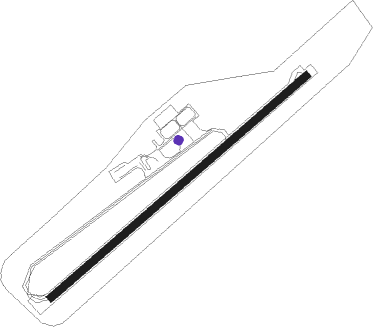
São Pedro - Sao Pedro
Airport details
| Country | Cabo Verde |
| State | Barlavento Islands |
| Region | GV |
| Airspace | Sal Oceanic Ctr |
| Municipality | Mindelo |
| Elevation | 63ft (19m) |
| Timezone | GMT -1 |
| Coordinates | 16.83361, -25.05472 |
| Magnetic var | |
| Type | land |
| Available since | X-Plane v10.40 |
| ICAO code | GVSV |
| IATA code | VXE |
| FAA code | n/a |
Communication
| Sao Pedro SAO VICENTE Tower | 118.400 |
| Sao Pedro SAO VICENTE Approach | 118.400 |
Approach frequencies
| LOC | RW06 | 109.7 | 18.00mi |
Nearby beacons
| code | identifier | dist | bearing | frequency |
|---|---|---|---|---|
| SVT | SAO VICENTE NDB | 0.6 | 246° | 333 |
| NCL | S. NICOLAU NDB | 47.2 | 109° | 357 |
Departure and arrival routes
| Transition altitude | 7000ft |
| SID end points | distance | outbound heading | |
|---|---|---|---|
| RW06 | |||
| KESI1U | 80mi | 6° | |
| LINI1U | 81mi | 13° | |
| MOPA2G, MOPA1U | 97mi | 38° | |
| NEMD2G, NEMD1U | 116mi | 50° | |
| NINA1U, NINA2G | 46mi | 90° | |
| SISA1U | 50mi | 124° | |
| SNT2G | 146mi | 140° | |
| DENE1U | 91mi | 205° | |
| EDIP1U, EDIP2G | 82mi | 240° | |
| EVKA2G, EVKA1U | 80mi | 315° | |
| RW24 | |||
| KESI1X | 80mi | 6° | |
| LINI1X | 81mi | 13° | |
| MOPA2H, MOPA1X | 97mi | 38° | |
| NEMD2H, NEMD1X | 116mi | 50° | |
| NINA2H, NINA1X | 46mi | 90° | |
| SISA1X, SISA2H | 50mi | 124° | |
| SNT2H | 146mi | 140° | |
| DENE1X | 91mi | 205° | |
| EDIP2H, EDIP1X | 82mi | 240° | |
| EVKA2H, EVKA1X | 80mi | 315° | |
| STAR starting points | distance | inbound heading | |
|---|---|---|---|
| ALL | |||
| DENE2V | 90.5 | 25° | |
| EVKA2V | 80.2 | 135° | |
| LINI2V | 80.9 | 193° | |
| NEMD2V | 115.7 | 230° | |
| NINA2V | 45.5 | 270° | |
| SISA2V | 50.3 | 304° | |
| SNT2V | 145.5 | 320° | |
| RW06 | |||
| DENE1Y | 90.5 | 25° | |
| EDIP1Y | 81.5 | 60° | |
| EVKA1Y | 80.2 | 135° | |
| NEMD1Y | 115.7 | 230° | |
| NINA1Y | 45.5 | 270° | |
| SISA1Y | 50.3 | 304° | |
| SNT1Y | 145.5 | 320° | |
| RW24 | |||
| DENE1Z | 90.5 | 25° | |
| EDIP1Z | 81.5 | 60° | |
| EVKA1Z | 80.2 | 135° | |
| NEMD1Z | 115.7 | 230° | |
| NINA1Z | 45.5 | 270° | |
| SISA1Z | 50.3 | 304° | |
| SNT1Z | 145.5 | 320° | |
Instrument approach procedures
| runway | airway (heading) | route (dist, bearing) |
|---|---|---|
| RW06 | SV401 (67°) | SV401 2500ft SV12W (6mi, 69°) 2500ft |
| RW06 | SV402 (46°) | SV402 2500ft SV12W (6mi, 359°) 2500ft |
| RW06 | SV403 (88°) | SV403 5300ft SV12W (6mi, 138°) 2500ft |
| RNAV | SV12W 2500ft SV07W (5mi, 69°) 2300ft SV02W (5mi, 69°) 704ft SV404 (6mi, 69°) SV405 (5mi, 19°) SV406 (5mi, 308°) SV403 (19mi, 241°) 5300ft SV403 (turn) 5300ft | |
| RW24 | SV501 (257°) | SV501 4000ft SV11E (6mi, 303°) 2500ft |
| RW24 | SV502 (235°) | SV502 2500ft SV11E (6mi, 235°) 2500ft |
| RNAV | SV11E 2500ft SV06E (5mi, 235°) 2100ft GVSV (7mi, 235°) 151ft SV504 (2mi, 235°) SV505 (6mi, 143°) SV506 (7mi, 74°) SV501 (10mi, 38°) 4000ft SV501 (turn) 4000ft |
Disclaimer
The information on this website is not for real aviation. Use this data with the X-Plane flight simulator only! Data taken with kind consent from X-Plane 12 source code and data files. Content is subject to change without notice.
