Cairo - Cairo Intl
Airport details
| Country | Egypt |
| State | Cairo |
| Region | HE |
| Airspace | Cairo Ctr |
| Elevation | 377ft (115m) |
| Timezone | GMT +2 |
| Coordinates | 30.12956, 31.40281 |
| Magnetic var | |
| Type | land |
| Available since | X-Plane v10.40 |
| ICAO code | HECA |
| IATA code | CAI |
| FAA code | n/a |
Communication
| Cairo Intl ATIS | 122.600 |
| Cairo Intl Ground Control SOUTH | 121.900 |
| Cairo Intl Ground Control NORTH | 126.375 |
| Cairo Intl Tower | 118.100 |
| Cairo Intl Approach | 119.050 |
| Cairo Intl Approach | 120.700 |
| Cairo Intl Approach | 119.550 |
Approach frequencies
| ILS-cat-II | RW05R | 108.9 | 18.00mi |
| ILS-cat-II | RW05L | 110.9 | 18.00mi |
| ILS-cat-II | RW05C | 109.9 | 18.00mi |
| ILS-cat-II | RW23R | 110.3 | 18.00mi |
| ILS-cat-II | RW23L | 108.7 | 18.00mi |
| ILS-cat-II | RW23C | 109.5 | 18.00mi |
| 3° GS | RW05R | 108.9 | 18.00mi |
| 3° GS | RW23C | 109.5 | 18.00mi |
| 3° GS | RW23L | 108.7 | 18.00mi |
| 3° GS | RW05L | 110.9 | 18.00mi |
| 3° GS | RW23R | 110.3 | 18.00mi |
| 3° GS | RW05C | 109.9 | 18.00mi |
Nearby Points of Interest:
Gamal Eddin Youssef Istadar Mosque
-Mosque-Madrassa of Sultan Barquq
-Madrassa of Al-Nasir Muhammad
-Sultan Qaytbay Complex
-Wikala of Al-Ghuri
-Amir Khayrbak Funerary Complex
-Mosque of Qanibay al-Muhammadi
-Mosque and Khanqah of Shaykhu
-Fustat
-Giza pyramid complex
-Memphis and its Necropolis – the Pyramid Fields from Giza to Dahshur
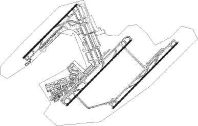
Runway info
Runway 05R / 23L  | ||
| length | 4005m (13140ft) | |
| bearing | 53° / 233° | |
| width | 60m (197ft) | |
| surface | asphalt | |
| blast zone | 65m (213ft) / 66m (217ft) | |
| Runway 05C / 23C | ||
| length | 4001m (13127ft) | |
| bearing | 53° / 233° | |
| width | 60m (197ft) | |
| surface | asphalt | |
| blast zone | 72m (236ft) / 64m (210ft) | |
| Runway 05L / 23R | ||
| length | 3295m (10810ft) | |
| bearing | 53° / 233° | |
| width | 60m (197ft) | |
| surface | asphalt | |
| blast zone | 58m (190ft) / 62m (203ft) | |
Nearby beacons
| code | identifier | dist | bearing | frequency |
|---|---|---|---|---|
| CAI | CAIRO VOR/DME | 1.7 | 43° | 112.50 |
| CVO | CAIRO VOR/DME | 2.3 | 201° | 115.20 |
| ALI | CAIRO NDB | 2.4 | 335° | 310 |
| MXR | ALMAZA TACAN | 3.2 | 231° | 116.30 |
| A | ALMAZA NDB | 4 | 218° | 490 |
| MKT | MOQUATTAM NDB | 8.4 | 236° | 317 |
| OCT | OCTOBER NDB | 35.3 | 241° | 340 |
Instrument approach procedures
| runway | airway (heading) | route (dist, bearing) |
|---|---|---|
| RW05C | CA442 (16°) | CA442 4500ft CA416 (14mi, 344°) 3500ft |
| RNAV | CA416 3500ft CA417 (5mi, 53°) 2500ft CA418 (6mi, 53°) 651ft CA419 (3mi, 53°) CA442 (24mi, 200°) 4500ft CA442 (turn) | |
| RW05L | CA442 (16°) | CA442 4500ft CA434 (16mi, 344°) 3500ft |
| RNAV | CA434 3500ft CA436 (4mi, 53°) 2500ft CA437 (7mi, 53°) 242ft CA412 (3mi, 54°) CA442 (26mi, 198°) 4500ft CA442 (turn) | |
| RW05R | CA442 (16°) | CA442 4500ft CA452 (13mi, 344°) 3500ft |
| RNAV | CA452 3500ft CA453 (7mi, 53°) 2500ft HECA (7mi, 37°) 498ft CA456 (4mi, 81°) CA442 (26mi, 205°) 4500ft CA442 (turn) 4500ft | |
| RW23C | CA422 (249°) | CA422 CA423 (10mi, 254°) 3200ft CA424 (5mi, 254°) 2500ft |
| RW23C | CA428 (297°) | CA428 CA423 (12mi, 3°) 3200ft CA424 (5mi, 254°) 2500ft |
| RNAV | CA424 2500ft CA426 (7mi, 233°) 427ft CA418 (3mi, 233°) CA428 (12mi, 107°) CA428 (turn) | |
| RW23L | CA428 (297°) | CA428 CA471 (8mi, 28°) 4500ft CA473 (6mi, 315°) 3000ft |
| RW23L | CA472 (239°) | CA472 4500ft CA473 (6mi, 233°) 3000ft |
| RNAV | CA473 3000ft CA474 (5mi, 233°) 2100ft HECA (7mi, 249°) 517ft CA475 (8mi, 218°) CA476 (5mi, 135°) CA428 (12mi, 73°) CA428 (turn) | |
| RW23R | CA422 (249°) | CA422 4500ft CA429 (9mi, 258°) 3200ft CA431 (6mi, 259°) 2500ft |
| RW23R | CA428 (297°) | CA428 CA429 (13mi, 3°) 3200ft CA431 (6mi, 259°) 2500ft |
| RNAV | CA431 2500ft CA412 (6mi, 233°) 628ft CA518 (8mi, 282°) 2000ft CA519 (6mi, 24°) 2800ft CA520 (8mi, 130°) 4000ft CA428 (13mi, 130°) CA428 (turn) |
Disclaimer
The information on this website is not for real aviation. Use this data with the X-Plane flight simulator only! Data taken with kind consent from X-Plane 12 source code and data files. Content is subject to change without notice.