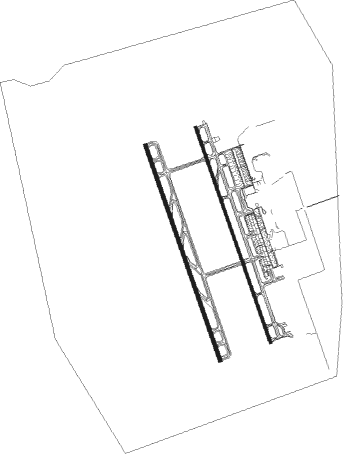
Hurghada - Hurghada Intl
Airport details
| Country | Egypt |
| State | Red Sea |
| Region | HE |
| Airspace | Cairo Ctr |
| Municipality | Al Hadaba |
| Elevation | 48ft (15m) |
| Timezone | GMT +2 |
| Coordinates | 27.17861, 33.80083 |
| Magnetic var | |
| Type | land |
| Available since | X-Plane v10.40 |
| ICAO code | HEGN |
| IATA code | HRG |
| FAA code | n/a |
Communication
| Hurghada Intl Ground Control | 121.900 |
| Hurghada Intl Tower | 119.600 |
| Hurghada Intl RADAR | 123.400 |
| Hurghada Intl RADAR | 119.100 |
Approach frequencies
| ILS-cat-II | RW34R | 110.3 | 18.00mi |
| 3° GS | RW34R | 110.3 | 18.00mi |
Nearby beacons
| code | identifier | dist | bearing | frequency |
|---|---|---|---|---|
| HGD | HURGHADA VOR/DME | 0.2 | 259° | 116.50 |
| SHM | SHARM EL SHEIKH VOR/DME | 59 | 37° | 114.20 |
Departure and arrival routes
| Transition altitude | 9500ft |
| Transition level | 11000ft |
| SID end points | distance | outbound heading | |
|---|---|---|---|
| RW34L | |||
| IMLU1B | 25mi | 36° | |
| ALMO1B | 25mi | 110° | |
| SOBE1B | 29mi | 132° | |
| KUSA1B | 25mi | 207° | |
| BOTI1B | 25mi | 275° | |
| SOLO1B | 25mi | 351° | |
| RW34R | |||
| IMLU1B | 25mi | 36° | |
| ALMO1B | 25mi | 110° | |
| SOBE1B | 29mi | 132° | |
| KUSA1B | 25mi | 207° | |
| BOTI1B | 25mi | 275° | |
| SOLO1B | 25mi | 351° | |
| STAR starting points | distance | inbound heading | |
|---|---|---|---|
| RW34 (ALL) | |||
| KUSA1A | 25.2 | 27° | |
| LUGA1A | 25.1 | 116° | |
| SOKO1A | 25.1 | 141° | |
| IMLU1A | 24.8 | 216° | |
| ALMO1A | 24.7 | 290° | |
| SOBE1A | 28.7 | 312° | |
Instrument approach procedures
| runway | airway (heading) | route (dist, bearing) |
|---|---|---|
| RW16L | GN711 (191°) | GN711 5000ft GN714 (7mi, 238°) 3000ft |
| RW16L | GN712 (164°) | GN712 5500ft GN714 (7mi, 163°) 3000ft |
| RW16L | GN713 (135°) | GN713 5500ft GN714 (8mi, 95°) 3000ft |
| RNAV | GN714 3000ft GN715 (5mi, 164°) 2000ft HEGN (7mi, 164°) 100ft GN716 (6mi, 163°) 1300ft GN717 (10mi, 76°) 2000ft GN711 (21mi, 333°) 5000ft GN711 (turn) 5000ft | |
| RW16R | GN711 (191°) | GN711 5000ft GN718 (7mi, 242°) 3100ft |
| RW16R | GN712 (164°) | GN712 5500ft GN718 (7mi, 168°) 3100ft |
| RW16R | GN713 (135°) | GN713 5500ft GN718 (7mi, 93°) 3100ft |
| RNAV | GN718 3100ft GN719 (5mi, 163°) 2000ft HEGN (7mi, 159°) 128ft GN720 (6mi, 169°) 1300ft GN721 (10mi, 76°) 2000ft GN711 (20mi, 334°) 5000ft GN711 (turn) 5000ft | |
| RW34L | GN200 (307°) | GN200 7100ft GN209 (12mi, 273°) 3100ft |
| RW34L | GN201 (344°) | GN201 5500ft GN209 (7mi, 339°) 3100ft |
| RW34L | GN202 (27°) | GN202 8800ft GN203 (7mi, 58°) 6100ft GN209 (7mi, 58°) 3100ft |
| RNAV | GN209 3100ft GN210 (5mi, 344°) 2000ft HEGN (7mi, 348°) 159ft GN211 (7mi, 339°) 1500ft GN207 (12mi, 77°) 3000ft GN200 (23mi, 164°) 7100ft GN200 (turn) 7100ft | |
| RW34R | GN200 (307°) | GN200 7100ft GN204 (12mi, 275°) 3000ft |
| RW34R | GN201 (344°) | GN201 5500ft GN204 (7mi, 344°) 3000ft |
| RW34R | GN202 (27°) | GN202 8800ft GN203 (7mi, 58°) 6100ft GN204 (8mi, 58°) 3000ft |
| RNAV | GN204 3000ft GN205 (5mi, 344°) 2000ft HEGN (7mi, 344°) 85ft GN206 (7mi, 344°) 1500ft GN207 (11mi, 77°) 3000ft GN200 (23mi, 164°) 7100ft GN200 (turn) 7100ft |
Holding patterns
| STAR name | hold at | type | turn | heading* | altitude | leg | speed limit |
|---|---|---|---|---|---|---|---|
| ALMO1A | GN200 | VHF | right | 91 (271)° | > 7100ft | 1.0min timed | ICAO rules |
| IMLU1A | GN200 | VHF | right | 91 (271)° | > 7100ft | 1.0min timed | ICAO rules |
| KUSA1A | GN200 | VHF | right | 91 (271)° | > 7100ft | 1.0min timed | ICAO rules |
| LUGA1A | LUGAT | VHF | left | 295 (115)° | > 13000ft | DME 5.0mi | ICAO rules |
| SOBE1A | GN200 | VHF | right | 91 (271)° | > 7100ft | 1.0min timed | ICAO rules |
| *) magnetic outbound (inbound) holding course | |||||||
Disclaimer
The information on this website is not for real aviation. Use this data with the X-Plane flight simulator only! Data taken with kind consent from X-Plane 12 source code and data files. Content is subject to change without notice.

