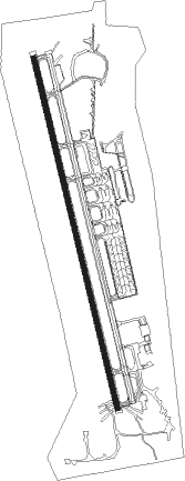
Aswan - Aswan Intl
Airport details
| Country | Egypt |
| State | Aswan |
| Region | HE |
| Airspace | Cairo Ctr |
| Elevation | 647ft (197m) |
| Timezone | GMT +2 |
| Coordinates | 23.96445, 32.82000 |
| Magnetic var | |
| Type | land |
| Available since | X-Plane v10.40 |
| ICAO code | HESN |
| IATA code | ASW |
| FAA code | n/a |
Communication
| Aswan Intl HESN TOWER | 118.300 |
| Aswan Intl HESN RADAR | 120.300 |
Approach frequencies
| ILS-cat-II | RW35 | 109.5 | 18.00mi |
| 3° GS | RW35 | 109.5 | 18.00mi |
Nearby Points of Interest:
Philae obelisk
-Qubbet el-Hawa
Nearby beacons
| code | identifier | dist | bearing | frequency |
|---|---|---|---|---|
| ASN | ASWAN VOR/DME | 0.4 | 337° | 112.30 |
Departure and arrival routes
| Transition altitude | 4000ft |
| Transition level | 5500ft |
| SID end points | distance | outbound heading | |
|---|---|---|---|
| RW17 | |||
| ULOL1B | 20mi | 218° | |
| VEDU1B | 21mi | 331° | |
| RW35 | |||
| ULOL1A | 20mi | 218° | |
| VEDU1A | 21mi | 331° | |
| STAR starting points | distance | inbound heading | |
|---|---|---|---|
| RW17 | |||
| TUBA1B | 19.8 | 55° | |
| TULB1B | 22.5 | 178° | |
| RW35 | |||
| TUBA1A | 19.8 | 55° | |
| TULB1A | 22.5 | 178° | |
Instrument approach procedures
| runway | airway (heading) | route (dist, bearing) |
|---|---|---|
| RW17 | SN711 (126°) | SN711 SN714 (10mi, 82°) 3200ft |
| RW17 | SN712 (170°) | SN712 SN714 (8mi, 170°) 3200ft |
| RNAV | SN714 3200ft SN715 (5mi, 170°) 2300ft HESN (6mi, 170°) 671ft SN716 (6mi, 170°) 1800ft SN717 (10mi, 262°) 3300ft SN711 (17mi, 350°) SN711 (turn) | |
| RW35 | SN301 (350°) | SN301 SN304 (7mi, 350°) 3300ft |
| RW35 | SN302 (35°) | SN302 SN304 (10mi, 82°) 3300ft |
| RNAV | SN304 3300ft SN305 (5mi, 350°) 2300ft HESN (6mi, 350°) 712ft SN306 (7mi, 350°) 2000ft SN307 (10mi, 262°) 3500ft SN302 (18mi, 170°) SN302 (turn) |
Holding patterns
| STAR name | hold at | type | turn | heading* | altitude | leg | speed limit |
|---|---|---|---|---|---|---|---|
| TUBA1A | SN123 | VHF | left | 257 (77)° | > 7000ft | 1.0min timed | ICAO rules |
| TUBA1B | SN113 | VHF | right | 257 (77)° | > 7000ft | 1.0min timed | ICAO rules |
| TULB1A | SN123 | VHF | left | 257 (77)° | > 7000ft | 1.0min timed | ICAO rules |
| *) magnetic outbound (inbound) holding course | |||||||
Disclaimer
The information on this website is not for real aviation. Use this data with the X-Plane flight simulator only! Data taken with kind consent from X-Plane 12 source code and data files. Content is subject to change without notice.