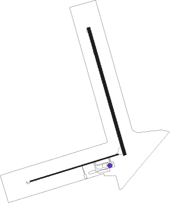
Malindi
Airport details
| Country | Kenya |
| State | Kilifi County |
| Region | HK |
| Airspace | Nairobi Ctr |
| Elevation | 83ft (25m) |
| Timezone | GMT +3 |
| Coordinates | -3.22305, 40.10049 |
| Magnetic var | |
| Type | land |
| Available since | X-Plane v10.40 |
| ICAO code | HKML |
| IATA code | MYD |
| FAA code | n/a |
Communication
| Malindi Tower | 120.400 |
| Malindi Approach /Departure | 120.400 |
Nearby Points of Interest:
Mnarani ruins
Nearby beacons
| code | identifier | dist | bearing | frequency |
|---|---|---|---|---|
| MLD | MALINDI VOR/DME | 0.6 | 169° | 113.30 |
| MOV | MOVEX VOR/DME | 51.4 | 212° | 112.30 |
Departure and arrival routes
| Transition altitude | 2000ft |
| Transition level | 3000ft |
| SID end points | distance | outbound heading | |
|---|---|---|---|
| RW17 | |||
| XALE1A | 61mi | 41° | |
| ETBA1A | 42mi | 213° | |
| NORV1A | 42mi | 301° | |
| RW35 | |||
| XALE1B | 61mi | 41° | |
| ETBA1B | 42mi | 213° | |
| NORV1B | 42mi | 301° | |
| STAR starting points | distance | inbound heading | |
|---|---|---|---|
| RW17 | |||
| ETBA1A | 42.2 | 33° | |
| XALE1A | 60.9 | 221° | |
| RW35 | |||
| ETBA1B | 42.2 | 33° | |
| XALE1B | 60.9 | 221° | |
Instrument approach procedures
| runway | airway (heading) | route (dist, bearing) |
|---|---|---|
| RW17 | ESTOG (196°) | ESTOG 2000ft NEXIB (6mi, 258°) 2000ft |
| RW17 | UTUGO (141°) | UTUGO 3000ft NEXIB (6mi, 78°) 2000ft |
| RW17 | XOVOS (169°) | XOVOS 2300ft NEXIB (6mi, 169°) 2000ft |
| RNAV | NEXIB 2000ft EGNAV (6mi, 169°) 1700ft HKML (5mi, 169°) 126ft UTUGO (13mi, 321°) 3000ft UTUGO (turn) 3000ft | |
| RW35 | AXIVI (349°) | AXIVI 2000ft APLOP (6mi, 349°) 2000ft |
| RW35 | UTADA (321°) | UTADA 2000ft APLOP (6mi, 258°) 2000ft |
| RW35 | UTEVI (16°) | UTEVI 3000ft APLOP (6mi, 78°) 2000ft |
| RNAV | APLOP 2000ft TEXUM (6mi, 349°) 1700ft HKML (5mi, 349°) 126ft UTEVI (13mi, 196°) 3000ft UTEVI (turn) 3000ft |
Disclaimer
The information on this website is not for real aviation. Use this data with the X-Plane flight simulator only! Data taken with kind consent from X-Plane 12 source code and data files. Content is subject to change without notice.

