Kamembe - Kamembe Intl
Airport details
| Country | Rwanda |
| State | Western Province |
| Region | HR |
| Municipality | Gihundwe |
| Elevation | 4891ft (1491m) |
| Timezone | GMT +2 |
| Coordinates | -2.45931, 28.90843 |
| Magnetic var | |
| Type | land |
| Available since | X-Plane v10.40 |
| ICAO code | HRZA |
| IATA code | KME |
| FAA code | n/a |
Communication
| Kamembe Intl Tower | 120.700 |
Runway info
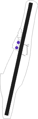
| Runway 02 / 20 | ||
| length | 1487m (4879ft) | |
| bearing | 17° / 197° | |
| width | 45m (148ft) | |
| surface | asphalt | |
Nearby beacons
| code | identifier | dist | bearing | frequency |
|---|---|---|---|---|
| BKV | BUKAVU NDB | 10.3 | 326° | 514 |
| RG | RWEGURA NDB | 45.7 | 127° | 305 |
| KW | BUJUMBURA NDB | 46.3 | 151° | 385 |
| GS | GOMA NDB | 49.7 | 24° | 397 |
| BU | BUTARE NDB | 50.2 | 100° | 340 |
| GOM | GOMA VOR/DME | 50.9 | 23° | 116.50 |
| BN | BUJUMBURA NDB | 53 | 153° | 255 |
| BJA | BUJUMBURA VOR/DME | 58.7 | 155° | 112.30 |
| BS | BUJUMBURA NDB | 58.8 | 155° | 285 |
Disclaimer
The information on this website is not for real aviation. Use this data with the X-Plane flight simulator only! Data taken with kind consent from X-Plane 12 source code and data files. Content is subject to change without notice.