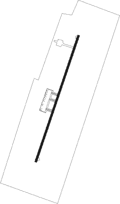
Merowe
Airport details
| Country | Sudan |
| State | Northern State |
| Region | HS |
| Airspace | Khartoum Ctr |
| Municipality | Merowe |
| Elevation | 896ft (273m) |
| Timezone | GMT +2 |
| Coordinates | 18.44300, 31.84358 |
| Magnetic var | |
| Type | land |
| Available since | X-Plane v10.40 |
| ICAO code | HSMN |
| IATA code | MWE |
| FAA code | n/a |
Communication
| Merowe Tower | 118.400 |
Approach frequencies
| ILS-cat-II | RW02 | 108.5 | 18.00mi |
| ILS-cat-II | RW20 | 109.5 | 18.00mi |
| 3° GS | RW02 | 108.5 | 18.00mi |
| 3° GS | RW20 | 109.5 | 18.00mi |
Nearby beacons
| code | identifier | dist | bearing | frequency |
|---|---|---|---|---|
| MRW | MEROWE VOR/DME | 1.9 | 204° | 116 |
Departure and arrival routes
| SID end points | distance | outbound heading | |
|---|---|---|---|
| RW02 | |||
| GERA1N, GERA1A | 29mi | 82° | |
| ROTA1N, ROTA1A | 31mi | 154° | |
| KURT1N, KURT1A | 30mi | 295° | |
| SOLE1A, SOLE1N | 29mi | 320° | |
| ORKA1A, ORKA1N | 28mi | 355° | |
| RW20 | |||
| GERA1S, GERA1B | 29mi | 82° | |
| ROTA1B, ROTA1S | 31mi | 154° | |
| KURT1B, KURT1S | 30mi | 295° | |
| SOLE1B, SOLE1S | 29mi | 320° | |
| ORKA1B, ORKA1S | 28mi | 355° | |
| STAR starting points | distance | inbound heading | |
|---|---|---|---|
| RW02 | |||
| KURT1A, KURT1N | 29.8 | 115° | |
| SOLE1A, SOLE1N | 29.1 | 140° | |
| ORKA1A, ORKA1N | 28.4 | 175° | |
| GERA1A, GERA1N | 28.9 | 262° | |
| ROTA1N, ROTA1A | 31.3 | 334° | |
| RW20 | |||
| KURT1B, KURT1S | 29.8 | 115° | |
| SOLE1S, SOLE1B | 29.1 | 140° | |
| ORKA1B, ORKA1S | 28.4 | 175° | |
| GERA1S, GERA1B | 28.9 | 262° | |
| ROTA1B, ROTA1S | 31.3 | 334° | |
Instrument approach procedures
| runway | airway (heading) | route (dist, bearing) |
|---|---|---|
| RW02 | MN406 (24°) | MN406 3000ft MN404 (5mi, 24°) 3000ft |
| RNAV | MN404 3000ft MN402 (3mi, 24°) 3000ft HSMN (8mi, 24°) 926ft MN401 (2mi, 24°) MN403 (11mi, 250°) MN410 (10mi, 189°) MN406 (5mi, 112°) 3000ft MN406 (turn) 3000ft | |
| RW20 | MN506 (177°) | MN506 3000ft MN504 (6mi, 112°) 3000ft |
| RW20 | MN508 (231°) | MN508 3000ft MN504 (6mi, 292°) 3000ft |
| RNAV | MN504 3000ft MN502 (4mi, 204°) 3000ft HSMN (8mi, 204°) 926ft MRW (2mi, 204°) MN500 (10mi, 346°) MN506 (6mi, 24°) 3000ft MN506 (turn) 3000ft |
Holding patterns
| STAR name | hold at | type | turn | heading* | altitude | leg | speed limit |
|---|---|---|---|---|---|---|---|
| GERA1A | MN406 | VHF | left | 200 (20)° | 3000ft - 8000ft | 1.0min timed | 220 |
| GERA1N | MRW | NDB | left | 41 (221)° | 3000ft - 11000ft | 1.0min timed | 230 |
| GERA1S | MRW | NDB | left | 41 (221)° | 3000ft - 11000ft | 1.0min timed | 230 |
| KURT1A | MN406 | VHF | left | 200 (20)° | 3000ft - 8000ft | 1.0min timed | 220 |
| KURT1B | MN506 | VHF | left | 290 (110)° | 3000ft - 14000ft | 1.0min timed | 235 |
| KURT1N | MRW | NDB | left | 41 (221)° | 3000ft - 11000ft | 1.0min timed | 230 |
| KURT1S | MRW | NDB | left | 41 (221)° | 3000ft - 11000ft | 1.0min timed | 230 |
| ORKA1A | MN406 | VHF | left | 200 (20)° | 3000ft - 8000ft | 1.0min timed | 220 |
| ORKA1B | MN506 | VHF | left | 290 (110)° | 3000ft - 14000ft | 1.0min timed | 235 |
| ORKA1N | MRW | NDB | left | 41 (221)° | 3000ft - 11000ft | 1.0min timed | 230 |
| ORKA1S | MRW | NDB | left | 41 (221)° | 3000ft - 11000ft | 1.0min timed | 230 |
| ROTA1A | MN406 | VHF | left | 200 (20)° | 3000ft - 8000ft | 1.0min timed | 220 |
| ROTA1N | MRW | NDB | left | 41 (221)° | 3000ft - 11000ft | 1.0min timed | 230 |
| ROTA1S | MRW | NDB | left | 41 (221)° | 3000ft - 11000ft | 1.0min timed | 230 |
| SOLE1A | MN406 | VHF | left | 200 (20)° | 3000ft - 8000ft | 1.0min timed | 220 |
| SOLE1B | MN506 | VHF | left | 290 (110)° | 3000ft - 14000ft | 1.0min timed | 235 |
| SOLE1N | MRW | NDB | left | 41 (221)° | 3000ft - 11000ft | 1.0min timed | 230 |
| SOLE1S | MRW | NDB | left | 41 (221)° | 3000ft - 11000ft | 1.0min timed | 230 |
| *) magnetic outbound (inbound) holding course | |||||||
Disclaimer
The information on this website is not for real aviation. Use this data with the X-Plane flight simulator only! Data taken with kind consent from X-Plane 12 source code and data files. Content is subject to change without notice.