Liberty - Liberty-casey County
Airport details
| Country | United States of America |
| State | Kentucky |
| Region | K5 |
| Airspace | Indianapolis Ctr |
| Municipality | Casey County |
| Elevation | 1040ft (317m) |
| Timezone | GMT -5 |
| Coordinates | 37.30856, -85.05911 |
| Magnetic var | |
| Type | land |
| Available since | X-Plane v10.40 |
| ICAO code | I53 |
| IATA code | n/a |
| FAA code | 53KT |
Communication
| Liberty-Casey County CTAF | 122.900 |
Nearby Points of Interest:
Campbellsville Historic Commercial District
-Merchant Tower
-Dr. Nathan Gaither House
-Adair County Courthouse
-Anderson House
-John Field House
-Mt. Gilead Baptist Church
-Zion Meetinghouse and School
-First Christian Church
-Downtown Greensburg Historic District (Greensburg, Kentucky)
-Green County Court Clerk's Office
-Greensburg Cumberland Presbyterian Church
-Perryville Battlefield State Historic Site
-James W. Alcorn House
-Samuel and Mary Logan Briggs House
-Stanford L&N Railroad Depot
-Lincoln County Courthouse
-Waveland
-William Blackwell House
-Johnson's Chapel AME Church
-Washington County Courthouse
-St. Dominic's Catholic Church
-Carnegie Library
-Kentucky School for the Deaf
-Ephraim McDowell House
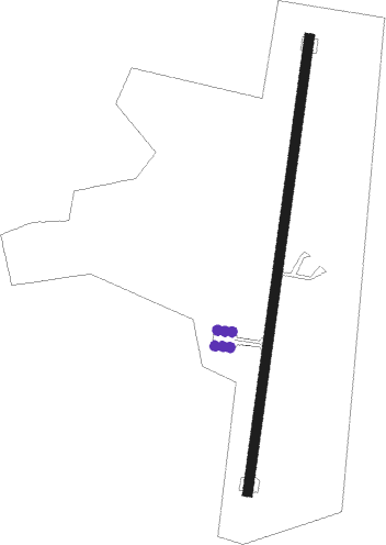
Runway info
| Runway 1 / 19 | ||
| length | 918m (3012ft) | |
| bearing | 15° / 195° | |
| width | 18m (60ft) | |
| surface | asphalt | |
Nearby beacons
| code | identifier | dist | bearing | frequency |
|---|---|---|---|---|
| DVK | GOODALL (DANVILLE) NDB | 21.3 | 48° | 311 |
| CDX | CUMBERLAND RIVER (SOMERSET) NDB | 26 | 130° | 388 |
| EWO | NEW HOPE VOR/DME | 35.2 | 298° | 110.80 |
| LVT | LIVINGSTON VOR/DME | 43.7 | 188° | 108.40 |
| LE | BLAYD (LEXINGTON) NDB | 44.9 | 30° | 242 |
| HYK | LEXINGTON VOR/DME | 48.3 | 42° | 112.60 |
| LOZ | LONDON VOR/DME | 48.3 | 106° | 116.55 |
| FFT | FRANKFORT VOR | 52.9 | 10° | 109.40 |
| IIU | LOUISVILLE VORTAC | 53.7 | 327° | 114.80 |
| GN | BRIDL (LEXINGTON) NDB | 55.5 | 34° | 340 |
| SCX | SCOTT (ONEIDA) NDB | 55.9 | 151° | 403 |
| FTK | FORT KNOX VOR/DME | 56.4 | 303° | 109.60 |
| LK | LAANG (LOUISVILLE) NDB | 57.1 | 326° | 414 |
| BQM | (LOUISVILLE) DME | 62.3 | 327° | 112.20 |
Disclaimer
The information on this website is not for real aviation. Use this data with the X-Plane flight simulator only! Data taken with kind consent from X-Plane 12 source code and data files. Content is subject to change without notice.