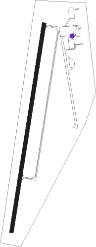
Iola - Allen Co
Airport details
| Country | United States of America |
| State | Kansas |
| Region | K3 |
| Airspace | Kansas City Ctr |
| Municipality | Allen County |
| Elevation | 1015ft (309m) |
| Timezone | GMT -6 |
| Coordinates | 37.86822, -95.38695 |
| Magnetic var | |
| Type | land |
| Available since | X-Plane v10.30 |
| ICAO code | K88 |
| IATA code | n/a |
| FAA code | n/a |
Communication
| ALLEN CO AWOS 3 | 128.325 |
| ALLEN CO CTAF/UNICOM | 122.800 |
Nearby Points of Interest:
Northrup House
-Allen County Jail
-City Square Park Bandstand
-Yates Center Carnegie Library
-Stockbrands and Kemmerer Department Store
-Woodson County Courthouse
-State Street Bridge
-Burlington Carnegie Free Library
-Anderson County Courthouse
-First Presbyterian Church
-Linn County Courthouse
Runway info
| Runway 1 / 19 | ||
| length | 1680m (5512ft) | |
| bearing | 17° / 197° | |
| width | 30m (100ft) | |
| surface | concrete | |
Nearby beacons
| code | identifier | dist | bearing | frequency |
|---|---|---|---|---|
| CNU | CHANUTE VOR/DME | 17.5 | 220° | 109.20 |
| OWI | OTTAWA NDB | 40.9 | 11° | 251 |
| OSW | OSWEGO VOR/DME | 43.5 | 166° | 117.60 |
| EMP | EMPORIA VORTAC | 43.6 | 299° | 112.80 |
| BUM | BUTLER VORTAC | 48.9 | 66° | 115.90 |
| JL | LUNNS (JOPLIN) NDB | 56.1 | 129° | 344 |
| PK | HERBB (OLATHE) NDB | 61.3 | 36° | 420 |
Instrument approach procedures
| runway | airway (heading) | route (dist, bearing) |
|---|---|---|
| RW01 | CNU (40°) | CNU VUGBY (8mi, 69°) 3000ft |
| RW01 | KUVPE (340°) | KUVPE VUGBY (10mi, 303°) 3000ft |
| RW01 | VUGBY (17°) | VUGBY 3000ft |
| RNAV | VUGBY 3000ft HEKBO (6mi, 17°) 2600ft K88 (5mi, 17°) 1060ft (5660mi, 112°) 1255ft TIGAY (5657mi, 292°) 3000ft TIGAY (turn) | |
| RW19 | HOCJO (143°) | HOCJO WAGEP (8mi, 111°) 3000ft TIGAY (5mi, 101°) 3000ft |
| RW19 | NALLY (308°) | NALLY YACUC (32mi, 332°) 3000ft TIGAY (5mi, 281°) 3000ft |
| RW19 | TIGAY (197°) | TIGAY 3000ft |
| RNAV | TIGAY 3000ft SAVOF (6mi, 197°) 2600ft VEYUT (2mi, 197°) 1860ft K88 (3mi, 197°) 1068ft VUGBY (11mi, 197°) 3000ft VUGBY (turn) |
Disclaimer
The information on this website is not for real aviation. Use this data with the X-Plane flight simulator only! Data taken with kind consent from X-Plane 12 source code and data files. Content is subject to change without notice.
