Apalachicola - Apalachicola Municipal
Airport details
| Country | United States of America |
| State | Florida |
| Region | K7 |
| Airspace | Jacksonville Ctr |
| Municipality | Franklin County |
| Elevation | 20ft (6m) |
| Timezone | GMT -5 |
| Coordinates | 29.72755, -85.02737 |
| Magnetic var | |
| Type | land |
| Available since | X-Plane v10.32 |
| ICAO code | KAAF |
| IATA code | AAF |
| FAA code | AAF |
Communication
| Apalachicola Municipal ASOS | 119.925 |
| Apalachicola Municipal CTAF/UNICOM | 122.800 |
| Apalachicola Municipal TYNDALL Approach/Departure | 125.200 |
| Apalachicola Municipal TYNDALL Approach/Departure | 124.150 |
Nearby Points of Interest:
Apalachicola Historic District
-Fort Gadsden
-St. Joseph Catholic Mission Church
-Port Theatre
-Old Sopchoppy High School Gymnasium
-Mount Beasor Primitive Baptist Church
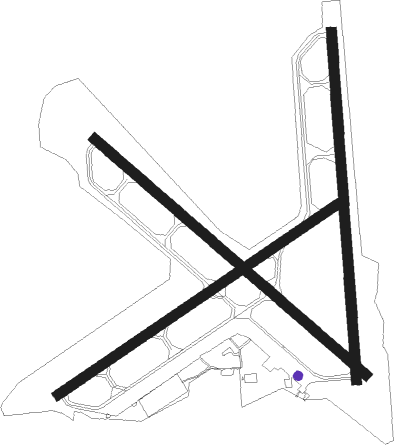
Runway info
Runway 14 / 32  | ||
| length | 1655m (5430ft) | |
| bearing | 131° / 311° | |
| width | 46m (150ft) | |
| surface | concrete | |
| Runway 18 / 36 | ||
| length | 1606m (5269ft) | |
| bearing | 180° / 0° | |
| width | 46m (150ft) | |
| surface | concrete | |
| displ threshold | 0m (0ft) / 154m (505ft) | |
| Runway 6 / 24 | ||
| length | 1582m (5190ft) | |
| bearing | 64° / 244° | |
| width | 46m (150ft) | |
| surface | concrete | |
| displ threshold | 0m (0ft) / 38m (125ft) | |
Nearby beacons
| code | identifier | dist | bearing | frequency |
|---|---|---|---|---|
| PAM | TYNDALL (PANAMA CITY) TACAN | 35.1 | 302° | 133.70 |
| PFN | LYNNE (PANAMA CITY) NDB | 53.2 | 308° | 278 |
| SZW | SEMINOLE VORTAC | 60.2 | 38° | 117.50 |
Instrument approach procedures
| runway | airway (heading) | route (dist, bearing) |
|---|---|---|
| RW06 | TERES (253°) | TERES CADIV (49mi, 251°) 2300ft CADIV (turn) 2300ft |
| RNAV | CADIV 2300ft DONEY (6mi, 63°) 1600ft KAAF (5mi, 63°) 59ft (5146mi, 109°) 420ft ONBOE (5137mi, 289°) 3000ft ONBOE (turn) | |
| RW14 | TERES (253°) | TERES ASVOY (44mi, 265°) 2300ft ASVOY (turn) 2300ft |
| RNAV | ASVOY 2300ft NINFI (6mi, 131°) 1600ft ZIPGA (3mi, 131°) 620ft KAAF (2mi, 130°) 55ft (5146mi, 109°) 500ft ONBOE (5137mi, 289°) 3000ft ONBOE (turn) | |
| RW24 | TERES (253°) | TERES ONBOE (27mi, 257°) 2300ft ONBOE (turn) 2300ft |
| RNAV | ONBOE 2300ft EXUTE (6mi, 244°) 1600ft KAAF (5mi, 244°) 60ft (5146mi, 109°) 600ft ASVOY (5154mi, 289°) 3000ft ASVOY (turn) | |
| RW32 | TERES (253°) | TERES FEZCU (35mi, 238°) 2300ft FEZCU (turn) 2300ft |
| RNAV | FEZCU 2300ft ODUGY (6mi, 312°) 1600ft KAAF (5mi, 312°) 58ft (5146mi, 109°) 347ft ASVOY (5154mi, 289°) 3000ft ASVOY (turn) |
Disclaimer
The information on this website is not for real aviation. Use this data with the X-Plane flight simulator only! Data taken with kind consent from X-Plane 12 source code and data files. Content is subject to change without notice.