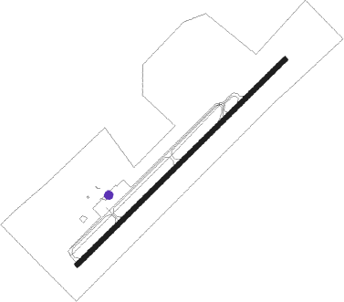
Campbellsville - Taylor County
Airport details
| Country | United States of America |
| State | Kentucky |
| Region | K5 |
| Airspace | Indianapolis Ctr |
| Municipality | Taylor County |
| Elevation | 917ft (280m) |
| Timezone | GMT -5 |
| Coordinates | 37.35828, -85.30942 |
| Magnetic var | |
| Type | land |
| Available since | X-Plane v10.40 |
| ICAO code | KAAS |
| IATA code | n/a |
| FAA code | AAS |
Communication
| Taylor County AWOS 3 | 121.125 |
| Taylor County CTAF/UNICOM | 122.700 |
Nearby Points of Interest:
Campbellsville Historic Commercial District
-Merchant Tower
-Anderson House
-Greensburg Cumberland Presbyterian Church
-Downtown Greensburg Historic District (Greensburg, Kentucky)
-Green County Court Clerk's Office
-Mt. Gilead Baptist Church
-Dr. Nathan Gaither House
-Adair County Courthouse
-John Field House
-Zion Meetinghouse and School
-William Blackwell House
-Johnson's Chapel AME Church
-Washington County Courthouse
-St. Dominic's Catholic Church
-Knob Creek Farm
-Sulphur Well Historic District
-Louisville and Nashville Railroad 152
-Louisville and Nashville Combine Car Number 665
-Bell House
-Hodgenville Women's Club
-Perryville Battlefield State Historic Site
-St. Thomas Roman Catholic Church and Howard-Flaget House
-Metcalfe County Jail
-Metcalfe County Kentucky Courthouse
Nearby beacons
| code | identifier | dist | bearing | frequency |
|---|---|---|---|---|
| EWO | NEW HOPE VOR/DME | 23.9 | 307° | 110.80 |
| DVK | GOODALL (DANVILLE) NDB | 29.1 | 68° | 311 |
| CDX | CUMBERLAND RIVER (SOMERSET) NDB | 37 | 120° | 388 |
| FTK | FORT KNOX VOR/DME | 45.6 | 310° | 109.60 |
| IIU | LOUISVILLE VORTAC | 46.5 | 340° | 114.80 |
| LVT | LIVINGSTON VOR/DME | 46.9 | 170° | 108.40 |
| LE | BLAYD (LEXINGTON) NDB | 48.7 | 46° | 242 |
| LK | LAANG (LOUISVILLE) NDB | 49.6 | 338° | 414 |
| FFT | FRANKFORT VOR | 53 | 26° | 109.40 |
| HYK | LEXINGTON VOR/DME | 54 | 54° | 112.60 |
| MYS | MYSTIC VOR | 54.8 | 300° | 108.20 |
| BQM | (LOUISVILLE) DME | 55 | 338° | 112.20 |
| GN | BRIDL (LEXINGTON) NDB | 59.7 | 46° | 340 |
| SCX | SCOTT (ONEIDA) NDB | 64.3 | 141° | 403 |
Instrument approach procedures
| runway | airway (heading) | route (dist, bearing) |
|---|---|---|
| RW05 | KANOA (56°) | KANOA 3000ft |
| RNAV | KANOA 3000ft LEXKO (7mi, 56°) 2500ft KAAS (5mi, 56°) 911ft (5181mi, 114°) 1154ft DOODA (5173mi, 294°) 3000ft DOODA (turn) | |
| RW23 | DOODA (236°) | DOODA 3000ft |
| RNAV | DOODA 3000ft BOCVA (7mi, 236°) 2500ft PALSE (2mi, 236°) 1820ft KAAS (3mi, 236°) 969ft (5181mi, 114°) 1177ft KANOA (5190mi, 294°) 3000ft KANOA (turn) |
Disclaimer
The information on this website is not for real aviation. Use this data with the X-Plane flight simulator only! Data taken with kind consent from X-Plane 12 source code and data files. Content is subject to change without notice.
