Abilene - Abilene Regl
Airport details
| Country | United States of America |
| State | Texas |
| Region | K4 |
| Airspace | Ft Worth Ctr |
| Municipality | Abilene |
| Elevation | 1791ft (546m) |
| Timezone | GMT -6 |
| Coordinates | 32.41133, -99.68189 |
| Magnetic var | |
| Type | land |
| Available since | X-Plane v10.30 |
| ICAO code | KABI |
| IATA code | ABI |
| FAA code | ABI |
Communication
| Abilene Regl ATIS | 118.250 |
| Abilene Regl UNICOM | 122.950 |
| Abilene Regl Ground Control | 121.700 |
| Abilene Regl Tower | 120.100 |
| Abilene Regl Approach/Departure | 127.200 |
| Abilene Regl Approach/Departure | 125.000 |
Approach frequencies
| LOC | RW17R | 109.75 | 18.00mi |
| ILS-cat-I | RW35R | 110.3 | 18.00mi |
| 3° GS | RW35R | 110.3 | 18.00mi |
Nearby Points of Interest:
Abilene Fire Station No. 2
-First Presbyterian Church
-Shackelford County Courthouse Historic District
-Saint John’s Methodist Church
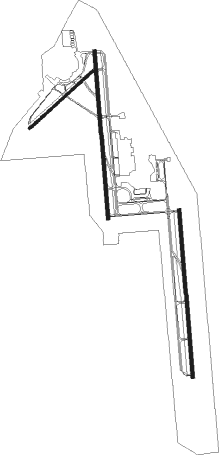
Runway info
Runway 17L / 35R  | ||
| length | 2200m (7218ft) | |
| bearing | 180° / 360° | |
| width | 46m (150ft) | |
| surface | asphalt | |
| Runway 17R / 35L | ||
| length | 2201m (7221ft) | |
| bearing | 180° / 360° | |
| width | 46m (150ft) | |
| surface | asphalt | |
| Runway 4 / 22 | ||
| length | 1123m (3684ft) | |
| bearing | 57° / 237° | |
| width | 30m (100ft) | |
| surface | asphalt | |
Nearby beacons
| code | identifier | dist | bearing | frequency |
|---|---|---|---|---|
| AB | TOMHI (ABILENE) NDB | 6.7 | 176° | 353 |
| DYS | DYESS (ABILENE) TACAN | 8.8 | 272° | 133.60 |
| ABI | ABILENE VORTAC | 10.1 | 291° | 113.70 |
| TQA | TUSCOLA (ABILENE) VOR/DME | 12.5 | 218° | 111.60 |
| BWD | BROWNWOOD VOR/DME | 48.2 | 126° | 108.60 |
Instrument approach procedures
| runway | airway (heading) | route (dist, bearing) |
|---|---|---|
| RW17L | ABI (111°) | ABI ANETY (8mi, 39°) 3900ft HIZSU (5mi, 90°) 3900ft |
| RW17L | ROGEE (227°) | ROGEE EHHAD (20mi, 237°) 3900ft HIZSU (5mi, 270°) 3900ft |
| RNAV | HIZSU 3900ft GOFDO (6mi, 180°) 3400ft KABI (5mi, 185°) 1845ft (5895mi, 108°) 2041ft IBRIF (5896mi, 288°) 4000ft IBRIF (turn) | |
| RW35R | ABI (111°) | ABI INECO (17mi, 162°) 4000ft NILSE (5mi, 90°) 4000ft |
| RW35R | KEYJO (333°) | KEYJO NILSE (5mi, 270°) 4000ft |
| RNAV | NILSE 4000ft IBRIF (6mi, 360°) 3400ft BERUF (3mi, 360°) 2440ft KABI (3mi, 352°) 1834ft (5895mi, 108°) 1976ft GOFDO (5895mi, 288°) 4000ft GOFDO (turn) 4000ft |
Disclaimer
The information on this website is not for real aviation. Use this data with the X-Plane flight simulator only! Data taken with kind consent from X-Plane 12 source code and data files. Content is subject to change without notice.