Nantucket - Nantucket Memorial
Airport details
| Country | United States of America |
| State | Massachusetts |
| Region | K6 |
| Airspace | Boston Ctr |
| Municipality | Nantucket |
| Elevation | 45ft (14m) |
| Timezone | GMT -5 |
| Coordinates | 41.25298, -70.05991 |
| Magnetic var | |
| Type | land |
| Available since | X-Plane v10.30 |
| ICAO code | KACK |
| IATA code | ACK |
| FAA code | ACK |
Communication
| Nantucket Memorial ATIS | 127.500 |
| Nantucket Memorial CTAF | 118.300 |
| Nantucket Memorial UNICOM | 122.950 |
| Nantucket Memorial Clearance DEL | 119.375 |
| Nantucket Memorial Ground Control | 121.700 |
| Nantucket Memorial Tower | 118.300 |
| Nantucket Memorial CAPE Approach/Departure | 126.100 |
Approach frequencies
| ILS-cat-I | RW24 | 109.1 | 18.00mi |
| ILS-cat-I | RW06 | 109.1 | 18.00mi |
| 3° GS | RW24 | 109.1 | 18.00mi |
| 3° GS | RW06 | 109.1 | 18.00mi |
Nearby Points of Interest:
West Dennis Graded School
-Captain James Berry House
-Kennedy Compound
-South Yarmouth/Bass River Historic District
-Hyannis Port Historic District
-Lot Crocker House
-Capt. Alexander Crocker House
-Louis Brandeis House
-South Harwich Methodist Church
-Dr. Harrison A. Tucker Cottage
-Union Chapel
-Mercelia Evelyn Eldridge Kelley House
-Lemuel B. Chase House
-S. Alexander Hinckley House
-Old Village Historic District (Chatham, Massachusetts)
-Half Way House
-Dr. Edward Francis Gleason House
-Capt. Rodney J. Baxter House
-Crowell-Smith House
-Building at 606 Main Street
-Building at 614 Main Street
-Building at 600 Main Street
-Capt. Oliver Bearse House
-Pleasant-School Street Historic District
-Municipal Group Historic District
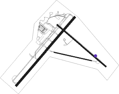
Runway info
Runway 6 / 24  | ||
| length | 1920m (6299ft) | |
| bearing | 53° / 233° | |
| width | 46m (150ft) | |
| surface | asphalt | |
| displ threshold | 164m (538ft) / 0m (0ft) | |
| Runway 15 / 33 | ||
| length | 1371m (4498ft) | |
| bearing | 127° / 307° | |
| width | 30m (100ft) | |
| surface | asphalt | |
| Runway 12 / 30 | ||
| length | 820m (2690ft) | |
| bearing | 103° / 283° | |
| width | 15m (50ft) | |
| surface | asphalt | |
Nearby beacons
| code | identifier | dist | bearing | frequency |
|---|---|---|---|---|
| ACK | NANTUCKET VOR/DME | 2.2 | 49° | 116.20 |
| MVY | MARTHA'S VINEYARD VOR/DME | 26.3 | 285° | 114.50 |
| CQX | NAUSET (CHATHAM) NDB | 26.5 | 9° | 279 |
| HY | BOGEY (HYANNIS) NDB | 28.5 | 343° | 342 |
| FMH | OTIS (FALMOUTH) TACAN | 31.8 | 312° | 115.80 |
| LFV | MARCONI (NORTH TRURO) VOR/DME | 45.9 | 2° | 114.70 |
| PVC | PROVINCETOWN NDB | 49.5 | 349° | 389 |
Departure and arrival routes
| Transition altitude | 18000ft |
| Transition level | 18000ft |
| STAR starting points | distance | inbound heading | |
|---|---|---|---|
| ALL | |||
| DEEPO1 | 36.0 | 80° | |
| NEWBE3 | 45.8 | 87° | |
Instrument approach procedures
| runway | airway (heading) | route (dist, bearing) |
|---|---|---|
| RW06 | ACK (229°) | ACK UFTAC (14mi, 233°) 2300ft UFTAC (turn) 2300ft |
| RW06 | BOMLY (21°) | BOMLY UFTAC (6mi, 307°) 2300ft |
| RW06 | MVY (105°) | MVY AFHAS (17mi, 127°) 2300ft UFTAC (6mi, 127°) 2300ft |
| RNAV | UFTAC 2300ft CRAYG (6mi, 53°) 1700ft KACK (6mi, 54°) 85ft (4513mi, 120°) 238ft WAIVS (4510mi, 301°) 1800ft WAIVS (turn) | |
| RW15 | CRACO (155°) | CRACO HOKEL (9mi, 203°) 2000ft |
| RW15 | MVY (105°) | MVY HOKEL (16mi, 89°) 2000ft |
| RW15 | PEAKE (132°) | PEAKE HOKEL (12mi, 137°) 2000ft |
| RNAV | HOKEL 2000ft JOBAP (6mi, 127°) 2000ft WEBDI (3mi, 127°) 980ft KACK (3mi, 130°) 90ft (4513mi, 120°) 295ft DUPKE (4503mi, 300°) 2300ft DUPKE (turn) | |
| RW24 | ACK (229°) | ACK OBUBE (9mi, 53°) 2000ft OBUBE (turn) 2000ft |
| RW24 | CUPNU (257°) | CUPNU OBUBE (6mi, 307°) 2000ft |
| RW24 | LFV (182°) | LFV ZEDUP (33mi, 174°) 2000ft OBUBE (6mi, 127°) 2000ft |
| RNAV | OBUBE 2000ft WAIVS (7mi, 233°) 1600ft KACK (5mi, 231°) 94ft (4513mi, 120°) 247ft UFTAC (4519mi, 300°) 2300ft UFTAC (turn) | |
| RW33 | ACK (229°) | ACK DUPKE (12mi, 137°) 2300ft DUPKE (turn) 2300ft |
| RW33 | CLAMY (81°) | CLAMY FARGU (27mi, 102°) 2500ft DUPKE (5mi, 53°) 2300ft |
| RW33 | LFV (182°) | LFV EVPAW (52mi, 163°) 2300ft DUPKE (5mi, 233°) 2300ft |
| RNAV | DUPKE 2300ft HIKSO (6mi, 307°) 1800ft GADRE (3mi, 307°) 720ft KACK (3mi, 303°) 96ft (4513mi, 120°) 290ft CEROD (4518mi, 301°) CLAMY (20mi, 250°) 2500ft CLAMY (turn) |
Holding patterns
| STAR name | hold at | type | turn | heading* | altitude | leg | speed limit |
|---|---|---|---|---|---|---|---|
| NEWBE3 | JORDN | VHF | left | 79 (259)° | 1.0min timed | ICAO rules | |
| NEWBE3 | NEWBE | VHF | right | 280 (100)° | < 17999ft | 1.0min timed | ICAO rules |
| *) magnetic outbound (inbound) holding course | |||||||
Disclaimer
The information on this website is not for real aviation. Use this data with the X-Plane flight simulator only! Data taken with kind consent from X-Plane 12 source code and data files. Content is subject to change without notice.