Waco - Waco Regl
Airport details
| Country | United States of America |
| State | Texas |
| Region | K4 |
| Airspace | Ft Worth Ctr |
| Municipality | Waco |
| Elevation | 516ft (157m) |
| Timezone | GMT -6 |
| Coordinates | 31.60966, -97.21932 |
| Magnetic var | |
| Type | land |
| Available since | X-Plane v10.40 |
| ICAO code | KACT |
| IATA code | ACT |
| FAA code | ACT |
Communication
| Waco Regl ATIS | 123.850 |
| Waco Regl UNICOM | 122.950 |
| Waco Regl CTAF | 119.300 |
| Waco Regl WACO GROUND | 121.900 |
| Waco Regl WACO TOWER | 119.300 |
| Waco Regl WACO ApproachROACH | 127.650 |
| Waco Regl WACO DepartureARTURE | 126.125 |
Approach frequencies
| ILS-cat-I | RW19 | 109.7 | 18.00mi |
| 3° GS | RW19 | 109.7 | 18.00mi |
Nearby Points of Interest:
Waco High School
-Praetorian Building
-Westphalia
-Coryell County Courthouse
-Bosque County Courthouse
-The Church of the Visitation
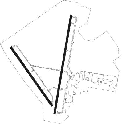
Runway info
Runway 1 / 19  | ||
| length | 2173m (7129ft) | |
| bearing | 17° / 197° | |
| width | 46m (151ft) | |
| surface | asphalt | |
| displ threshold | 32m (105ft) / 0m (0ft) | |
| Runway 14 / 32 | ||
| length | 1557m (5108ft) | |
| bearing | 145° / 325° | |
| width | 46m (151ft) | |
| surface | asphalt | |
Nearby beacons
| code | identifier | dist | bearing | frequency |
|---|---|---|---|---|
| ACT | WACO VORTAC | 4 | 317° | 115.30 |
| ROB | ROBINSON (WACO) NDB | 9.9 | 125° | 400 |
| TPL | DME | 26.2 | 207° | 110.40 |
| GNL | GROESBECK (MEXIA) VOR/DME | 34.3 | 92° | 108.80 |
| LXY | MEXIA NDB | 36.2 | 88° | 329 |
| IL | IRESH (KILLEEN) NDB | 43.1 | 220° | 278 |
| GRK | GRAY (FORT HOOD) VOR/DME | 46.1 | 226° | 111.80 |
| JEN | GLEN ROSE TACAN | 47 | 310° | 115 |
| CGQ | POWELL (CORSICANA) NDB | 48.8 | 60° | 344 |
| CRS | CORSICANA NDB | 49 | 63° | 396 |
| AGJ | GOOCH SPRINGS VORTAC | 53.7 | 245° | 112.50 |
Instrument approach procedures
| runway | airway (heading) | route (dist, bearing) |
|---|---|---|
| RW01 | SATTY (322°) | SATTY XAFLE (6mi, 288°) 3000ft SHAIL (8mi, 282°) 3000ft |
| RNAV | SHAIL 3000ft URNER (6mi, 16°) 2000ft WOXAD (3mi, 16°) 1100ft KACT (2mi, 29°) 564ft (5774mi, 108°) 759ft CHRUS (5771mi, 288°) 3000ft CHRUS (turn) | |
| RW14 | DRILL (236°) | DRILL ETOHI (24mi, 267°) 3000ft EVVIS (8mi, 214°) 3000ft |
| RW14 | SONET (105°) | SONET UFIFO (7mi, 65°) 3000ft EVVIS (7mi, 95°) 3000ft |
| RNAV | EVVIS 3000ft IAGER (5mi, 145°) 2100ft KACT (6mi, 139°) 564ft (5774mi, 108°) 1000ft BOSEL (5776mi, 288°) 4000ft BOSEL (turn) 4000ft | |
| RW19 | IGORR (131°) | IGORR UZOKU (8mi, 90°) 3000ft CHRUS (7mi, 102°) 3000ft |
| RW19 | IMIPE (228°) | IMIPE CHRUS (8mi, 273°) 3000ft |
| RW19 | WESLI (195°) | WESLI CHRUS (5mi, 197°) 3000ft |
| RNAV | CHRUS 3000ft COFFI (6mi, 197°) 2100ft KACT (6mi, 191°) 557ft (5774mi, 108°) 705ft YAYUC (5775mi, 288°) BOSEL (8mi, 178°) 4000ft BOSEL (turn) 4000ft | |
| RW32 | BARES (358°) | BARES KOCYU (6mi, 21°) 3600ft ILINI (8mi, 21°) 3000ft |
| RW32 | DRILL (236°) | DRILL PRKRR (29mi, 200°) 3000ft ILINI (8mi, 270°) 3000ft |
| RW32 | SATTY (322°) | SATTY ILINI (7mi, 311°) 3000ft |
| RNAV | ILINI 3000ft SKOCH (7mi, 325°) 2100ft IWIFY (3mi, 325°) 1160ft KACT (2mi, 346°) 571ft (5774mi, 108°) 762ft EVVIS (5780mi, 288°) 4000ft EVVIS (turn) |
Disclaimer
The information on this website is not for real aviation. Use this data with the X-Plane flight simulator only! Data taken with kind consent from X-Plane 12 source code and data files. Content is subject to change without notice.