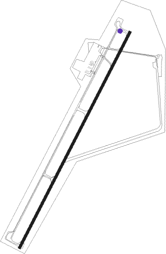
Alamosa - San Luis Valley Regional Bergman Field
Airport details
| Country | United States of America |
| State | Colorado |
| Region | K2 |
| Airspace | Denver Ctr |
| Municipality | Alamosa County |
| Elevation | 7539ft (2298m) |
| Timezone | GMT -7 |
| Coordinates | 37.43512, -105.86787 |
| Magnetic var | |
| Type | land |
| Available since | X-Plane v10.40 |
| ICAO code | KALS |
| IATA code | ALS |
| FAA code | ALS |
Communication
| San Luis Valley Regional Bergman Field ASOS | 135.175 |
| San Luis Valley Regional Bergman Field CTAF/UNICOM | 122.800 |
| San Luis Valley Regional Bergman Field CTAF | 122.800 |
Approach frequencies
| ILS-cat-I | RW02 | 111.9 | 18.00mi |
| 3° GS | RW02 | 111.9 | 18.00mi |
Nearby Points of Interest:
American National Bank Building
-Alamosa County Courthouse
-La Jara Depot
-San Luis Southern Railway Trestle
-Carnegie Library
-Big Spring Creek
-Trujillo Homestead
-Medano Ranch Headquarters
-Palace Hotel
-Superintendent's Residence, Great Sand Dunes National Monument
-Rito Seco Creek Culvert
-Capilla de San Isidro
-Capilla de San Juan Bautista
Nearby beacons
| code | identifier | dist | bearing | frequency |
|---|---|---|---|---|
| ALS | ALAMOSA VORTAC | 5.7 | 149° | 113.90 |
| TAS | TAOS VORTAC | 49.6 | 183° | 117.60 |
| CIM | CIMARRON VORTAC | 74.1 | 133° | 116.40 |
Instrument approach procedures
| runway | airway (heading) | route (dist, bearing) |
|---|---|---|
| RW02 | ALS (329°) | ALS RODDS (14mi, 238°) 12200ft RODDS (turn) 12200ft |
| RW02 | GEMKY (64°) | GEMKY RODDS (13mi, 94°) 12200ft |
| RW02 | WAPRE (43°) | WAPRE RODDS (6mi, 58°) 12200ft |
| RW02 | ZOTOS (359°) | ZOTOS VEPUY (8mi, 298°) 12200ft RODDS (8mi, 343°) 12200ft |
| RNAV | RODDS 12200ft KROWZ (8mi, 38°) 9800ft BREZE (2mi, 38°) 9300ft XOGSY (4mi, 38°) 8060ft KALS (2mi, 38°) 7588ft (6158mi, 109°) 7739ft JADGU (6150mi, 290°) 10500ft JADGU (turn) | |
| RW20 | ALS (329°) | ALS JADGU (16mi, 17°) 10800ft JADGU (turn) 10800ft |
| RW20 | GEMKY (64°) | GEMKY HOPOR (17mi, 56°) 12400ft JADGU (19mi, 57°) 10800ft JADGU (turn) 10800ft |
| RW20 | ICORY (156°) | ICORY LUYEL (12mi, 101°) 10800ft JADGU (10mi, 157°) 10800ft |
| RNAV | JADGU 10800ft KABPE (6mi, 218°) 9300ft KALS (6mi, 218°) 7591ft RODDS (16mi, 218°) 11500ft RODDS (turn) |
Disclaimer
The information on this website is not for real aviation. Use this data with the X-Plane flight simulator only! Data taken with kind consent from X-Plane 12 source code and data files. Content is subject to change without notice.
