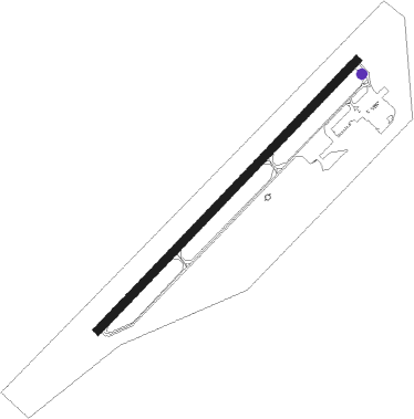
Anniston - Anniston Regional
Airport details
| Country | United States of America |
| State | Alabama |
| Region | K7 |
| Airspace | Atlanta Ctr |
| Municipality | Calhoun County |
| Elevation | 609ft (186m) |
| Timezone | GMT -6 |
| Coordinates | 33.58817, -85.85811 |
| Magnetic var | |
| Type | land |
| Available since | X-Plane v10.32 |
| ICAO code | KANB |
| IATA code | ANB |
| FAA code | ANB |
Communication
| Anniston Regional ASOS | 119.675 |
| Anniston Regional CTAF | 123.600 |
| Anniston Regional UNICOM | 123.000 |
| Anniston Regional BIRMINGHAM Approach/Departure | 125.450 |
Approach frequencies
| ILS-cat-I | RW05 | 111.5 | 18.00mi |
| 3° GS | RW05 | 111.5 | 18.00mi |
Nearby Points of Interest:
Davis C. Cooper House
-Dudley Snow House
-Glen Addie Volunteer Hose Company Fire Hall
-Caldwell Building
-Bank of Anniston
-Bagley–Cater Building
-Calhoun County Courthouse
-United States Post Office
-Union Depot and Freight House
-Temple Beth-El
-Saint Paul's Methodist Episcopal Church
-Kilby House
-Crowan Cottage
-McKleroy-Wilson-Kirby House
-East Anniston Residential Historic District
-Richard P. Huger House
-Idlewild
-J. L. M. Curry House
-Aderholdt's Mill
-Cleburne County Courthouse
-Ten Oaks
-John Morgan House
-First Presbyterian Church
-Fort Strother
-Alexander Woods House
Nearby beacons
| code | identifier | dist | bearing | frequency |
|---|---|---|---|---|
| AN | BOGGA (ANNISTON) NDB | 4.8 | 234° | 211 |
| TDG | DME | 9.2 | 266° | 108.80 |
| GAD | GADSDEN VOR/DME | 25.8 | 330° | 112.30 |
| GPQ | CARROLLTON NDB | 36.4 | 92° | 278 |
| LGC | LA GRANGE VORTAC | 46 | 130° | 115.60 |
| BH | MCDEN (BIRMINGHAM) NDB | 49.6 | 266° | 224 |
| RMG | ROME VORTAC | 50.4 | 52° | 115.40 |
| CSG | COLUMBUS VORTAC | 72.1 | 139° | 117.10 |
Instrument approach procedures
| runway | airway (heading) | route (dist, bearing) |
|---|---|---|
| RW05 | LINTZ (53°) | LINTZ 3500ft |
| RNAV | LINTZ 3500ft COLOB (12mi, 53°) 2400ft KANB (6mi, 53°) 635ft (5198mi, 111°) 1600ft CAMKU (5184mi, 291°) CANUG (15mi, 210°) LINTZ (23mi, 292°) 3500ft LINTZ (turn) | |
| RW23 | ODOVY (234°) | ODOVY 3700ft |
| RNAV | ODOVY 3700ft HILAG (6mi, 234°) 3100ft NOWOP (2mi, 234°) 2800ft KANB (7mi, 233°) 668ft (5198mi, 111°) 952ft LINTZ (5211mi, 291°) 3400ft LINTZ (turn) |
Disclaimer
The information on this website is not for real aviation. Use this data with the X-Plane flight simulator only! Data taken with kind consent from X-Plane 12 source code and data files. Content is subject to change without notice.