Napa - Napa Co
Airport details
| Country | United States of America |
| State | California |
| Region | K2 |
| Airspace | Oakland Ctr |
| Municipality | Napa County |
| Elevation | 35ft (11m) |
| Timezone | GMT -8 |
| Coordinates | 38.21320, -122.28069 |
| Magnetic var | |
| Type | land |
| Available since | X-Plane v10.40 |
| ICAO code | KAPC |
| IATA code | APC |
| FAA code | APC |
Communication
| Napa Co ATIS | 124.050 |
| Napa Co CTAF | 118.700 |
| Napa Co UNICOM | 122.950 |
| Napa Co Ground Control | 121.700 |
| Napa Co Tower | 118.700 |
| Napa Co NORCAL Approach/Departure | 127.800 |
Approach frequencies
| ILS-cat-I | RW01L | 111.3 | 18.00mi |
| 3° GS | RW01L | 111.3 | 18.00mi |
Nearby Points of Interest:
Eliza G. Yount House
-Capt. N. H. Wulff House
-William Andrews House
-Napa County Courthouse Plaza
-Goodman Library
-Gordon Building
-U.S. Post Office
-Semorile Building
-Bank of Napa
-Napa Valley Opera House
-Sam Kee Laundry Building
-First Street Bridge
-Vallejo Old City Historic District
-Mare Island Naval Shipyard
-Trefethen Vineyards
-Sonoma Plaza
-Old Masonic Hall
-Suisun Masonic Lodge No. 55
-Benicia Southern Pacific Railroad Passenger Depot
-Benicia Arsenal
-Nicholas Carriger Estate
-USCGC Storis
-Bernardo Fernandez House
-Bank of Pinole
-Tucker House
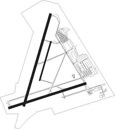
Runway info
Runway 1L / 19R  | ||
| length | 1813m (5948ft) | |
| bearing | 26° / 206° | |
| width | 46m (150ft) | |
| surface | asphalt | |
| blast zone | 43m (141ft) / 0m (0ft) | |
| Runway 6 / 24 | ||
| length | 1525m (5003ft) | |
| bearing | 79° / 259° | |
| width | 46m (150ft) | |
| surface | concrete | |
| Runway 1R / 19L | ||
| length | 766m (2513ft) | |
| bearing | 26° / 206° | |
| width | 23m (75ft) | |
| surface | asphalt | |
Nearby beacons
| code | identifier | dist | bearing | frequency |
|---|---|---|---|---|
| SGD | SCAGGS ISLAND (NAPA) VORTAC | 4.8 | 250° | 112.10 |
| CCR | CONCORD VOR/DME | 15 | 126° | 117 |
| SUU | TRAVIS (FAIRFIELD) TACAN | 15.9 | 84° | 116.60 |
| SAU | SAUSALITO VOR/DME | 24.3 | 214° | 116.20 |
| PYE | POINT REYES VOR/DME | 28.8 | 257° | 113.70 |
| OAK | OAKLAND VOR/DME | 29.3 | 173° | 116.80 |
| STS | ROSA DME | 30.6 | 299° | 116.15 |
| SFO | SAN FRANCISCO VOR/DME | 35.9 | 189° | 115.80 |
| SAC | SACRAMENTO VORTAC | 37 | 72° | 115.20 |
| LV | REIGA (LIVERMORE) NDB | 42.1 | 131° | 374 |
| NUQ | MOFFETT (MOUNTAIN VIEW) TACAN | 48 | 164° | 117.60 |
| OSI | WOODSIDE VOR/DME | 49.2 | 180° | 113.90 |
| MCC | MC CLELLAN (SACRAMENTO) VOR/DME | 49.4 | 63° | 109.20 |
| ILA | WILLIAMS VORTAC | 52.8 | 16° | 114.40 |
| SJC | SAN JOSE VOR/DME | 52.8 | 158° | 114.10 |
| MYV | MARYSVILLE VOR/DME | 62.6 | 39° | 110.80 |
| BAB | BEALE (MARYSVILLE) TACAN | 67.9 | 42° | 108.60 |
| ENI | MENDOCINO (UKIAH) VORTAC | 68.6 | 310° | 112.30 |
Departure and arrival routes
| Transition altitude | 18000ft |
| Transition level | 18000ft |
| SID end points | distance | outbound heading | |
|---|---|---|---|
| RW01 (ALL) | |||
| LIZRD5 | 29mi | 257° | |
| RW01L | |||
| OZIEE4 | 113mi | 1° | |
| RW01R | |||
| OZIEE4 | 113mi | 1° | |
| RW19 (ALL) | |||
| LIZRD5 | 29mi | 257° | |
| RW19L | |||
| OZIEE4 | 113mi | 1° | |
| RW19R | |||
| OZIEE4 | 113mi | 1° | |
| RW24 | |||
| OZIEE4 | 113mi | 1° | |
| LIZRD5 | 29mi | 257° | |
Instrument approach procedures
| runway | airway (heading) | route (dist, bearing) |
|---|---|---|
| RW01LY | HABAP (108°) | HABAP PEBGE (10mi, 150°) 4000ft FESAV (8mi, 150°) 2600ft FESAV (turn) 2600ft |
| RW01LY | MICRA (55°) | MICRA ZIRUP (7mi, 75°) 4100ft FESAV (7mi, 75°) 2600ft |
| RW01LY | SABLO (340°) | SABLO FESAV (8mi, 283°) 2900ft FESAV (turn) 2600ft |
| RW01LY | SAU (34°) | SAU WEGNA (7mi, 41°) 3200ft FESAV (6mi, 41°) 2600ft |
| RNAV | FESAV 2600ft CIKPI (6mi, 26°) 1800ft KAPC (6mi, 27°) 65ft (6895mi, 107°) 436ft CIVDA (6893mi, 287°) POPES (13mi, 337°) 5000ft POPES (turn) 5000ft | |
| RW01LZ | HABAP (108°) | HABAP PEBGE (10mi, 150°) 4000ft FESAV (8mi, 150°) 2600ft FESAV (turn) 2600ft |
| RW01LZ | MICRA (55°) | MICRA ZIRUP (7mi, 75°) 4100ft FESAV (7mi, 75°) 2600ft |
| RW01LZ | SABLO (340°) | SABLO FESAV (8mi, 283°) 2900ft FESAV (turn) 2600ft |
| RW01LZ | SAU (34°) | SAU WEGNA (7mi, 41°) 3200ft FESAV (6mi, 41°) 2600ft |
| RNAV | FESAV 2600ft CIKPI (6mi, 26°) 1800ft KAPC (6mi, 27°) 65ft (6895mi, 107°) 217ft CIVDA (6893mi, 287°) POPES (13mi, 337°) 5000ft POPES (turn) 5000ft | |
| RW06 | PYE (77°) | PYE WHTLE (16mi, 78°) 2800ft |
| RW06 | ROZZA (119°) | ROZZA WHTLE (25mi, 142°) 2800ft |
| RW06 | SAU (34°) | SAU SIBME (8mi, 358°) 3800ft WHTLE (10mi, 358°) 2800ft |
| RNAV | WHTLE 2800ft CEBAN (7mi, 75°) 1700ft ZAPIX (4mi, 79°) 339ft (6897mi, 107°) 436ft HABAP (6904mi, 287°) 4200ft HABAP (turn) 4200ft |
Disclaimer
The information on this website is not for real aviation. Use this data with the X-Plane flight simulator only! Data taken with kind consent from X-Plane 12 source code and data files. Content is subject to change without notice.