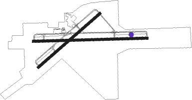
Watertown - Watertown Intl
Airport details
| Country | United States of America |
| State | New York |
| Region | K6 |
| Airspace | Boston Ctr |
| Municipality | Town of Hounsfield |
| Elevation | 325ft (99m) |
| Timezone | GMT -5 |
| Coordinates | 43.99189, -76.02067 |
| Magnetic var | |
| Type | land |
| Available since | X-Plane v10.40 |
| ICAO code | KART |
| IATA code | ART |
| FAA code | ART |
Communication
| Watertown Intl ASOS | 133.525 |
| Watertown Intl CTAF/UNICOM | 123.000 |
| Watertown Intl WHEELER SACK Approach/Departure | 128.250 |
Approach frequencies
| ILS-cat-I | RW07 | 111.1 | 18.00mi |
| 3° GS | RW07 | 111.1 | 18.00mi |
Nearby Points of Interest:
Dexter Universalist Church
-William Archer House
-Gen. Jacob Brown Mansion
-Dr. Samuel Guthrie House
-Madison Barracks
-Thomas Memorial AME Zion Church
-Emma Flower Taylor Mansion
-Jefferson County Courthouse Complex
-Paddock Mansion
-Watertown Masonic Temple
-Paddock Arcade
-Roswell P. Flower Memorial Library
-Public Square
-Elisha Camp House
-George Brothers Building
-Smith-Ripley House
-Adams Commercial Historic District
-La Fargeville United Methodist Church
-La Farge Retainer Houses
-La Farge Land Office
-Central Garage
-Cyrus Bates House
-Fairview Manor
-Capt. Simon Johnston House
-Clayton Historic District
Nearby beacons
| code | identifier | dist | bearing | frequency |
|---|---|---|---|---|
| ART | WATERTOWN VORTAC | 3 | 228° | 109.80 |
| YGK | KINGSTON NDB | 31.1 | 298° | 263 |
| FZ | FALLN (FULTON) NDB | 44 | 202° | 220 |
| SYR | SYRACUSE VORTAC | 50.5 | 192° | 117 |
| OG | OGIVE (OGDENSBURG) NDB | 51.3 | 43° | 358 |
| UCA | UTICA TACAN | 68.9 | 138° | 111.20 |
Instrument approach procedures
| runway | airway (heading) | route (dist, bearing) |
|---|---|---|
| RW07 | NOYAQ (62°) | NOYAQ 3500ft |
| RNAV | NOYAQ 3500ft KRUPP (10mi, 62°) 2000ft KART (6mi, 62°) 361ft (4804mi, 120°) 900ft NOYAQ (4815mi, 300°) 3500ft NOYAQ (turn) | |
| RW10 | TAREE (92°) | TAREE 4000ft |
| RNAV | TAREE 4000ft FOGUS (7mi, 92°) 2000ft RICOS (3mi, 92°) 980ft KART (2mi, 92°) 356ft (4804mi, 120°) 568ft BAMPE (4800mi, 300°) PATEE (13mi, 125°) 3600ft PATEE (turn) | |
| RW28 | CIPNA (196°) | CIPNA MUVRE (15mi, 131°) 3500ft MUVRE (turn) 3500ft |
| RW28 | LIDLE (358°) | LIDLE PATEE (16mi, 68°) 3600ft SUVOY (5mi, 340°) 3600ft MUVRE (4mi, 340°) 3500ft |
| RNAV | MUVRE 3500ft WONPO (5mi, 272°) 2200ft HUPUM (3mi, 272°) 1300ft KART (4mi, 272°) 376ft (4804mi, 120°) 581ft TAREE (4816mi, 300°) 2400ft TAREE (turn) |
Disclaimer
The information on this website is not for real aviation. Use this data with the X-Plane flight simulator only! Data taken with kind consent from X-Plane 12 source code and data files. Content is subject to change without notice.

