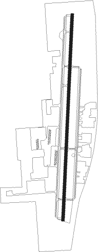
Springdale - Springdale Muni
Airport details
| Country | United States of America |
| State | Arkansas |
| Region | K4 |
| Airspace | Memphis Ctr |
| Municipality | Springdale |
| Elevation | 1353ft (412m) |
| Timezone | GMT -6 |
| Coordinates | 36.17639, -94.11925 |
| Magnetic var | |
| Type | land |
| Available since | X-Plane v10.40 |
| ICAO code | KASG |
| IATA code | SPZ |
| FAA code | ASG |
Communication
| Springdale Muni AWOS 3 | 124.675 |
| Springdale Muni CTAF | 118.200 |
| Springdale Muni UNICOM | 122.950 |
| Springdale Muni Ground Control | 121.600 |
| Springdale Muni Tower | 118.200 |
| Springdale Muni RAZORBACK Approach/Departure | 128.150 |
Approach frequencies
| ILS-cat-I | RW18 | 110.9 | 18.00mi |
| 3° GS | RW18 | 110.9 | 18.00mi |
Nearby Points of Interest:
Price Produce and Service Station
-Beely-Johnson American Legion Post 139
-Shiloh Church
-House at 712 N. Mill Street
-Old Springdale High School
-Fitzgerald Station and Farmstead
-Beasley Homestead
-Johnson Switch Building
-Johnson House and Mill
-Hemingway House and Barn
-Skillern House
-Pinkston-Mays Store Building
-Springfield to Fayetteville Road-Cross Hollow Segment
-Troy Gordon House
-Tontitown School Building
-St. Joseph Catholic Church
-Peter Smyth House
-McCleod House
-E. Fay and Gus Jones House
-Fayetteville Veterans Administration Hospital
-Clack House
-Wade-Heerwagen House
-Maple Street Overpass
-Headquarters House (Fayetteville, Arkansas)
-Frisco Depot
Nearby beacons
| code | identifier | dist | bearing | frequency |
|---|---|---|---|---|
| RZC | RAZORBACK (FAYETTEVILLE) VORTAC | 4.2 | 358° | 116.40 |
| SLG | SILOAM SPRINGS NDB | 17.9 | 272° | 284 |
| EOS | NEOSHO VOR/DME | 42.8 | 335° | 117.30 |
| HRO | HARRISON VOR/DME | 44.7 | 81° | 112.50 |
| FSM | FORT SMITH VORTAC | 47.9 | 191° | 110.40 |
Departure and arrival routes
| Transition altitude | 18000ft |
| Transition level | 18000ft |
| SID end points | distance | outbound heading | |
|---|---|---|---|
| RW18 | |||
| ASG5 | 18mi | 105° | |
| RW36 | |||
| ASG5 | 18mi | 105° | |
Instrument approach procedures
| runway | airway (heading) | route (dist, bearing) |
|---|---|---|
| RW18 | CITGA (209°) | CITGA FITAL (14mi, 225°) 3300ft |
| RW18 | PINNE (157°) | PINNE JATUM (9mi, 153°) 3300ft FITAL (5mi, 96°) 3300ft |
| RW18 | RZC (178°) | RZC FITAL (7mi, 15°) 3300ft FITAL (turn) 3300ft |
| RW18 | TEEUP (225°) | TEEUP WARIT (4mi, 253°) 3300ft FITAL (5mi, 276°) 3300ft |
| RNAV | FITAL 3300ft BEDVE (6mi, 189°) 3000ft KASG (5mi, 189°) 1384ft (5605mi, 111°) 1630ft ZAVOR (5607mi, 291°) 3800ft ZAVOR (turn) | |
| RW36 | BARKK (15°) | BARKK ZAVOR (12mi, 21°) 3800ft |
| RW36 | CASKS (325°) | CASKS ESOVE (16mi, 315°) 4100ft ZAVOR (5mi, 276°) 3800ft |
| RW36 | RZC (178°) | RZC ZAVOR (16mi, 186°) 3800ft ZAVOR (turn) 3800ft |
| RW36 | SUMMO (59°) | SUMMO WELAD (9mi, 86°) 3800ft ZAVOR (5mi, 96°) 3800ft |
| RNAV | ZAVOR 3800ft HAPOD (6mi, 9°) 3000ft KASG (5mi, 9°) 1397ft (5605mi, 111°) 1602ft FITAL (5603mi, 291°) 3300ft FITAL (turn) |
Disclaimer
The information on this website is not for real aviation. Use this data with the X-Plane flight simulator only! Data taken with kind consent from X-Plane 12 source code and data files. Content is subject to change without notice.