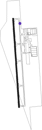
West Memphis - West Memphis Muni
Airport details
| Country | United States of America |
| State | Arkansas |
| Region | K4 |
| Airspace | Memphis Ctr |
| Municipality | West Memphis |
| Elevation | 209ft (64m) |
| Timezone | GMT -6 |
| Coordinates | 35.13506, -90.23444 |
| Magnetic var | |
| Type | land |
| Available since | X-Plane v10.40 |
| ICAO code | KAWM |
| IATA code | AWM |
| FAA code | AWM |
Communication
| West Memphis Muni ASOS | 118.175 |
| West Memphis Muni CTAF/UNICOM | 123.050 |
| West Memphis Muni MEMPHIS Approach | 119.100 |
| West Memphis Muni MEMPHIS Departure | 119.100 |
Approach frequencies
| ILS-cat-I | RW17 | 110.7 | 18.00mi |
| 3° GS | RW17 | 110.7 | 18.00mi |
Nearby Points of Interest:
Dabbs Store
-Johnson-Portis House
-West Memphis City Hall
-Hamilton Apartments
-Wilson Power and Light Company Ice Plant
-Lawrie House
-Crittenden County Bank and Trust Company
-Crittenden County Courthouse
-Marion Colored High School
-Tennessee Brewery
-South Main Arts District
-John Alexander Austin House
-University of Memphis School of Law building
-Shrine Building
-B. Lowenstein & Brothers Building
-Memphis Trust Building
-Bank of Commerce and Trust Company Building
-D.T. Porter Building
-Exchange Building
-Lincoln American Tower
-Tennessee Club-Overall Goodbar Building
-100 North Main
-William R. Moore Dry Goods Building
-Sterick Building
-Dermon Building
Nearby beacons
| code | identifier | dist | bearing | frequency |
|---|---|---|---|---|
| MEM | MEMPHIS VORTAC | 14.2 | 116° | 117.50 |
| GQE | GILMORE VOR/DME | 17.4 | 311° | 113 |
| UJM | MARVELL (HELENA) VOR/DME | 40 | 218° | 109.60 |
| HLI | HOLLY SPRINGS VORTAC | 42.4 | 116° | 112.40 |
| JBR | JONESBORO VOR/DME | 47.6 | 334° | 108.60 |
| UV | TUNNG (OXFORD) NDB | 54.1 | 141° | 426 |
| ARG | WALNUT RIDGE VORTAC | 68.2 | 324° | 114.50 |
| DYR | DYERSBURG VORTAC | 69.4 | 46° | 116.80 |
Instrument approach procedures
| runway | airway (heading) | route (dist, bearing) |
|---|---|---|
| RW17 | IMUDE (181°) | IMUDE 2500ft |
| RW17 | JUSON (153°) | JUSON 2500ft IMUDE (5mi, 90°) 2500ft |
| RW17 | KIDHU (208°) | KIDHU 2500ft IMUDE (5mi, 270°) 2500ft |
| RNAV | IMUDE 2500ft HEDIM (6mi, 181°) 2000ft KAWM (6mi, 181°) 263ft USUPE (11mi, 181°) 2100ft USUPE (turn) | |
| RW35 | LOGNE (29°) | LOGNE 2500ft USUPE (5mi, 90°) 2100ft |
| RW35 | NEGNE (332°) | NEGNE 2500ft USUPE (5mi, 270°) 2100ft |
| RW35 | USUPE (1°) | USUPE 2100ft |
| RNAV | USUPE 2100ft ITOXE (6mi, 1°) 1800ft KAWM (5mi, 1°) 252ft IMUDE (12mi, 1°) 2500ft IMUDE (turn) |
Disclaimer
The information on this website is not for real aviation. Use this data with the X-Plane flight simulator only! Data taken with kind consent from X-Plane 12 source code and data files. Content is subject to change without notice.