Arlington - Arlington Municipal
Airport details
| Country | United States of America |
| State | Washington |
| Region | K1 |
| Airspace | Seattle Ctr |
| Municipality | Arlington |
| Elevation | 141ft (43m) |
| Timezone | GMT -8 |
| Coordinates | 48.15593, -122.15969 |
| Magnetic var | |
| Type | land |
| Available since | X-Plane v10.40 |
| ICAO code | KAWO |
| IATA code | n/a |
| FAA code | AWO |
Communication
| Arlington Municipal AWOS 3 | 135.625 |
| Arlington Municipal CTAF/UNICOM | 122.700 |
Approach frequencies
| LOC | RW34 | 111.5 | 18.00mi |
Nearby Points of Interest:
Marysville Opera House
-St. Anne's Roman Catholic Church
-Indian Shaker Church
-North Coast Casket Company Building
-Weyerhaeuser Office Building
-Stanwood IOOF Public Hall
-Roland Hartley House
-Swalwell Cottage
-Community Center and War Memorial Building
-McCabe Building
-Commerce Building
-Hewitt Avenue Historic District
-Everett Carnegie Library
-Snohomish County Courthouse
-U.S. Post Office and Customshouse
-Everett City Hall
-Rucker House
-Cama Beach State Park
-Snohomish County Centennial Trail
-Bethsaida Swedish Evangelical Lutheran Church Parsonage
-Three Fingers Lookout
-Ebey's Landing National Historical Reserve
-Fort Flagler State Park
-North Creek School
-Andrew Carnegie Library
Runway info
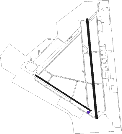
Runway 11 / 29  | ||
| length | 1070m (3510ft) | |
| bearing | 117° / 297° | |
| width | 23m (75ft) | |
| surface | asphalt | |
| Runway 16 / 34 | ||
| length | 1622m (5322ft) | |
| bearing | 179° / 359° | |
| width | 33m (108ft) | |
| surface | asphalt | |
Nearby beacons
| code | identifier | dist | bearing | frequency |
|---|---|---|---|---|
| AW | WATON (ARLINGTON) NDB | 4.7 | 176° | 382 |
| PAE | PAINE (EVERETT) VOR/DME | 14.9 | 207° | 110.60 |
| BVS | SKAGIT/BAY VIEW (BURLINGTON) NDB | 21.4 | 320° | 240 |
| CVV | PENN COVE VOR/DME | 23.2 | 279° | 117.20 |
| NUW | WHIDBEY ISLAND (OAK HARBO TACAN | 23.3 | 292° | 113.80 |
| FHR | FRIDAY HARBOR NDB | 40.5 | 292° | 284 |
| SEA | SEATTLE VORTAC | 43.6 | 192° | 116.80 |
| HUH | WHATCOM VORTAC | 50.2 | 332° | 113 |
| XX | ABBOTSFORD NDB | 53.2 | 339° | 344 |
| WC | WHITE ROCK NDB | 56 | 325° | 332 |
| YVR | VANCOUVER VOR/DME | 67.8 | 313° | 115.90 |
Departure and arrival routes
| Transition altitude | 18000ft |
| Transition level | 18000ft |
| SID end points | distance | outbound heading | |
|---|---|---|---|
| RW16 | |||
| ARLIN2 | 37mi | 286° | |
| RW34 | |||
| ARLIN2 | 37mi | 286° | |
Instrument approach procedures
| runway | airway (heading) | route (dist, bearing) |
|---|---|---|
| RW34 | PAE (27°) | PAE SAVOY (6mi, 66°) 2000ft |
| RW34 | SAVOY (358°) | SAVOY 2000ft |
| RNAV | SAVOY 2000ft YAYKU (6mi, 359°) 1700ft WIGIB (3mi, 359°) 680ft KAWO (2mi, 352°) 174ft (6654mi, 112°) 1000ft SAVOY (6659mi, 291°) 2000ft SAVOY (turn) |
Disclaimer
The information on this website is not for real aviation. Use this data with the X-Plane flight simulator only! Data taken with kind consent from X-Plane 12 source code and data files. Content is subject to change without notice.