Bedford - Laurence G Hanscom Field
Airport details
| Country | United States of America |
| State | Massachusetts |
| Region | K6 |
| Airspace | Boston Ctr |
| Municipality | Bedford |
| Elevation | 129ft (39m) |
| Timezone | GMT -5 |
| Coordinates | 42.46994, -71.28900 |
| Magnetic var | |
| Type | land |
| Available since | X-Plane v10.40 |
| ICAO code | KBED |
| IATA code | BED |
| FAA code | BED |
Communication
| Laurence G Hanscom Field ATIS | 124.600 |
| Laurence G Hanscom Field CTAF | 118.500 |
| Laurence G Hanscom Field UNICOM | 122.950 |
| Laurence G Hanscom Field Clearance DEL | 121.850 |
| Laurence G Hanscom Field HANSCOM Ground Control | 121.700 |
| Laurence G Hanscom Field HANSCOM Tower | 118.500 |
| Laurence G Hanscom Field BOSTON Approach/Departure | 124.400 |
Approach frequencies
| ILS-cat-I | RW11 | 111.15 | 18.00mi |
| ILS-cat-I | RW29 | 111.15 | 18.00mi |
| 3° GS | RW11 | 111.15 | 18.00mi |
| 3° GS | RW29 | 111.15 | 18.00mi |
Nearby Points of Interest:
Wheeler-Merriam House
-Bedford Center Historic District
-Daniel Brooks House
-Shawsheen Cemetery
-Nathaniel Page House
-David Lane House
-The Wayside
-Christopher Page House
-Hoar Tavern
-Bedford Veterans Affairs Medical Center
-Wilson Mill-Old Burlington Road District
-Flint House
-Bacon-Gleason-Blodgett Homestead
-Wright's Tavern
-Concord Armory
-Henry Higginson House
-Hancock School
-Gen. Samuel Chandler House
-Lincoln Center Historic District
-Old Billerica Road Historic District
-Walden Pond
-Two Brothers Rocks-Dudley Road Historic District
-Woods End Road Historic District
-United States Post Office–Lexington Main
-Thoreau-Alcott House
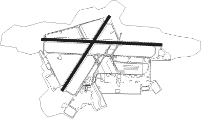
Runway info
Runway 11 / 29  | ||
| length | 2129m (6985ft) | |
| bearing | 95° / 275° | |
| width | 46m (151ft) | |
| surface | asphalt | |
| blast zone | 255m (837ft) / 255m (837ft) | |
| Runway 5 / 23 | ||
| length | 1556m (5105ft) | |
| bearing | 46° / 226° | |
| width | 46m (151ft) | |
| surface | asphalt | |
| blast zone | 178m (584ft) / 255m (837ft) | |
Nearby beacons
| code | identifier | dist | bearing | frequency |
|---|---|---|---|---|
| BOS | BOSTON VOR/DME | 14.8 | 111° | 112.70 |
| LWM | DME | 18.3 | 36° | 112.50 |
| OW | STOGE (NORWOOD) NDB | 22.2 | 155° | 397 |
| MHT | MANCHESTER VOR/DME | 24.2 | 349° | 114.40 |
| MJ | FITZY (MANCHESTER) NDB | 25.9 | 329° | 209 |
| GDM | GARDNER VOR/DME | 34.3 | 276° | 110.60 |
| PUT | PUTNAM VOR/DME | 39.5 | 227° | 117.40 |
| CO | EPSOM (CONCORD) NDB | 39.6 | 346° | 216 |
| PSM | (PORTSMOUTH) DME | 42 | 37° | 116.50 |
| PVD | PROVIDENCE VOR/DME | 45.2 | 191° | 115.60 |
| CON | CONCORD VOR/DME | 46.7 | 339° | 112.90 |
| ESG | ROLLINS (ROLLINSFORD) NDB | 49.4 | 32° | 260 |
| SF | SANFD (SANFORD) NDB | 55.6 | 28° | 349 |
| FMH | OTIS (FALMOUTH) TACAN | 59.6 | 136° | 115.80 |
| ORW | NORWICH VOR/DME | 63.3 | 218° | 110 |
| ENE | KENNEBUNK VOR/DME | 64.6 | 35° | 117.10 |
Departure and arrival routes
| Transition altitude | 18000ft |
| Transition level | 18000ft |
| SID end points | distance | outbound heading | |
|---|---|---|---|
| RW05 | |||
| HNSCM3 | 21mi | 240° | |
| RW11 | |||
| HNSCM3 | 21mi | 240° | |
| RW23 | |||
| HNSCM3 | 21mi | 240° | |
| RW29 | |||
| HNSCM3 | 21mi | 240° | |
| STAR starting points | distance | inbound heading | |
|---|---|---|---|
| ALL | |||
| GRAYM6 | 39.7 | 64° | |
| ZELKA2 | 11.8 | 95° | |
| RW11 | |||
| DREEM2 | 21.1 | 77° | |
| RW23 | |||
| DREEM2 | 21.1 | 77° | |
| RW29 | |||
| DREEM2 | 21.1 | 77° | |
Instrument approach procedures
| runway | airway (heading) | route (dist, bearing) |
|---|---|---|
| RW11-Y | BRONC (96°) | BRONC LOBBY (5mi, 95°) 2300ft ZELKA (3mi, 99°) 2000ft JOPVU (6mi, 95°) 1800ft |
| RW11-Y | FOVEG (62°) | FOVEG WIDKA (5mi, 5°) 2000ft URTOQ (3mi, 45°) 1800ft JOPVU (2mi, 85°) 1800ft |
| RW11-Y | HIDRI (117°) | HIDRI ZELKA (6mi, 189°) 2000ft JOPVU (6mi, 95°) 1800ft |
| RW11-Y | LWRNC (216°) | LWRNC OMIXY (8mi, 242°) 2000ft ZARAB (5mi, 242°) 2000ft ILEXE (6mi, 242°) 2000ft JOPVU (5mi, 161°) 1800ft |
| RW11-Y | WANLA (82°) | WANLA CESOL (6mi, 74°) 1900ft URTOQ (3mi, 74°) 1800ft JOPVU (2mi, 85°) 1800ft |
| RNAV | JOPVU 1800ft KBED (6mi, 96°) 182ft (4583mi, 121°) 1000ft ZIMOT (4580mi, 301°) 2000ft ZIMOT (turn) | |
| RW11-Z | HIDRI (117°) | HIDRI ZELKA (6mi, 189°) 1900ft |
| RW11-Z | ZELKA (95°) | ZELKA 1900ft |
| RNAV | ZELKA 1900ft JOPVU (6mi, 95°) 1800ft SUVVO (3mi, 95°) 880ft KBED (3mi, 96°) 182ft (4583mi, 121°) 1000ft ZIMOT (4580mi, 301°) 2000ft ZIMOT (turn) | |
| RW23 | DREEM (77°) | DREEM JABMU (10mi, 59°) 3100ft EZKOW (20mi, 59°) 3000ft JENDI (5mi, 119°) 2000ft |
| RW23 | JENDI (226°) | JENDI 2000ft |
| RW23 | LOBBY (96°) | LOBBY EZKOW (20mi, 66°) 3000ft JENDI (5mi, 119°) 2000ft |
| RW23 | LWRNC (216°) | LWRNC JENDI (7mi, 198°) 2000ft |
| RNAV | JENDI 2000ft OYIVE (6mi, 226°) 1800ft KBED (5mi, 225°) 181ft (4583mi, 121°) 532ft CACVA (4585mi, 301°) WHYBE (9mi, 200°) 3000ft WHYBE (turn) | |
| RW29-Y | EXXRO (222°) | EXXRO UJEGE (5mi, 110°) 1800ft HADEV (2mi, 136°) 1800ft ZOSLA (4mi, 233°) 1800ft JAYSE (2mi, 275°) 1800ft |
| RW29-Y | LWRNC (216°) | LWRNC YANRU (8mi, 169°) 2000ft HADEV (7mi, 170°) 1800ft ZOSLA (4mi, 233°) 1800ft JAYSE (2mi, 275°) 1800ft |
| RW29-Y | MORIS (275°) | MORIS ZOSLA (4mi, 275°) 1800ft JAYSE (2mi, 275°) 1800ft |
| RNAV | JAYSE 1800ft KBED (6mi, 275°) 178ft COMON (3mi, 276°) SOSYO (3mi, 278°) 2000ft SOSYO (turn) | |
| RW29-Z | SEGOE (253°) | SEGOE MORIS (7mi, 190°) 1800ft |
| RNAV | MORIS 1800ft JAYSE (6mi, 275°) 1800ft ROGGR (2mi, 275°) 1000ft KBED (3mi, 275°) 178ft (4583mi, 121°) 323ft COMON (4586mi, 301°) SOSYO (3mi, 278°) 2000ft SOSYO (turn) |
Holding patterns
| STAR name | hold at | type | turn | heading* | altitude | leg | speed limit |
|---|---|---|---|---|---|---|---|
| DREEM2 | DREEM | VHF | left | 233 (53)° | 1.0min timed | ICAO rules | |
| GRAYM6 | DREEM | VHF | left | 233 (53)° | 1.0min timed | ICAO rules | |
| *) magnetic outbound (inbound) holding course | |||||||
Disclaimer
The information on this website is not for real aviation. Use this data with the X-Plane flight simulator only! Data taken with kind consent from X-Plane 12 source code and data files. Content is subject to change without notice.