Bar Harbor - Hancock Co Bar Harbor
Airport details
| Country | United States of America |
| State | Maine |
| Region | K6 |
| Airspace | Boston Ctr |
| Municipality | Trenton |
| Elevation | 83ft (25m) |
| Timezone | GMT -5 |
| Coordinates | 44.44977, -68.36156 |
| Magnetic var | |
| Type | land |
| Available since | X-Plane v10.40 |
| ICAO code | KBHB |
| IATA code | BHB |
| FAA code | BHB |
Communication
| Hancock Co Bar Harbor AWOS 3 | 118.350 |
| Hancock Co Bar Harbor CTAF | 123.000 |
| Hancock Co Bar Harbor CLEARANCE DELIVERY | 119.900 |
| Hancock Co Bar Harbor UNICOM | 123.000 |
| Hancock Co Bar Harbor BANGOR APCH/Departure | 133.600 |
Approach frequencies
| ILS-cat-I | RW22 | 108.3 | 18.00mi |
| 3° GS | RW22 | 108.3 | 18.00mi |
Nearby Points of Interest:
First Baptist Church
-Ellsworth Public Library
-Eegonos
-Hancock County Jail
-Reverie Cove
-West Street Historic District
-Agassiz Bedrock Outcrop
-US Post Office-Bar Harbor Main
-33 Ledgelawn Avenue
-Jesup Memorial Library
-Bubble Pond Bridge
-John Innes Kane Cottage
-Granite Store
-Carriage Paths, Bridges and Gatehouses
-Ellsworth City Hall
-Jonathan Fisher House
-Blackwoods Campground
-West Gouldsboro Village Library
-Bass Harbor Memorial Library
-Seawall Campground
-Brooklin IOOF Hall
-Henry D. Moore Parish House and Library
-Winter Harbor Light
-Pumpkin Island Light
-Bowdoin
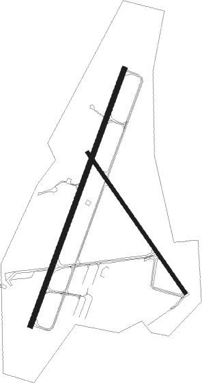
Runway info
Runway 4 / 22  | ||
| length | 1586m (5203ft) | |
| bearing | 33° / 213° | |
| width | 30m (98ft) | |
| surface | asphalt | |
| Runway 17 / 35 | ||
| length | 993m (3258ft) | |
| bearing | 141° / 321° | |
| width | 23m (75ft) | |
| surface | asphalt | |
| displ threshold | 195m (640ft) / 45m (148ft) | |
Nearby beacons
| code | identifier | dist | bearing | frequency |
|---|---|---|---|---|
| BGR | BANGOR VORTAC | 32.1 | 307° | 114.80 |
| SUH | SPRUCEHEAD (OWLS HEAD) NDB | 39.9 | 242° | 356 |
| BUP | BURNHAM (PITTSFIELD) NDB | 45.1 | 284° | 348 |
| PNN | DME | 59.7 | 37° | 114.30 |
Instrument approach procedures
| runway | airway (heading) | route (dist, bearing) |
|---|---|---|
| RW04 | CUDVA (4°) | CUDVA 3000ft WHAME (5mi, 288°) 2900ft |
| RW04 | FOMLU (56°) | FOMLU 2900ft WHAME (5mi, 108°) 2900ft |
| RW04 | WHAME (33°) | WHAME 2900ft |
| RNAV | WHAME 2900ft TABUU (6mi, 32°) 2000ft HALBO (3mi, 33°) 860ft KBHB (3mi, 34°) 124ft (4489mi, 123°) 333ft BECRA (4487mi, 303°) 3000ft BECRA (turn) | |
| RW22 | BECRA (212°) | BECRA 3000ft |
| RW22 | CARDA (184°) | CARDA 3000ft BECRA (5mi, 108°) 3000ft |
| RW22 | DIRNE (235°) | DIRNE 3000ft BECRA (5mi, 288°) 3000ft |
| RNAV | BECRA 3000ft CDLAC (6mi, 213°) 2100ft JESUL (4mi, 213°) 780ft KBHB (3mi, 211°) 120ft (4489mi, 123°) 283ft WHAME (4491mi, 303°) 2900ft WHAME (turn) |
Disclaimer
The information on this website is not for real aviation. Use this data with the X-Plane flight simulator only! Data taken with kind consent from X-Plane 12 source code and data files. Content is subject to change without notice.