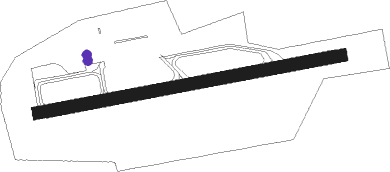
Block Island - Block Island State
Airport details
| Country | United States of America |
| State | Rhode Island |
| Region | K6 |
| Airspace | Boston Ctr |
| Municipality | New Shoreham |
| Elevation | 105ft (32m) |
| Timezone | GMT -5 |
| Coordinates | 41.16811, -71.57784 |
| Magnetic var | |
| Type | land |
| Available since | X-Plane v10.40 |
| ICAO code | KBID |
| IATA code | BID |
| FAA code | BID |
Communication
| Block Island State AWOS-3 | 134.775 |
| Block Island State CTAF/UNICOM | 123.000 |
| Block Island State PROVIDENCE APCH/Departure | 125.750 |
Nearby Points of Interest:
Hygeia House
-US Weather Bureau Station
-Babcock House
-Browning's Beach Historic District
-Dewey Cottage
-Joseph Stanton House
-Massie Wireless Station
-Perry-Carpenter Grist Mill
-District Schoolhouse No. 2
-Willow Dell
-Hale House
-Red House
-Anthony-Kinney Farm
-Dunmere
-Commodore Oliver Perry Farm
-Flying Horse Carousel
-Ocean Road Historic District
-Druidsdream
-Robert Stanton House
-Earlscourt Historic District
-Gardencourt
-Joseph Jeffrey House
-William Davis Miller House
-Gladstone Springhouse and Bottling Plant
-Central Street Historic District
Runway info
| Runway 10 / 28 | ||
| length | 763m (2503ft) | |
| bearing | 85° / 265° | |
| width | 30m (100ft) | |
| surface | asphalt | |
Nearby beacons
| code | identifier | dist | bearing | frequency |
|---|---|---|---|---|
| SEY | SANDY POINT (BLOCK ISLAND VOR/DME | 0 | 111° | 117.80 |
| GON | GROTON VOR/DME | 23.5 | 289° | 110.85 |
| ORW | NORWICH VOR/DME | 30 | 313° | 110 |
| PVD | PROVIDENCE VOR/DME | 34 | 15° | 115.60 |
| HTO | HAMPTON (EAST HAMPTON) VORTAC | 36.6 | 251° | 113.60 |
| MVY | MARTHA'S VINEYARD VOR/DME | 45.6 | 77° | 114.50 |
| PUT | PUTNAM VOR/DME | 48.7 | 341° | 117.40 |
| HFD | HARTFORD VOR/DME | 52.1 | 296° | 114.90 |
| OW | STOGE (NORWOOD) NDB | 60.6 | 25° | 397 |
Instrument approach procedures
| runway | airway (heading) | route (dist, bearing) |
|---|---|---|
| RW10 | GARRD (89°) | GARRD SUFOK (10mi, 89°) 1700ft |
| RW10 | JORDN (71°) | JORDN SUFOK (8mi, 38°) 1700ft |
| RW10 | SUFOK (89°) | SUFOK 1700ft |
| RNAV | SUFOK 1700ft RHINA (6mi, 89°) 1700ft ILACI (5mi, 89°) 315ft (4579mi, 120°) 508ft SUFOK (4590mi, 300°) 1700ft SUFOK (turn) | |
| RW28 | FALMA (243°) | FALMA WAVON (14mi, 223°) 2000ft |
| RW28 | NEWBE (266°) | NEWBE WAVON (12mi, 266°) 2000ft |
| RW28 | OSSER (289°) | OSSER WAVON (11mi, 316°) 2000ft |
| RW28 | SUFOK (89°) | SUFOK WAVON (22mi, 87°) 2000ft WAVON (turn) 2000ft |
| RNAV | WAVON 2000ft BLOKK (6mi, 265°) 1500ft KBID (4mi, 265°) 138ft (4579mi, 120°) 358ft CUGDA (4583mi, 300°) SUFOK (7mi, 271°) 1500ft SUFOK (turn) |
Disclaimer
The information on this website is not for real aviation. Use this data with the X-Plane flight simulator only! Data taken with kind consent from X-Plane 12 source code and data files. Content is subject to change without notice.
