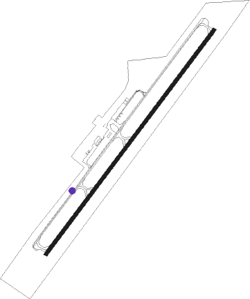
Cortez - Cortez Muni
Airport details
| Country | United States of America |
| State | Colorado |
| Region | K2 |
| Airspace | Denver Ctr |
| Municipality | Montezuma County |
| Elevation | 5916ft (1803m) |
| Timezone | GMT -7 |
| Coordinates | 37.30499, -108.62840 |
| Magnetic var | |
| Type | land |
| Available since | X-Plane v10.30 |
| ICAO code | KCEZ |
| IATA code | CEZ |
| FAA code | CEZ |
Communication
| Cortez Muni ASOS | 135.625 |
| Cortez Muni CTAF/UNICOM | 122.800 |
Nearby Points of Interest:
Montezuma Valley National Bank and Store Building
-Ertel Funeral Home
-Mancos Theatre
-Bauer Bank Block
-Lowry Pueblo
Nearby beacons
| code | identifier | dist | bearing | frequency |
|---|---|---|---|---|
| CEZ | CORTEZ VOR/DME | 6 | 38° | 108.40 |
| DVC | DOVE CREEK VORTAC | 33.5 | 329° | 114.60 |
| RSK | RATTLESNAKE (FARMINGTON) VORTAC | 41.9 | 136° | 115.30 |
| DRO | DURANGO VOR/DME | 42.9 | 100° | 116.55 |
| BDG | BLANDING NDB | 43.1 | 284° | 340 |
| ETL | CONES (TELLURIDE) VOR/DME | 47.5 | 27° | 110.20 |
Instrument approach procedures
| runway | airway (heading) | route (dist, bearing) |
|---|---|---|
| RW03 | CEZ (218°) | CEZ TAHIB (23mi, 215°) 11200ft TAHIB (turn) 9000ft |
| RW03 | RSK (316°) | RSK TAHIB (38mi, 294°) 9000ft |
| RW03 | ZENFO (19°) | ZENFO TAHIB (27mi, 10°) 9000ft |
| RNAV | TAHIB 9000ft ROLQE (10mi, 27°) 8000ft FAPOP (3mi, 43°) 7040ft OVOWY (3mi, 43°) 6113ft (6290mi, 109°) 6318ft CEZ (6285mi, 289°) YURVE (15mi, 319°) 9800ft YURVE (turn) | |
| RW21-Y | HAVWU (194°) | HAVWU DOLRR (25mi, 200°) 12200ft REMAE (5mi, 125°) 10500ft OKALE (5mi, 114°) 9100ft PAMUE (4mi, 228°) 8500ft |
| RW21-Y | MANCA (275°) | MANCA TANRE (5mi, 317°) 11100ft OKALE (10mi, 317°) 9100ft PAMUE (4mi, 228°) 8500ft |
| RW21-Y | YURVE (159°) | YURVE DOLRR (6mi, 100°) 10500ft REMAE (5mi, 125°) 10500ft OKALE (5mi, 114°) 9100ft PAMUE (4mi, 228°) 8500ft |
| RNAV | PAMUE 8500ft ATEMY (3mi, 228°) 8000ft NATGE (4mi, 228°) 6740ft KCEZ (3mi, 230°) 5959ft (6289mi, 109°) 6318ft YURVE (6291mi, 289°) 9800ft YURVE (turn) | |
| RW21-Z | HAVWU (194°) | HAVWU DOLRR (25mi, 200°) 12200ft REMAE (5mi, 125°) 10500ft OKALE (5mi, 114°) 9100ft PAMUE (4mi, 228°) 8500ft |
| RW21-Z | MANCA (275°) | MANCA TANRE (5mi, 317°) 11100ft OKALE (10mi, 317°) 9100ft PAMUE (4mi, 228°) 8500ft |
| RW21-Z | YURVE (159°) | YURVE DOLRR (6mi, 100°) 10500ft REMAE (5mi, 125°) 10500ft OKALE (5mi, 114°) 9100ft PAMUE (4mi, 228°) 8500ft |
| RNAV | PAMUE 8500ft ATEMY (3mi, 228°) 8000ft KCEZ (7mi, 229°) 5959ft (6289mi, 109°) 6215ft OVOWY (6290mi, 289°) ROLQE (6mi, 223°) TAHIB (10mi, 207°) 9000ft TAHIB (turn) |
Disclaimer
The information on this website is not for real aviation. Use this data with the X-Plane flight simulator only! Data taken with kind consent from X-Plane 12 source code and data files. Content is subject to change without notice.
