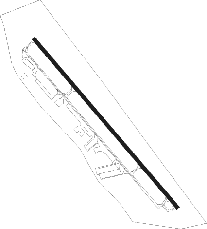
Cambridge - Cambridge Dorchester Regl
Airport details
| Country | United States of America |
| State | Maryland |
| Region | K6 |
| Airspace | Washington Ctr |
| Municipality | Cambridge |
| Elevation | 19ft (6m) |
| Timezone | GMT -5 |
| Coordinates | 38.53933, -76.03039 |
| Magnetic var | |
| Type | land |
| Available since | X-Plane v10.30 |
| ICAO code | KCGE |
| IATA code | CGE |
| FAA code | CGE |
Communication
| Cambridge Dorchester Regl AWOS 3 | 120.675 |
| Cambridge Dorchester Regl CTAF/UNICOM | 122.700 |
| Cambridge Dorchester Regl PATUXENT Approach/Departure | 127.950 |
Nearby Points of Interest:
LaGrange
-Dorchester County Courthouse and Jail
-Goldsborough House
-Pine Street Neighborhood Historic District
-Sycamore Cottage
-Cambridge Historic District, Wards I and III
-Glasgow
-Annie Oakley House
-Jena
-Handsell
-Otwell (Oxford, Maryland)
-Barnaby House
-Oxford Historic District (Oxford, Maryland)
-Rehoboth
-Miller's House
-Hughes A.M.E. Chapel
-Grace Episcopal Church Complex
-Easton Historic District
-Old Bloomfield
-San Domingo School
-Exeter
-Long Hill
-The Anchorage
-Beaudley
-St. John's Chapel of St. Michael's Parish
Nearby beacons
| code | identifier | dist | bearing | frequency |
|---|---|---|---|---|
| PXT | PATUXENT (PATUXENT RIVER) VORTAC | 23 | 236° | 117.60 |
| NHK | PATUXENT NDB | 23.2 | 236° | 400 |
| NHK | NAS PATUXENT RIVER TACAN | 23.6 | 236° | 110.25 |
| SBY | SALISBURY VORTAC | 27 | 110° | 111.20 |
| OTT | NOTTINGHAM VORTAC | 34.9 | 283° | 113.70 |
| SWL | SNOW HILL VORTAC | 39.4 | 130° | 112.40 |
| OX | LANDY (OCEAN CITY) NDB | 40.5 | 102° | 407 |
| ATR | WATERLOO VOR/DME | 41.6 | 72° | 112.60 |
| ADW | ANDREWS (CAMP SPRINGS) VORTAC | 42.3 | 288° | 113.10 |
| DOV | DOVER TACAN | 44.2 | 44° | 110 |
| BUH | ANNE ARUNDEL (FT MEADE) NDB | 47.2 | 307° | 260 |
| BAL | BALTIMORE VORTAC | 48 | 315° | 115.10 |
| ENO | SMYRNA (KENTON) VORTAC | 48 | 37° | 111.40 |
| DCA | OXONN (WASHINGTON) NDB | 48.7 | 283° | 332 |
| MTN | MARTIN (BALTIMORE) TACAN | 50.7 | 334° | 134.10 |
| FND | ELLICOTT (BALTIMORE) NDB | 56.8 | 315° | 371 |
| RNB | RAINBOW (MILLVILLE) NDB | 67.3 | 46° | 363 |
| EMI | WESTMINSTER VORTAC | 72.4 | 315° | 117.90 |
Instrument approach procedures
| runway | airway (heading) | route (dist, bearing) |
|---|---|---|
| RW34 | GOFER (64°) | GOFER PROFS (19mi, 95°) 2000ft PROFS (turn) 2000ft |
| RW34 | SBY (290°) | SBY PROFS (18mi, 276°) 2000ft |
| RNAV | PROFS 2000ft WUGUM (6mi, 317°) 1700ft KCGE (5mi, 317°) 73ft (4751mi, 117°) 286ft OVAYO (4760mi, 297°) 2000ft OVAYO (turn) | |
| RWNVA | GOFER (64°) | GOFER OVAYO (17mi, 20°) 2000ft OVAYO (turn) 2000ft |
| RWNVA | GRACO (157°) | GRACO OVAYO (15mi, 175°) 2000ft |
| RNAV | OVAYO 2000ft ZADEP (7mi, 137°) 1700ft KCGE (5mi, 137°) 59ft (4751mi, 117°) 420ft PROFS (4743mi, 297°) 2000ft PROFS (turn) |
Disclaimer
The information on this website is not for real aviation. Use this data with the X-Plane flight simulator only! Data taken with kind consent from X-Plane 12 source code and data files. Content is subject to change without notice.