Chattanooga - Lovell Field
Airport details
| Country | United States of America |
| State | Tennessee |
| Region | K7 |
| Airspace | Atlanta Ctr |
| Municipality | Chattanooga |
| Elevation | 683ft (208m) |
| Timezone | GMT -5 |
| Coordinates | 35.03519, -85.20355 |
| Magnetic var | |
| Type | land |
| Available since | X-Plane v10.40 |
| ICAO code | KCHA |
| IATA code | CHA |
| FAA code | CHA |
Communication
| Lovell Field ATIS | 119.850 |
| Lovell Field CTAF | 118.300 |
| Lovell Field UNICOM | 122.950 |
| Lovell Field Clearance DEL | 120.950 |
| Lovell Field Ground Control | 121.700 |
| Lovell Field CHATTANOOGA Tower | 118.300 |
| Lovell Field CHATTANOOGA Tower | 122.500 |
| Lovell Field CHATTANOOGA Approach | 119.200 |
| Lovell Field CHATTANOOGA Approach | 125.100 |
| Lovell Field CHATTANOOGA Approach | 126.500 |
| Lovell Field CHATTANOOGA Departure | 125.100 |
| Lovell Field CHATTANOOGA Departure | 119.200 |
Approach frequencies
| ILS-cat-II | RW20 | 109.5 | 18.00mi |
| ILS-cat-I | RW02 | 108.3 | 18.00mi |
| 3° GS | RW02 | 108.3 | 18.00mi |
| 3° GS | RW20 | 109.5 | 18.00mi |
Nearby Points of Interest:
Jones Observatory
-Seamour and Gerte Shavin House
-Southern Railway 4501
-Highland Park Methodist Episcopal Church
-Ferger Place Historic District
-Fort Wood Historic District
-Trinity Methodist Episcopal Church
-St. Elmo Historic District
-Northside Presbyterian Church
-First Baptist Church
-First Baptist Church Education Building
-John Ross House
-Old Library Building
-Hamilton County Courthouse
-Joel W. Solomon Federal Building and United States Courthouse
-Ross's Landing
-Chattanooga Car Barns
-Delta Queen
-St. Paul's Episcopal Church
-Lookout Mountain Incline Railway
-Wauhatchie Pike
-James County Courthouse
-Ringgold Gap Battlefield
-Lee and Gordon Mill
-Tennessee River Blueway
Runway info
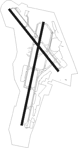
Runway 2 / 20  | ||
| length | 2261m (7418ft) | |
| bearing | 20° / 200° | |
| width | 46m (151ft) | |
| surface | asphalt | |
| blast zone | 15m (49ft) / 0m (0ft) | |
| Runway 15 / 33 | ||
| length | 1702m (5584ft) | |
| bearing | 140° / 320° | |
| width | 46m (151ft) | |
| surface | asphalt | |
| displ threshold | 32m (105ft) / 175m (574ft) | |
Nearby beacons
| code | identifier | dist | bearing | frequency |
|---|---|---|---|---|
| GQO | CHOO CHOO (CHATTANOOGA) VORTAC | 5 | 146° | 115.80 |
| CQN | DAISY (N.CHATTANOOGA) NDB | 8.2 | 19° | 341 |
| DTE | MARK ANTON (DAYTON) NDB | 29.9 | 31° | 394 |
| HCH | HINCH MTN (CROSSVILLE) VOR/DME | 46.1 | 17° | 117.60 |
| RMG | ROME VORTAC | 52.5 | 174° | 115.40 |
| DJD | CHERO NDB | 58.8 | 138° | 415 |
| HEM | HUCHN NDB | 60.2 | 338° | 233 |
Departure and arrival routes
| Transition altitude | 18000ft |
| Transition level | 18000ft |
| SID end points | distance | outbound heading | |
|---|---|---|---|
| RW02 | |||
| CHA7 | 57mi | 332° | |
| RW20 | |||
| CHA7 | 57mi | 332° | |
Instrument approach procedures
| runway | airway (heading) | route (dist, bearing) |
|---|---|---|
| RW02 | ADMIT (43°) | ADMIT FIDGO (14mi, 66°) 3800ft |
| RW02 | DUMBB (352°) | DUMBB FIDGO (16mi, 327°) 3800ft |
| RW02 | FIDGO (20°) | FIDGO 6000ft FIDGO (turn) 3800ft |
| RNAV | FIDGO 3800ft CECAY (9mi, 20°) 2500ft KCHA (6mi, 20°) 732ft (5169mi, 112°) 883ft HETIP (5166mi, 292°) 3800ft HETIP (turn) | |
| RW15 | BOOPS (202°) | BOOPS LIBKE (10mi, 246°) 4200ft HEXEX (8mi, 241°) 4100ft |
| RW15 | GQO (326°) | GQO HEXEX (20mi, 322°) 4600ft HEXEX (turn) 4100ft |
| RW15 | TOBAY (110°) | TOBAY ZOLOT (7mi, 103°) 4400ft HEXEX (8mi, 60°) 4100ft |
| RNAV | HEXEX 4100ft CIKSA (4mi, 140°) 3500ft SUCOR (2mi, 140°) 3200ft ICEKE (4mi, 140°) 1960ft KCHA (5mi, 142°) 716ft (5169mi, 112°) 1083ft IYODA (5163mi, 292°) 3300ft IYODA (turn) | |
| RW20 | BOOPS (202°) | BOOPS HETIP (9mi, 204°) 3800ft |
| RW20 | COMAR (74°) | COMAR HETIP (32mi, 56°) 3800ft HETIP (turn) 3800ft |
| RW20 | CRAND (283°) | CRAND HETIP (22mi, 317°) 3800ft HETIP (turn) 3800ft |
| RW20 | DUBBS (243°) | DUBBS HETIP (18mi, 267°) 3800ft HETIP (turn) 3800ft |
| RW20 | GQO (326°) | GQO HETIP (17mi, 6°) 3800ft HETIP (turn) 3800ft |
| RW20 | PALER (148°) | PALER HETIP (11mi, 95°) 4000ft HETIP (turn) 3800ft |
| RNAV | HETIP 3800ft JOXAT (4mi, 200°) 3200ft ZUBAN (4mi, 200°) 2500ft COKIT (3mi, 200°) 1540ft KCHA (3mi, 201°) 720ft (5169mi, 112°) 873ft FIDGO (5173mi, 292°) 3800ft FIDGO (turn) | |
| RW33 | CRAND (283°) | CRAND IYODA (12mi, 255°) 3300ft |
| RW33 | GQO (326°) | GQO IYODA (5mi, 133°) 3300ft IYODA (turn) 3300ft |
| RW33 | UZOVO (2°) | UZOVO WOXIX (7mi, 29°) 3900ft IYODA (9mi, 29°) 3300ft |
| RNAV | IYODA 3300ft JILIS (4mi, 320°) 2500ft FOGVI (3mi, 320°) 1600ft KCHA (3mi, 317°) 712ft (5169mi, 112°) 1083ft HEXEX (5178mi, 292°) 4100ft HEXEX (turn) |
Disclaimer
The information on this website is not for real aviation. Use this data with the X-Plane flight simulator only! Data taken with kind consent from X-Plane 12 source code and data files. Content is subject to change without notice.