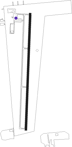
Chanute - Chanute Martin Johnson
Airport details
| Country | United States of America |
| State | Kansas |
| Region | K3 |
| Airspace | Kansas City Ctr |
| Municipality | Chanute |
| Elevation | 1000ft (305m) |
| Timezone | GMT -6 |
| Coordinates | 37.66789, -95.48672 |
| Magnetic var | |
| Type | land |
| Available since | X-Plane v10.40 |
| ICAO code | KCNU |
| IATA code | CNU |
| FAA code | CNU |
Communication
| Chanute Martin Johnson ASOS | 127.075 |
| Chanute Martin Johnson CTAF/UNICOM | 122.700 |
Nearby Points of Interest:
City Square Park Bandstand
-State Street Bridge
-Northrup House
-Allen County Jail
-Stockbrands and Kemmerer Department Store
-Woodson County Courthouse
-Yates Center Carnegie Library
-Booth Theater
-Union Implement and Hardware Building-Masonic Temple
-First Presbyterian Church
Runway info
| Runway 18 / 36 | ||
| length | 1300m (4265ft) | |
| bearing | 188° / 8° | |
| width | 23m (75ft) | |
| surface | asphalt | |
| displ threshold | 0m (0ft) / 82m (269ft) | |
Nearby beacons
| code | identifier | dist | bearing | frequency |
|---|---|---|---|---|
| CNU | CHANUTE VOR/DME | 5.6 | 249° | 109.20 |
| OSW | OSWEGO VOR/DME | 33.4 | 151° | 117.60 |
| EMP | EMPORIA VORTAC | 48.4 | 314° | 112.80 |
| JL | LUNNS (JOPLIN) NDB | 52.3 | 117° | 344 |
| OWI | OTTAWA NDB | 53.6 | 15° | 251 |
| BV | DEWIE (BARTLESVILLE) NDB | 55.7 | 212° | 201 |
| BVO | BARTLESVILLE VOR/DME | 56.1 | 213° | 117.90 |
| BUM | BUTLER VORTAC | 59.5 | 59° | 115.90 |
Instrument approach procedures
| runway | airway (heading) | route (dist, bearing) |
|---|---|---|
| RW36 | HOTAP (35°) | HOTAP ALEFO (5mi, 95°) 2600ft |
| RW36 | NALLY (284°) | NALLY CUMTA (22mi, 262°) 2600ft ALEFO (5mi, 275°) 2600ft |
| RW36 | OSW (331°) | OSW CUMTA (21mi, 327°) 2600ft ALEFO (5mi, 275°) 2600ft |
| RNAV | ALEFO 2600ft MYYER (6mi, 8°) 2600ft FLOUR (3mi, 8°) 1700ft KCNU (2mi, 8°) 1038ft (5666mi, 112°) 1400ft IFAPY (5665mi, 292°) ERECI (10mi, 325°) 2900ft ERECI (turn) |
Disclaimer
The information on this website is not for real aviation. Use this data with the X-Plane flight simulator only! Data taken with kind consent from X-Plane 12 source code and data files. Content is subject to change without notice.
