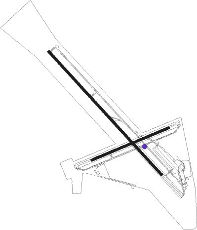
Hollister - Hollister Muni
Airport details
| Country | United States of America |
| State | California |
| Region | K2 |
| Airspace | Oakland Ctr |
| Municipality | Hollister |
| Elevation | 229ft (70m) |
| Timezone | GMT -8 |
| Coordinates | 36.88861, -121.41356 |
| Magnetic var | |
| Type | land |
| Available since | X-Plane v10.40 |
| ICAO code | KCVH |
| IATA code | n/a |
| FAA code | n/a |
Communication
| Hollister Muni AWOS | 120.425 |
| Hollister Muni CTAF/UNICOM | 123.000 |
| Hollister Muni AWOS @ E16 | 118.350 |
| Hollister Muni NORCAL Approach/Departure | 124.525 |
Nearby Points of Interest:
Hollister Carnegie Library
-Downtown Hollister Historic District
-Rozas House
-Edgar Holloway House
-Gilroy Free Library
-Pacheco Pass
-California State Route 152
-Godfrey M. Bockius House
-Porter-Vallejo Mansion
-Frank Norris Cabin
-Samuel M. Black House
-B. V. Sargent House
-Monterey County Court House
-Redman Hirahara Farmstead
-Monterey County Jail
-Elkhorn Slough
-Castro Adobe
-Peter J. Bontadelli House
-Odd Fellows Hall
-Fort Ord Station Veterinary Hospital
-Bear Valley School
-Venetian Court
-New Almaden
-G. T. Marsh and Sons
-Cathedral of San Carlos Borromeo
Nearby beacons
| code | identifier | dist | bearing | frequency |
|---|---|---|---|---|
| SNS | SALINAS VORTAC | 16.2 | 220° | 117.30 |
| UAD | CHUALAR (SALINAS) NDB | 24 | 189° | 263 |
| MR | MUNSO (MONTEREY) NDB | 29.9 | 243° | 385 |
| PXN | PANOCHE VORTAC | 32.2 | 105° | 112.60 |
| SJC | SAN JOSE VOR/DME | 38.7 | 312° | 114.10 |
| BSR | BIG SUR VORTAC | 43.8 | 198° | 114 |
| NUQ | MOFFETT (MOUNTAIN VIEW) TACAN | 44.9 | 310° | 117.60 |
| MOD | MODESTO VOR/DME | 49.4 | 32° | 114.60 |
| LV | REIGA (LIVERMORE) NDB | 49.9 | 341° | 374 |
| OSI | WOODSIDE VOR/DME | 51.3 | 300° | 113.90 |
| HGT | HUNTER LIGGETT NDB | 56.7 | 166° | 209 |
| OAK | OAKLAND VOR/DME | 63.4 | 316° | 116.80 |
| SFO | SAN FRANCISCO VOR/DME | 63.5 | 307° | 115.80 |
Instrument approach procedures
| runway | airway (heading) | route (dist, bearing) |
|---|---|---|
| RW31 | RANCK (314°) | RANCK WAKAM (4mi, 313°) 5400ft IGRUC (6mi, 313°) 4100ft |
| RW31 | RUDNY (341°) | RUDNY KEKDY (4mi, 47°) 5200ft IGRUC (3mi, 47°) 4100ft |
| RNAV | IGRUC 4100ft JINDI (4mi, 316°) 3300ft CAMAF (2mi, 316°) 2700ft KAZWY (3mi, 316°) 1700ft KCVH (5mi, 312°) 275ft (6885mi, 107°) 1200ft SANTY (6913mi, 287°) 7000ft SANTY (turn) 7000ft |
Disclaimer
The information on this website is not for real aviation. Use this data with the X-Plane flight simulator only! Data taken with kind consent from X-Plane 12 source code and data files. Content is subject to change without notice.

