Calhoun - Tom B David Fld
Airport details
| Country | United States of America |
| State | Georgia |
| Region | K7 |
| Airspace | Atlanta Ctr |
| Municipality | Calhoun |
| Elevation | 645ft (197m) |
| Timezone | GMT -5 |
| Coordinates | 34.45539, -84.93916 |
| Magnetic var | |
| Type | land |
| Available since | X-Plane v10.40 |
| ICAO code | KCZL |
| IATA code | n/a |
| FAA code | CZL |
Communication
| TOM B DAVID FLD CTAF/UNICOM | 122.800 |
Approach frequencies
| LOC | RW35 | 110.7 | 18.00mi |
Nearby Points of Interest:
Calhoun Depot
-New Echota
-Corra White Harris House, Study, and Chapel
-Cassville Post Office
-United States Post Office and Courthouse
-Between the Rivers Historic District
-Marshall Forest
-Masonic Lodge No. 238
-Roselawn Museum
-Old Bartow County Courthouse
-Bartow County Courthouse
-Western and Atlantic Depot (Dalton, Georgia)
-Thomas A. Berry House
-Chief Vann House Historic Site
-Murray County Courthouse
-Wright Hotel
-Etowah Indian Mounds
-Walker County Courthouse
-Marsh-Warthen House
-Cagle House
-Pickens County Courthouse
-Crescent Farm
-Cherokee County Courthouse
-Prater's Mill
-Gilmer County Courthouse
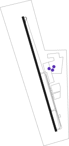
Runway info
| Runway 17 / 35 | ||
| length | 1841m (6040ft) | |
| bearing | 166° / 346° | |
| width | 30m (100ft) | |
| surface | asphalt | |
| displ threshold | 0m (0ft) / 118m (387ft) | |
| blast zone | 31m (102ft) / 0m (0ft) | |
Nearby beacons
| code | identifier | dist | bearing | frequency |
|---|---|---|---|---|
| RMG | ROME VORTAC | 19.7 | 212° | 115.40 |
| DJD | CHERO NDB | 25.4 | 114° | 415 |
| GQO | CHOO CHOO (CHATTANOOGA) VORTAC | 32.1 | 337° | 115.80 |
| DOB | DOBBINS (MARIETTA) TACAN | 38.9 | 141° | 113 |
| CQN | DAISY (N.CHATTANOOGA) NDB | 44 | 343° | 341 |
| PDK | PEACHTREE (ATLANTA) VOR/DME | 47.1 | 132° | 116.60 |
| AT | CATTA (ATLANTA) NDB | 52.4 | 154° | 375 |
| GPQ | CARROLLTON NDB | 54.2 | 192° | 278 |
| ATL | ATLANTA VORTAC | 55.6 | 149° | 116.90 |
| AN | BOGGA (ANNISTON) NDB | 74.1 | 227° | 211 |
Instrument approach procedures
| runway | airway (heading) | route (dist, bearing) |
|---|---|---|
| RW17 | ETONE (207°) | ETONE WAPMO (6mi, 247°) 4000ft JOTKI (5mi, 247°) 3300ft |
| RW17 | RMG (32°) | RMG JOTKI (30mi, 15°) 4000ft JOTKI (turn) 3300ft |
| RW17 | UZOVO (126°) | UZOVO OLPUE (6mi, 91°) 4000ft JOTKI (5mi, 91°) 3300ft |
| RNAV | JOTKI 3300ft SOYOY (3mi, 166°) 2800ft LEYLI (3mi, 166°) 2600ft KCZL (6mi, 166°) 699ft (5155mi, 112°) 930ft GECYE (5152mi, 292°) 2800ft GECYE (turn) | |
| RW35 | DUMBB (117°) | DUMBB GECYE (21mi, 139°) 4000ft GECYE (turn) 2800ft |
| RW35 | NELLO (265°) | NELLO HOGUK (23mi, 241°) 5000ft GECYE (5mi, 261°) 2800ft |
| RW35 | RMG (32°) | RMG ICUSI (8mi, 65°) 4000ft GECYE (5mi, 65°) 2800ft |
| RNAV | GECYE 2800ft KEYEY (6mi, 346°) 2300ft UVNIH (2mi, 346°) 1580ft KCZL (3mi, 346°) 703ft (5155mi, 112°) 1056ft JOTKI (5158mi, 292°) 3300ft JOTKI (turn) |
Disclaimer
The information on this website is not for real aviation. Use this data with the X-Plane flight simulator only! Data taken with kind consent from X-Plane 12 source code and data files. Content is subject to change without notice.