Dickinson - Dickinson - Theodore Roosevelt
Airport details
| Country | United States of America |
| State | North Dakota |
| Region | K3 |
| Airspace | Minneapolis Ctr |
| Municipality | Stark County |
| Elevation | 2591ft (790m) |
| Timezone | GMT -7 |
| Coordinates | 46.79733, -102.80186 |
| Magnetic var | |
| Type | land |
| Available since | X-Plane v10.40 |
| ICAO code | KDIK |
| IATA code | DIK |
| FAA code | DIK |
Communication
| Dickinson - Theodore Roosevelt ASOS | 118.375 |
| Dickinson - Theodore Roosevelt CTAF/UNICOM | 123.000 |
| Dickinson - Theodore Roosevelt MINNEAPOLIS ApproachROACH | 124.250 |
| Dickinson - Theodore Roosevelt MINNEAPOLIS DepartureARTURE | 124.250 |
Nearby Points of Interest:
Elks Club and Store Building-Dickinson Lodge No. 1137
-U.S. Post Office-Dickinson
-Stark County Courthouse
-Dickinson (Carnegie Area) Public Library
-Dr. S.W. Hill Drug Store
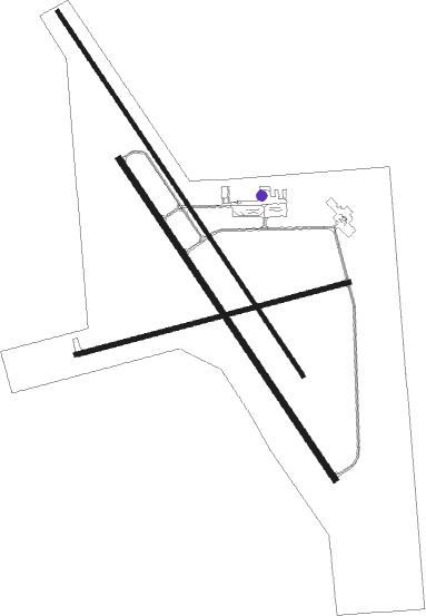
Runway info
Runway 15 / 33  | ||
| length | 2225m (7300ft) | |
| bearing | 140° / 320° | |
| width | 20m (66ft) | |
| surface | concrete | |
| Runway 14 / 32 | ||
| length | 1950m (6398ft) | |
| bearing | 140° / 320° | |
| width | 30m (100ft) | |
| surface | asphalt | |
| Runway 7 / 25 | ||
| length | 1429m (4688ft) | |
| bearing | 83° / 263° | |
| width | 23m (75ft) | |
| surface | asphalt | |
Nearby beacons
| code | identifier | dist | bearing | frequency |
|---|---|---|---|---|
| DIK | DICKINSON VORTAC | 3.9 | 24° | 112.90 |
| LEM | LEMMON VOR | 60.1 | 141° | 111.40 |
Instrument approach procedures
| runway | airway (heading) | route (dist, bearing) |
|---|---|---|
| RW15 | FONZA (141°) | FONZA 4400ft |
| RW15 | QATSA (88°) | QATSA ZOMPA (14mi, 63°) 4400ft FONZA (7mi, 69°) 4400ft |
| RW15 | SOXOW (263°) | SOXOW CEPOP (19mi, 297°) 4400ft FONZA (7mi, 249°) 4400ft |
| RNAV | FONZA 4400ft AZIZO (6mi, 140°) 4300ft KDIK (6mi, 141°) 2634ft (5929mi, 114°) 2786ft SCABS (5924mi, 294°) 5000ft SCABS (turn) | |
| RW25 | GEBEY (263°) | GEBEY 4800ft |
| RNAV | GEBEY 4800ft FAMIR (5mi, 263°) 4300ft YOWQO (3mi, 263°) 3240ft KDIK (2mi, 263°) 2620ft (5929mi, 114°) 3200ft NEPFY (5938mi, 294°) 4800ft NEPFY (turn) | |
| RW33 | NEXRU (360°) | NEXRU SCABS (8mi, 69°) 5000ft |
| RW33 | SCABS (320°) | SCABS 5000ft |
| RW33 | ULLIN (268°) | ULLIN YURTS (26mi, 255°) 5000ft SCABS (8mi, 249°) 5000ft |
| RNAV | SCABS 5000ft TIBEE (6mi, 321°) 5000ft APPUL (5mi, 320°) 3540ft KDIK (3mi, 318°) 2640ft (5929mi, 114°) 2836ft FONZA (5933mi, 295°) 4400ft FONZA (turn) |
Disclaimer
The information on this website is not for real aviation. Use this data with the X-Plane flight simulator only! Data taken with kind consent from X-Plane 12 source code and data files. Content is subject to change without notice.