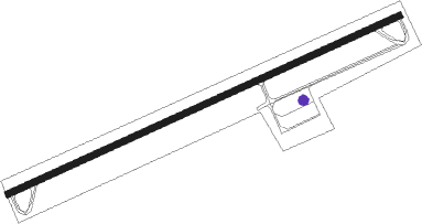
Delbarton - Appalachian Regl
Airport details
| Country | United States of America |
| State | West Virginia |
| Region | K6 |
| Airspace | Indianapolis Ctr |
| Municipality | Mingo County |
| Elevation | 1881ft (573m) |
| Timezone | GMT -5 |
| Coordinates | 37.68176, -82.12207 |
| Magnetic var | |
| Type | land |
| Available since | X-Plane v10.32 |
| ICAO code | KEBD |
| IATA code | n/a |
| FAA code | EBD |
Communication
| Appalachian Regl AWOS - 6L4 | 119.380 |
| Appalachian Regl UNICOM | 122.800 |
Nearby Points of Interest:
Williamson Historic District
-Coal House
-Martin Himler House
-Chesapeake and Ohio Passenger Depot
-Pikeville College Academy Building
-Buchanan County Courthouse
-Madison National Bank
-Boone County Courthouse
-Wyoming County Courthouse and Jail
-Carter Coal Company Store
-Foster Hardware
-Mine No. 5 Store
-Welch Commercial Historic District
-McDowell County Courthouse
-Methodist Episcopal Church, South (Prestonsburg, Kentucky)
-Samuel May House
Nearby beacons
| code | identifier | dist | bearing | frequency |
|---|---|---|---|---|
| HVQ | CHARLESTON VOR/DME | 43.4 | 28° | 117.40 |
| ECB | DME | 47 | 301° | 110.40 |
| BKW | BECKLEY VOR/DME | 47.8 | 84° | 117.70 |
| BLF | BLUEFIELD VOR/DME | 49.6 | 112° | 110 |
| GZG | GLADE SPRING (BLACKFORD) VOR/DME | 51.4 | 177° | 110.20 |
| YRK | YORK VORTAC | 70.5 | 318° | 112.80 |
Instrument approach procedures
| runway | airway (heading) | route (dist, bearing) |
|---|---|---|
| RW08 | RUJAP (91°) | RUJAP 5000ft SEPBU (5mi, 155°) 5000ft |
| RW08 | SEPBU (74°) | SEPBU 5000ft |
| RW08 | TAULS (55°) | TAULS 5400ft SEPBU (5mi, 335°) 5000ft |
| RNAV | SEPBU 5000ft UBIRE (7mi, 74°) 3800ft KEBD (6mi, 74°) 1866ft (5031mi, 115°) 2282ft NEGVE (5019mi, 295°) 5000ft NEGVE (turn) | |
| RW26 | KUVNY (235°) | KUVNY 5000ft NEGVE (5mi, 156°) 5000ft |
| RW26 | NEGVE (254°) | NEGVE 5000ft |
| RW26 | OCPAH (271°) | OCPAH 5000ft NEGVE (5mi, 336°) 5000ft |
| RNAV | NEGVE 5000ft PAADS (7mi, 254°) 3800ft QIGUZ (3mi, 254°) 2840ft KEBD (3mi, 254°) 1923ft (5031mi, 115°) 2282ft SEPBU (5043mi, 295°) 5000ft SEPBU (turn) |
Disclaimer
The information on this website is not for real aviation. Use this data with the X-Plane flight simulator only! Data taken with kind consent from X-Plane 12 source code and data files. Content is subject to change without notice.
