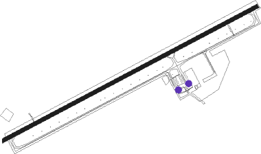
Evanston - Evanston Uinta Co Burns Fld
Airport details
| Country | United States of America |
| State | Wyoming |
| Region | K1 |
| Airspace | Salt Lake City Ctr |
| Municipality | Uinta County |
| Elevation | 7143ft (2177m) |
| Timezone | GMT -7 |
| Coordinates | 41.27478, -111.03464 |
| Magnetic var | |
| Type | land |
| Available since | X-Plane v10.40 |
| ICAO code | KEVW |
| IATA code | EVW |
| FAA code | EVW |
Communication
| Evanston Uinta Co Burns Fld ASOS | 120.000 |
| Evanston Uinta Co Burns Fld CTAF/UNICOM | 122.800 |
Approach frequencies
| ILS-cat-I | RW23 | 108.9 | 18.00mi |
| 3° GS | RW23 | 108.9 | 18.00mi |
Nearby Points of Interest:
Union Pacific Railroad Complex
-Downtown Evanston Historic District
-Wyoming State Insane Asylum
-Woodruff Stake House
-Randolph Tabernacle
-Echo Post Office
-Echo School
-Thomas L. Allen House
-Thomas and Jane Beech House
-Summit Stake Tabernacle
-Annie Birch House
-Samuel P. Hoyt House
Nearby beacons
| code | identifier | dist | bearing | frequency |
|---|---|---|---|---|
| EVW | EVANSTON VOR/DME | 0.5 | 259° | 109.60 |
| FBR | FORT BRIDGER VOR/DME | 28.2 | 80° | 114.45 |
| HIF | HILL (OGDEN) TACAN | 42.9 | 261° | 111.20 |
| TCH | WASATCH VORTAC | 49.8 | 246° | 116.80 |
| LHO | BRIGHAM CITY (LOGAN) VOR/DME | 53.7 | 298° | 112.90 |
| FFU | FAIRFIELD (PROVO) VORTAC | 72.8 | 222° | 116.60 |
Instrument approach procedures
| runway | airway (heading) | route (dist, bearing) |
|---|---|---|
| RW05 | COOLI (55°) | COOLI OLUNE (7mi, 15°) 10500ft OLUNE (turn) 10500ft |
| RW05 | EXILE (266°) | EXILE OLUNE (28mi, 260°) 10500ft OLUNE (turn) 10500ft |
| RW05 | PACKY (96°) | PACKY OLUNE (6mi, 177°) 10500ft OLUNE (turn) 10500ft |
| RNAV | OLUNE 10500ft CEMAM (6mi, 72°) 9000ft KEVW (6mi, 72°) 7190ft (6345mi, 110°) 7543ft JADUR (6343mi, 290°) EXILE (14mi, 89°) 12000ft EXILE (turn) | |
| RW23 | COOLI (55°) | COOLI EMUME (32mi, 63°) 10900ft EMUME (turn) 9900ft |
| RW23 | FBR (260°) | FBR EMUME (14mi, 269°) 9900ft |
| RW23 | PACKY (96°) | PACKY EMUME (26mi, 83°) 10900ft EMUME (turn) 9900ft |
| RNAV | EMUME 9900ft CESLA (9mi, 252°) 9100ft JADUR (4mi, 252°) 7700ft KEVW (2mi, 252°) 7183ft SOLNE (2mi, 252°) COOLI (15mi, 233°) 12000ft COOLI (turn) |
Disclaimer
The information on this website is not for real aviation. Use this data with the X-Plane flight simulator only! Data taken with kind consent from X-Plane 12 source code and data files. Content is subject to change without notice.
